New Concord in Muskingum County, Ohio — The American Midwest (Great Lakes)
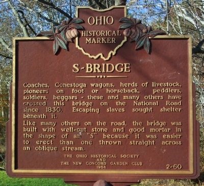
S-Bridge
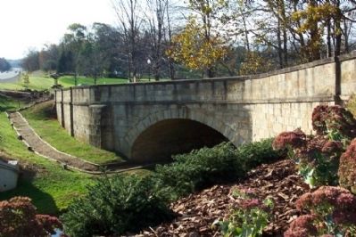
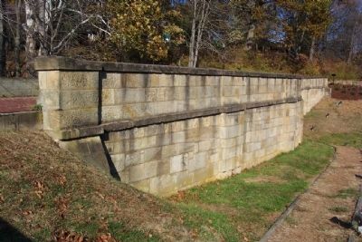
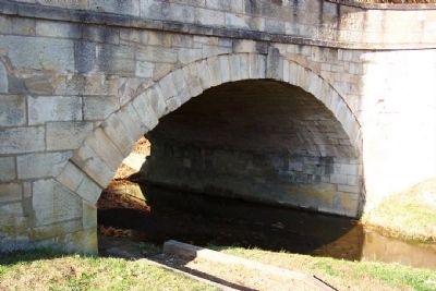
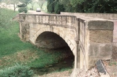
Like many others on the road, the bridge was built with well-cut stone and good mortar in the shape of an "S" because it was easier to erect than one thrown straight across an oblique stream.
Erected 1964 by New Concord Garden Club and The Ohio Historical Society. (Marker Number 2-60.)
Topics and series. This historical marker is listed in these topic lists: Abolition & Underground RR • Bridges & Viaducts • Military • Roads & Vehicles • Settlements & Settlers. In addition, it is included in the Ohio Historical Society / The Ohio History Connection, and the The Historic National Road series lists. A significant historical year for this entry is 1830.
Location. 39° 59.569′ N, 81° 44.784′ W. Marker is in New Concord, Ohio, in Muskingum County. Marker is on U.S. 40, on the right when traveling west. Marker and bridge are just west of Shadyside Drive. Touch for map. Marker is in this post office area: New Concord OH 43762, United States of America. Touch for directions.
Other nearby markers. At least 8 other markers are within walking distance of this marker. Fox Creek Bridge (a few steps from this marker); Fox Creek "S" Bridge Park (within shouting distance of this marker); Zane's Trace (within shouting distance of this marker); Findley Settlement (approx. 0.4 miles away); John Glenn (approx. half a mile away); Boyhood Home of John H. Glenn, Jr. (approx. half a mile away); The New Concord Underground Railroad (approx. 0.6 miles away); Muskingum College (approx. 0.6 miles away). Touch for a list and map of all markers in New Concord.
Photographed By William Fischer, Jr., “ ”
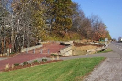
3. The Fox Creek "S" Bridge Park
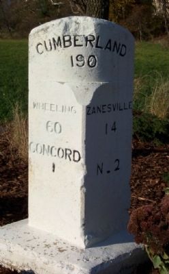
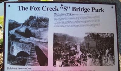
The Fox Creek “S” Bridge is one of a series of such bridges which lined the path of the National Road. All but a handful were destroyed during the construction of U.S. Route 40. The National Road, completed here in 1828, “opened wide the doors to the West.” Every township crossed by the Road doubled its population in a decade. The entire National Road from Cumberland, Maryland, to Vandalia, Illinois, was bricked during World War I to accommodate military traffic. The Fox Creek “S” Bridge was the last section to be bricked. The photo below records this event in 1919.
The house at the top of the picture to the left is that of Robert West Speer, a “conductor” on the Underground Railroad. Speer was a Reformed Presbyterian (Covenanter). His denomination, as well as the Associate Presbyterians (Seceders) and the Associate Reformed Presbyterians made the Fox Creek/Crooked Creek area a bastion of Abolitionism before and during the Civil War.
The house at the top of the picture to the left is that of Robert West Speer, a “conductor” on the Underground Railroad. Speer was a Reformed Presbyterian (Covenanter). His denomination, as well as the Associate Presbyterians (Seceders) and the Associate Reformed Presbyterians made the Fox Creek/Crooked Creek area a bastion of Abolitionism before and during the Civil War.
Credits. This page was last revised on June 16, 2016. It was originally submitted on November 6, 2008, by William Fischer, Jr. of Scranton, Pennsylvania. This page has been viewed 1,439 times since then and 18 times this year. Photos: 1, 2, 3, 4, 5, 6, 7. submitted on November 6, 2008, by William Fischer, Jr. of Scranton, Pennsylvania. 8. submitted on August 3, 2013. 9. submitted on November 6, 2008, by William Fischer, Jr. of Scranton, Pennsylvania. • Bill Pfingsten was the editor who published this page.
