Near Wrightsville in Johnson County, Georgia — The American South (South Atlantic)
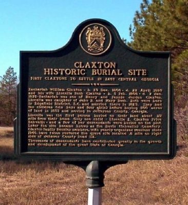
Claxton Historic Burial Site
First Claxtons to Settle in East Central Georgia
Lincella was the first person buried on their land about 1/2 mile from their home. Only one child - Lincella E. Claxton Price Schwalls - and a few of her descendants were buried on the plot. Later the site became known as the Davis (Schwalls) Cemetery. Claxton Family Reunion members, with yearly organized reunions since 1946, have twice restored the grave site located .8 mile on right side of Johnson County Road 112.
Thousands of descendants have contributed greatly to the growth and development of the great State of Georgia.
Topics. This historical marker is listed in these topic lists: Cemeteries & Burial Sites • Settlements & Settlers. A significant historical date for this entry is April 22, 1895.
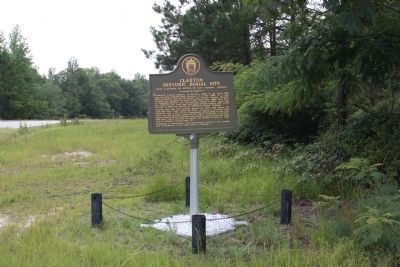
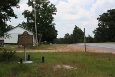
Location. 32° 47.608′ N, 82° 32.718′ W. Marker is near Wrightsville, Georgia, in Johnson County. Marker is at the intersection of U.S. 319 and Greenwood Cemetery Road , on the left when traveling east on U.S. 319. Touch for map. Marker is in this post office area: Wrightsville GA 31096, United States of America. Touch for directions.
Other nearby markers. At least 8 other markers are within 8 miles of this marker, measured as the crow flies. Old Sunbury Road (approx. 2.3 miles away); a different marker also named Old Sunbury Road (approx. 2.8 miles away); Historic Highways (approx. 5.8 miles away); Old Savannah Road (approx. 6.1 miles away); Site of Fort Wood (approx. 7.2 miles away); Spier's Turnout (approx. 7.2 miles away); Bartow (approx. 7.2 miles away); Tarver's Mill (approx. 7.3 miles away). Touch for a list and map of all markers in Wrightsville.
Credits. This page was last revised on January 31, 2020. It was originally submitted on November 7, 2008, by David Seibert of Sandy Springs, Georgia. This page has been viewed 1,571 times since then and 15 times this year. Photos: 1. submitted on November 7, 2008, by David Seibert of Sandy Springs, Georgia. 2, 3. submitted on July 18, 2009, by Mike Stroud of Bluffton, South Carolina. • Bill Pfingsten was the editor who published this page.


