Near Flintstone in Allegany County, Maryland — The American Northeast (Mid-Atlantic)
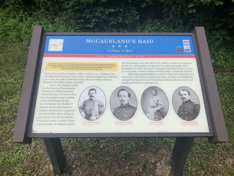
McCausland's Raid
A Pause to Rest
— 1864 Chambersburg Raid —
During the Civil War, retribution by one side for "atrocities" committed against civilian by the other quickly escalated. Confederate Gen. Jubal A. Early, during his 1864 Maryland invasion, demanded that several towns pay "ransoms" or be torched to avenge Union Gen. David Hunter's destruction of houses in the Shenandoah Valley. After Early returned to Virginia, he ordered Gen. John McCausland north to demand a ransom of Chambersburg, Pa. When Chambersburg residents refused, McCausland burned the town on July 31. The timely arrival of Union troops prevented his burning of Hancock, Md., and McCausland retreated to Virginia.
Early in the morning of August 1, 1864, at about 3 a.m., Confederate Gen. John McCausland and part of his cavalry command stopped here at Bevansville to rest, eat, and care for their horses. They had ridden hard from Hancock with Federal cavalry in pursuit.
Late in the afternoon of July 31, after burning Chambersburg, Pennsylvania, McCausland had entered Hancock. He tried to force the townspeople to pay a ransom or face Chambersburg's fate, but Confederate Gen. Bradley t. Johnson objected that Hancock residents had Southern sympathies and ordered Maj. Harry Gilmor to post guards from the 1st and 2nd Maryland Cavalry to protect homes and businesses. As Johnson argued with McCausland, Union Gen. William W. Averell's command was approaching the town. McCausland retreated west from Hancock roughly along present-day U.S. Route 40 toward Cumberland. He ordered Johnson, acting as a rear guard, to destroy bridges and block roads to impede the Federals.
McCausland passed Bellegrove, about 11 miles west of Hancock, and arrived here while Johnson executed his orders. At dawn, the Confederates continued moving west toward Cumberland. Johnson followed, and Averell steadily pressed the Confederate rear.
Erected by Maryland Civil War Trails.
Topics and series. This historical marker is listed in this topic list: War, US Civil. In addition, it is included in the Maryland Civil War Trails series list. A significant historical date for this entry is July 31, 1864.
Location. 39° 40.981′ N, 78° 27.34′ W. Marker is near Flintstone, Maryland, in Allegany County. Marker is on 15 Mile Creek Road Southeast north of National Pike Northeast, on the left when traveling north. Touch for map. Marker is at or near this postal address: 10708 15 Mile Creek Road Southeast, Flintstone MD 21530, United States of America. Touch for directions.
Other nearby markers. At least 8 other markers are within 3 miles of this marker, measured as the crow flies. Pine Lick Trail (approx. 1.4 miles away); Twin Oaks Trail (approx. 1.4 miles away); Long Pond Trail (approx. 1.4 miles away); Log Roll Trail
Credits. This page was last revised on October 29, 2021. It was originally submitted on May 26, 2019, by Devry Becker Jones of Washington, District of Columbia. This page has been viewed 581 times since then and 43 times this year. Photos: 1, 2. submitted on May 26, 2019, by Devry Becker Jones of Washington, District of Columbia.

