Unionville in Farmington in Hartford County, Connecticut — The American Northeast (New England)
Suburban Park 1895-1905
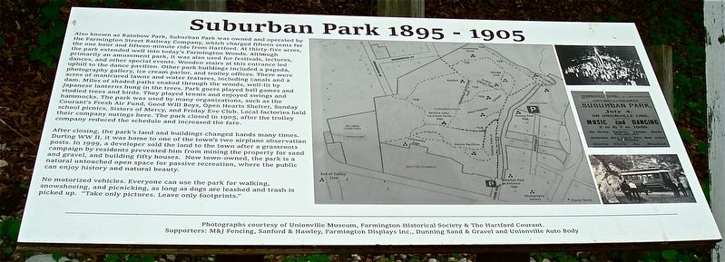
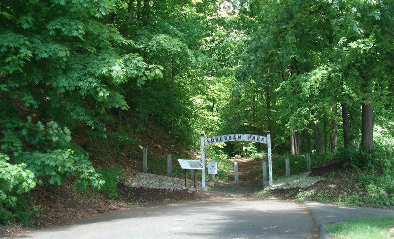
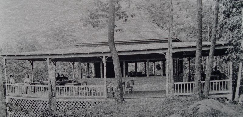
Also known as Rainbow Park, Suburban Park was owned and operated by the Farmington Street Railway Company, which charged fifteen cents for the one hour and fifteen-minute ride from Hartford. At thirty-five acres, the park extended well into today’s Farmington Woods. Although primarily an amusement park, it was also used for festivals, lectures, dances, and other special events. Wooden stairs at this entrance led uphill to the dance pavilion. Other park buildings include a pagoda, photography gallery, ice cream parlor, and trolley offices. There were acres of manicured lawns and water features, including canals and a dam. Miles of shaded paths snaked through the woods, well-lit by Japanese lanterns hung in the trees. Park goers played ball games and studied trees and birds. They played tennis and enjoyed swings and hammocks. The park was used by many organizations, such as the Courant’s Fresh Air Fund, Good Will Boys, Open Hearts Shelter, Sunday school picnics, Sisters of Mercy, and Friday Eve Club. Local factories held their company outings here. The park closed in 1905, after the trolley company reduced the schedule and increased the fare.
After closing, the park’s land and buildings changed hands many times. During WW II, it was home to one of the town’s two airplane observation posts. In 1999, a developer sold the land to the town after a grassroots campaign by residents prevented him from mining the property for sand and gravel, and building fifty houses. Now town-owned, the park is a natural untouched open space for passive recreation, where the public can enjoy history and natural beauty.
Erected 2019.
Topics. This historical marker is listed in these topic lists: Entertainment • Parks & Recreational Areas • Railroads & Streetcars. A significant historical year for this entry is 1895.
Location. 41° 45.444′ N, 72° 52.986′ W. Marker is in Farmington, Connecticut, in Hartford County. It is in Unionville. Marker is on Farmington Avenue (Connecticut Route 4), on the right when traveling west. Touch for map. Marker is at or near this postal address: 1810 Farmington Avenue, Unionville CT 06085, United States of America. Touch for directions.
Other nearby markers. At least 8 other markers are within one mile of this marker, measured as the crow flies. Unionville (about 600 feet away, measured in a direct line); The Water Fountain (about 700 feet away); Unionville Veterans Monument (approx. 0.2 miles away); Unionville Civil War Memorial (approx. ¼ mile away); Yodkins-Morin Memorial (approx. 0.3 miles away); Yodkins-Morin Memorial Park (approx. 0.3 miles away); Farmington (approx. one mile away); Farmington Veterans Memorial (approx. one mile away). Touch for a list and map of all markers in Farmington.
Also see . . .
1. Suburban Park. (Submitted on June 5, 2019, by Alan M. Perrie of Unionville, Connecticut.)
2. Suburban Park. (Submitted on June 5, 2019, by Alan M. Perrie of Unionville, Connecticut.)
3. Suburban Park. (Submitted on June 5, 2019, by Alan M. Perrie of Unionville, Connecticut.)
4. Suburban Park. (Submitted on June 5, 2019, by Alan M. Perrie of Unionville, Connecticut.)
Credits. This page was last revised on August 9, 2023. It was originally submitted on June 5, 2019, by Alan M. Perrie of Unionville, Connecticut. This page has been viewed 748 times since then and 91 times this year. Photos: 1, 2, 3. submitted on June 5, 2019, by Alan M. Perrie of Unionville, Connecticut. • Andrew Ruppenstein was the editor who published this page.


