Mackinaw City in Cheboygan County, Michigan — The American Midwest (Great Lakes)
French House Ruin, 1765 - 1781
Mackinaw City Historical Pathway
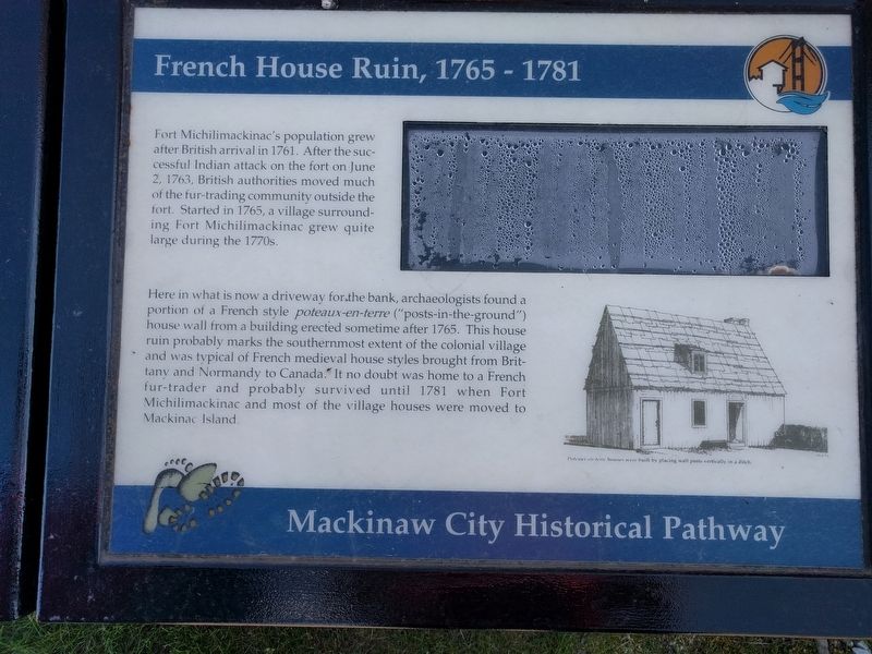
Fort Michilimackinac's population grew after British arrival in 1761. After the successful Indian attack on the fort on June 2, 1763, British authorities moved much of the fur-trading community outside the fort. Started in 1765, a village surrounding Fort Michilimackinac grew quite large during the 1770s.
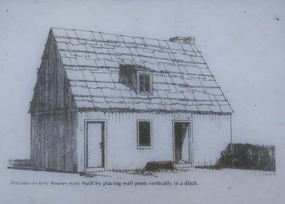
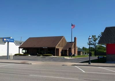
Here in what is now a driveway for the bank, archaeologists found a portion of a French style poteaux-en-terre ("posts-in-the-ground") house wall from a building erected sometime after 1765. This house ruin probably marks the southernmost extent of the colonial village and was typical of French medieval house styles brought from Brittany and Normandy to Canada. It no doubt was home to a French fur-trader and probably survived until 1781 when Fort Michilimackinac and most of the village houses were moved to Mackinac Island. (Marker Number 40.)
Topics. This historical marker is listed in this topic list: Colonial Era. A significant historical date for this entry is June 2, 1763.
Location. 45° 46.881′ N, 84° 43.855′ W. Marker is in Mackinaw City, Michigan, in Cheboygan County. Marker is on East Central Avenue east of South Nicolet Street, on the right when traveling east. Touch for map. Marker is at or near this postal address: 112 East Central Avenue, Mackinaw City MI 49701, United States of America. Touch for directions.
Other nearby markers. At least 8 other markers are within walking distance of this marker. French House Ruin, 1765-1781 (here, next to this marker); Tourism at Mackinac (about 300 feet away, measured in a direct line); British Colonial Farm 1774 - 1780 (about 300 feet away); Indians at the Straits (about 500 feet away); The Barnett Building (about 600 feet away); Winter at Mackinac (about 800 feet away); Hattie Stimpson 1875-1948 (approx. 0.2 miles away); Missionaries at Mackinac (approx. 0.2 miles away). Touch for a list and map of all markers in Mackinaw City.
Also see . . .
1. Fort Michilimackinac. Wikipedia article (Submitted on June 11, 2019, by Joel Seewald of Madison Heights, Michigan.)
2. Colonial Michilimackinac History. Timeline on Mackinac State Historic Parks website. (Submitted on June 11, 2019, by Joel Seewald of Madison Heights, Michigan.)
3. Post in ground. Wikipedia article that includes information about poteaux-en-terre construction. (Submitted on June 11, 2019, by Joel Seewald of Madison Heights, Michigan.)
Credits. This page was last revised on June 11, 2019. It was originally submitted on June 11, 2019, by Joel Seewald of Madison Heights, Michigan. This page has been viewed 121 times since then and 10 times this year. Photos: 1, 2, 3. submitted on June 11, 2019, by Joel Seewald of Madison Heights, Michigan.


