Cumberland Township near Gettysburg in Adams County, Pennsylvania — The American Northeast (Mid-Atlantic)
Nicholls's Brigade
Johnson's Division - Ewell's Corps
— Army of Northern Virginia —
Army of Northern Virginia
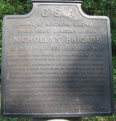
Ewell's Corps Johnson's Division
Nicholls's Brigade
1st. 2nd. 10th. 14th. 15th. Louisiana Infantry
July 1 Arrived near nightfall and took position east of Rock Creek north of Hanover Road and on the right of the Division.
July 2 About 6 p.m. changing to left of Jones's Brigade crossed the Creek attacked Union forces on Culp's Hill drove in their outposts and reached and held a line about 100 yards from their breastworks against which a steady fire was maintained for hours and some vigorous but unsuccessful assaults made.
July 3 At dawn the Brigade reopened fire and continued it for many hours then retired to line near the Creek whence about midnight it moved with the Division and Corps to Seminary Ridge.
July 4 Occupied Seminary Ridge. About 10 p.m. began the march to Hagerstown.
Present about 1100. Killed 43, wounded 309, missing 36. Total 388.
Erected 1910 by Gettysburg National Military Park Commission.
Topics. This historical marker is listed in this topic list: War, US Civil. A significant day of the year for for this entry is July 1.
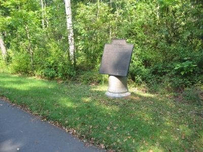
Location. 39° 49.29′ N, 77° 13.088′ W. Marker is near Gettysburg, Pennsylvania, in Adams County. It is in Cumberland Township. Marker is on East Confederate Avenue, on the left when traveling south. Located on the road up to Culp's Hill, Stop 13 on the driving tour of Gettysburg National Military Park. Touch for map. Marker is in this post office area: Gettysburg PA 17325, United States of America. Touch for directions.
Other nearby markers. At least 8 other markers are within walking distance of this marker. Johnson's Division (about 500 feet away, measured in a direct line); Jones's Brigade (about 600 feet away); 66th Ohio Infantry (about 700 feet away); 95th New York Infantry (about 700 feet away); 76th New York Infantry (about 700 feet away); Independent Battery E (about 800 feet away); 7th Indiana Infantry (about 800 feet away); O'Neal's Brigade (about 800 feet away). Touch for a list and map of all markers in Gettysburg.
Also see . . . Report of Col. J. M. Williams. Col. Williams of the 2nd Louisiana Infantry commanded the Brigade during the Gettysburg Campaign. Of the attack on Culp's Hill he wrote:
The brigade engaged the enemy near the base of these heights, and, having quickly driven his front line into the intrenchments on their crest, continued forward until it reached a line about 100 yards from the enemy's works, when it again engaged him with an almost incessant fire for four hours, pending which several attempts to carry the works by assault, being entirely unsupported on the right (Jones' brigade having failed to hold its line on the right), were attended with more loss than success. (Submitted on November 12, 2008, by Craig Swain of Leesburg, Virginia.)

Photographed By Craig Swain, September 17, 2008
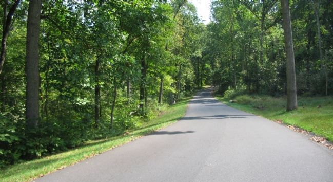
3. Advance of Nicholls' Brigade
Looking south down East Confederate Avenue. Nicholls' Brigade made their way up the slopes of Culp's Hill in this vicinity, moving from the left to the right. Eventually the Brigade's advanced would stop just short of modern day Slocum Avenue near the crest.
Credits. This page was last revised on February 7, 2023. It was originally submitted on November 12, 2008, by Craig Swain of Leesburg, Virginia. This page has been viewed 1,113 times since then and 19 times this year. Photos: 1, 2, 3. submitted on November 12, 2008, by Craig Swain of Leesburg, Virginia.

