Roseau, Saint George, Dominica — Caribbean Region of the Americas (Lesser Antilles of the West Indies)
Morne Bruce Garrison
North Point Battery
Morne Bruce Garrison
North Point Battery
Cannon and Signaling Station
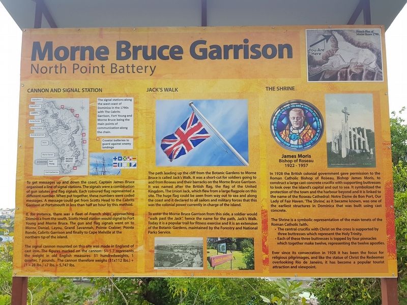
To get messages up and down the coast, Captain James Bruce organised a line of signal stations. The signals were a combination of gun salutes and flag signals. Each coloured flag represented a different number. When put together, these numbers were coded messages. A message could get from Scotts Head to the Cabrits Garrison at Portsmouth in less than half an hour by this method.
If, for instance, there was a fleet of French ships approaching Dominica from the south, Scotts Head station would signal to Fort Young and Morne Bruce. The gun and flag signals went on to Morne Daniel, Layou, Grand Savannah, Pointe Crabier, Pointe Ronde, Cabrits Garrison and finally to Cape Melville at the northern tip of the island.
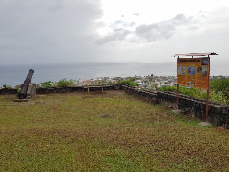
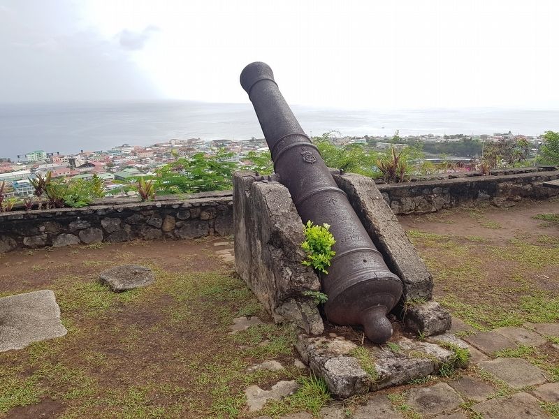
The signal cannon mounted on this site was made in England of cast iron. The figures marked on the cannon: 51-1-7 represents the weight in old English measures: 51 hundredweights, 1 quarter, 7 pounds. The cannon therefore weighs (51x112 lbs.) + (1=28 lbs.) + 7 lbs. = 5,747 lbs.
Captions:
The signal stations along the west coast of Dominica in the 1790s with The Cabrits Garrison, Fort Young and Morne Bruce being the main points of communication along the chain.
Coastal batteries to guard against enemy landings.
Jack’s Walk
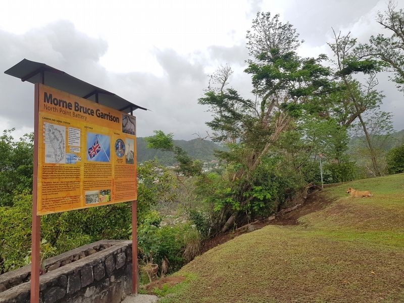
The path leading up the cliff from the Botanic Gardens to Morne Bruce is called Jack's Walk. It was a short-cut for soldiers going to and from Roseau and their barracks on the Morne Bruce Garrison. It was named after the British flag, the flag of the United Kingdom, The Union Jack, which flew from a large flagpole on this site. The huge flag could be seen from way out to sea and along the coast and it declared to all sailors and military forces that this was the colonial power currently in charge of the island.
To enter the Morne Bruce Garrison from this side, a soldier would “walk past the Jack”, hence the name for the path, Jack's Walk. Today it is a popular trail for fitness exercise and it is an extension of the Botanic Gardens, maintained by the Forestry and National Parks Service.
Caption: Panorama of Bath and Goodwill Estates, 1910
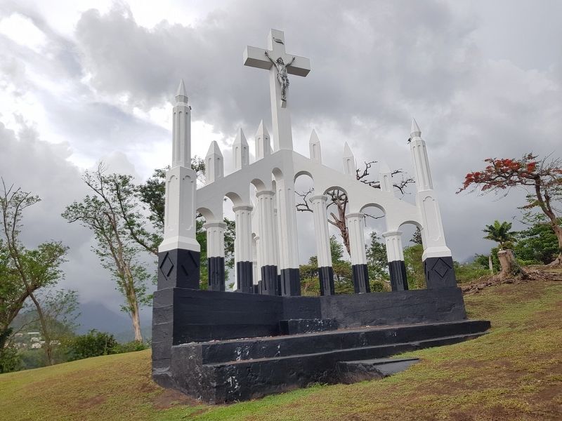
The Shrine
In 1928 the British colonial government gave permission to the Roman Catholic Bishop of Roseau, Bishop James Morris, to construct a large cast concrete crucifix with supporting buttresses to look over the island's capital and out to sea. It symbolized the protection of the town and the harbour beyond and it is linked to the name of the Roseau Cathedral: Notre Dame de Bon Port, Our Lady of Fair Haven. ‘The Shrine’, as it became known, was one of the earliest
structures in Dominica that was built using cast concrete.
The Shrine is a symbolic representation of the main tenets of the Roman Catholic faith.
∙ The central crucifix with Christ on the cross is supported by three buttresses which represent the Holy Trinity.
∙ Each of these three buttresses is topped by four pinnacles which together make twelve, representing the twelve apostles.
Ever since its consecration in 1928 it has been the focus for religious pilgrimages, and like the statue of Christ the Redeemer overlooking Rio de Janeiro, it has become a popular tourist attraction and viewpoint.
Captions:
French Plan of Morne Bruce 1780
James Morris ∙ Bishop of Roseau ∙ 1922-1957
Topics. This historical marker is listed in these topic lists: Churches & Religion • Colonial Era • Forts and Castles • Man-Made Features. A significant historical year for this entry is 1910.
Location. 15° 18.006′ N, 61° 22.806′ W. Marker is in Roseau, Saint George. Marker can be reached from Unnamed road just west of Morne Bruce Road, on the right when traveling north. Touch for map. Touch for directions.
Other nearby markers. At least 8 other markers are within walking distance of this marker. A different marker also named Morne Bruce Garrison (about 150 meters away, measured in a direct line); David the Goliath (approx. 0.4 kilometers away); Roseau Cathedral (approx. 0.7 kilometers
away); Methodist Church (approx. 0.7 kilometers away); Anglican Church (approx. 0.8 kilometers away); Carnegie Library of Roseau (approx. 0.8 kilometers away); World Wars Memorial (approx. 0.8 kilometers away); Cecil E. A. Rawle (approx. 0.8 kilometers away). Touch for a list and map of all markers in Roseau.
Credits. This page was last revised on June 16, 2019. It was originally submitted on June 16, 2019, by J. Makali Bruton of Accra, Ghana. This page has been viewed 360 times since then and 55 times this year. Photos: 1, 2, 3, 4, 5. submitted on June 16, 2019, by J. Makali Bruton of Accra, Ghana.
