Cumberland Township near Gettysburg in Adams County, Pennsylvania — The American Northeast (Mid-Atlantic)
Daniel's Brigade
Rodes's Division - Ewell's Corps
— Army of Northern Virginia —
Army of Northern Virginia
Ewell's Corps Rodes's Division
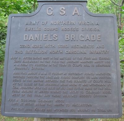
Daniel's Brigade
32nd. 43rd. 45th. 53rd. Regiments and
2nd. Battalion North Carolina Infantry
July 3 After taking part in the battles of the First and Second Days elsewhere on the fields the Brigade marched about 1.30 a.m. from its position in the town to Culp's Hill to reinforce Johnson's Division.
Arriving about 4 p.m. it fought at different points wherever ordered through the long an fierce conflict its main position being in the ravine between the two summits of Culp's Hill. At the close of the struggle near noon it was withdrawn by Gen. Johnson with the rest of his line to the base of the Hill from whence it moved during the night to Seminary Ridge west of the town and there rejoined Rodes's Division.
July 4 Occupied Seminary Ridge. Late at night began the march to Hagerstown.
Present 2100. Killed 185, wounded 635, missing 116. Total 918.
Erected 1910 by Gettysburg National Military Park Commission.
Topics. This historical marker is listed in this topic list: War, US Civil.
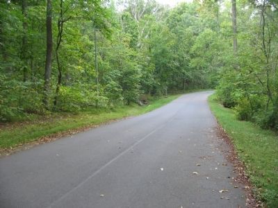
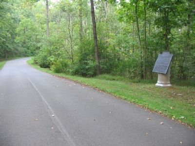
Location. 39° 49.139′ N, 77° 12.973′ W. Marker is near Gettysburg, Pennsylvania, in Adams County. It is in Cumberland Township. Marker is on East Confederate Avenue, on the right when traveling south. Located on the road up to Culp's Hill, Stop 13 on the driving tour of Gettysburg National Military Park. Touch for map. Marker is in this post office area: Gettysburg PA 17325, United States of America. Touch for directions.
Other nearby markers. At least 8 other markers are within walking distance of this marker. Forty-Third North Carolina Regiment (within shouting distance of this marker); O'Neal's Brigade (about 300 feet away, measured in a direct line); Johnson's Division (about 500 feet away); Steuart's Brigade (about 700 feet away); A Useless Sacrifice of Life (about 700 feet away); Fight for the Summit (approx. 0.2 miles away); 147th New York Infantry (approx. 0.2 miles away); 102 & 78th New York Infantry (approx. 0.2 miles away). Touch for a list and map of all markers in Gettysburg.
Related markers. Click here for a list of markers that are related to this marker. Daniel's Brigade at Gettysburg.
Also see . . . Report of Brig. Gen. Junins Daniel. General Daniel described his Brigade's actions on Culp's Hill:
In taking the position assigned me, the Thirty-second Regiment was subjected to a heavy artillery fire in a much exposed situation, which, however, it bore with great courage and steadiness. On coming up with Jones' brigade, I found its skirmishers engaging the enemy at long range. The hill in front of this position was, in my opinion, so strong that it could not have been carried by any force. After remaining here some two or three hours. I was ordered to move by the left flank to the left, under the guidance of a staff officer, who hail been sent to conduct me to the position it was desired I should occupy. In executing this movement, my troops were much exposed, and many were killed and wounded. On reaching the left, I received orders from General Johnson to charge the enemy's works, in conjunction with General Steuart. This charge was made in a most gallant manner, and the enemy driven from a portion of their works in front of my center and right, and near the works captured the evening before by Jones' brigade. Owing to the heavy fire brought upon General Steuart, he was unable to advance farther, and I was, therefore, unable to occupy the works of the enemy; but from a sheltered position, within less than 50 paces, I obtained through a gorge between their lines of intrenchments a most destructive fire with the whole of the Forty-fifth Regiment for five minutes upon a crowd of the enemy who were disorganized and fleeing in great confusion. And here, owing to the fact that the enemy were returning our fire at this time very feebly, and that our own aim was unobstructed, we succeeded in inflicting heavy loss upon them. This position I held, bringing a heavy, though unequal, fire on

Photographed By Craig Swain, September 17, 2008
3. Daniel's Brigade Sector
Daniel's Brigade advanced up the slope of Culp's Hill (to the right) near the tablet location. Later, after the Federals had pressed the Confederates off the crest, the Brigade reformed in the low ground between Rock Creek and what is today East Confederate Avenue.
Credits. This page was last revised on February 7, 2023. It was originally submitted on November 14, 2008, by Craig Swain of Leesburg, Virginia. This page has been viewed 969 times since then and 24 times this year. Photos: 1, 2, 3. submitted on November 14, 2008, by Craig Swain of Leesburg, Virginia.

