Chetumal in Othón P. Blanco, Quintana Roo, Mexico — The Yucatan Peninsula (The Southeast)
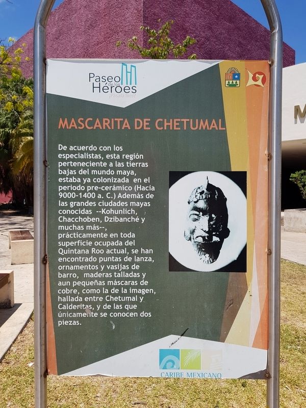
The Chetumal Mask
Paseo de los Héroes
De acuerdo con los especialistas, esta región perteneciente a las tierras bajas del mundo maya, estaba ya colonizada en el periodo pre-cerámico (Hacia 9000-1400 a.C.) Además de las grandes ciudades mayas conocidas – Kohunlich, Chacchoben, Dzibanché y muchas más --, prácticamente en toda superficie ocupada del Quintana Roo actual, se han encontrado puntas de lanza, ornamentos y vasijas de barro, maderas talladas y aun pequeñas máscaras de cobre, como la de la imagen, hallada entre Chetumal y Calderitas, y de las que únicamente se conocen dos piezas.
The Chetumal Mask
According to specialists, this region belonged to the lowlands of the Mayan world and was already colonized in the pre-ceramic period (around 9000-1400 BCE). In the well known Mayan cities - Kohunlich, Chacchoben, Dzibanché and many more – and in practically all the occupied areas of the current Quintana Roo, have been found spearheads, ornaments and clay pots, carved wood and even small copper masks, like the one in the image, found between Chetumal and Calderitas, and of which only two examples are known.
Topics. This historical marker is listed in these topic lists: Anthropology & Archaeology • Native Americans • Settlements & Settlers.
Location. 18° 30.23′ N, 88° 17.73′ W. Marker is in Chetumal, Quintana Roo, in Othón P. Blanco. Marker is at the intersection of Avenida de los Héroes and Mahatma Gandhi, on the left when traveling north on Avenida de los Héroes. Touch for map. Marker is in this post office area: Chetumal QR 77000, Mexico. Touch for directions.
Other nearby markers. At least 8 other markers are within walking distance of this marker. Manuel Antonio Ay (within shouting distance of this marker); Cecilio Chi (within shouting distance of this marker); Jacinto Pat (within shouting distance of this marker); The Caste War (within shouting distance of this marker); Allegory of Mestizaje (within shouting distance of this marker); Archaeological Sites of Southern Quintana Roo (about 90 meters away, measured in a direct line); Manuel Ignacio Altamirano Market (about 90 meters away); La Chetumaleña (about 120 meters away). Touch for a list and map of all markers in Chetumal.
Credits. This page was last revised on June 25, 2019. It was originally submitted on June 25, 2019, by J. Makali Bruton of Accra, Ghana. This page has been viewed 129 times since then and 9 times this year. Photos: 1, 2. submitted on June 25, 2019, by J. Makali Bruton of Accra, Ghana.

