Near Calderitas in Othón P. Blanco, Quintana Roo, Mexico — The Yucatan Peninsula (The Southeast)
Structure IV at Oxtankah
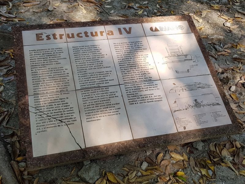
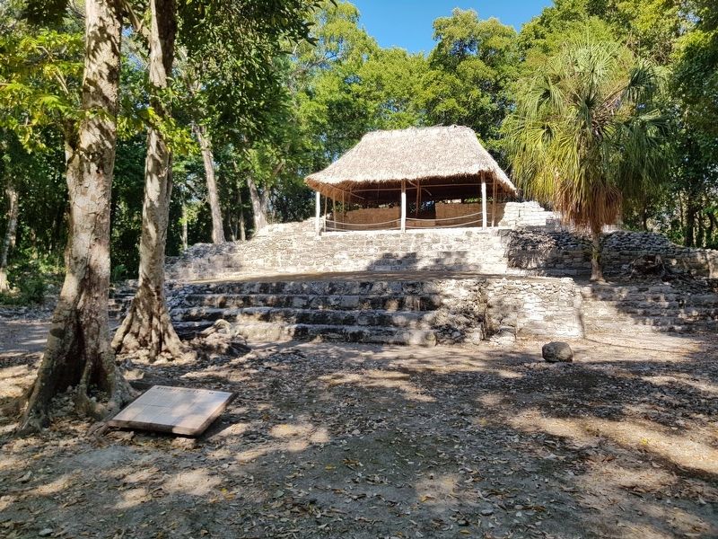
Amplia plataforma de tres cuerpos que delimita la plaza por el oeste; aún pueden apreciarse, en la parte superior, cuatro habitaciones de planta rectangular. El intrincado acceso entre estos cuartos, construido a la manera de un laberinto, obedecía seguramente a algún motivo sagrado.
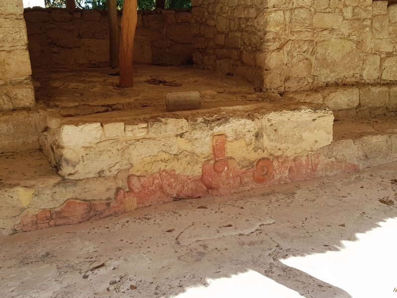
En la banqueta de acceso a este recinto y custodiando la entrada, los mayas modelaron un mascarón de estuco policromado, acompañado de diversos signos. Desafortunadamente, su estado de conservación es malo, aunque aún pueden identificarse, al centro de la figura: la naríz, el labio superior y los colmillos de un jaguar, dos representaciones de sus patas delanteras, asi como dos glifos de Ahau (señor), invertidos.
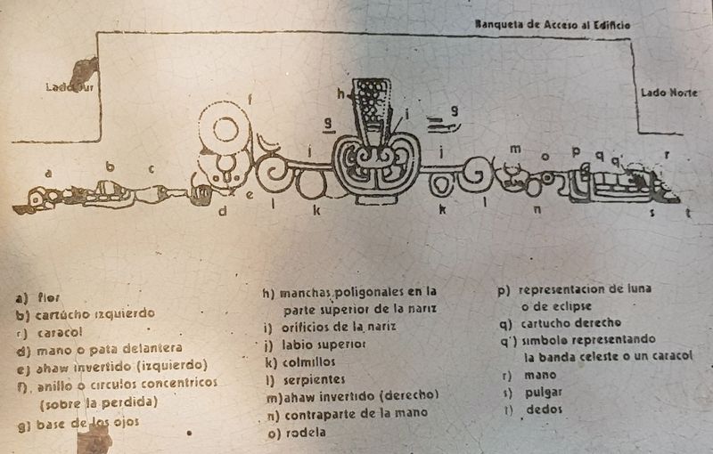
El dibujo muestra con detalle una interpretación de estos signos. El acceso a las habitaciones está orientado al este, lo que puede indicar la relación entre el jaguar personificando al Sol en su paso por el mundo de los muertos (la noche) y Venus, como estrella de la mañana. El edificio fue construido entre los años 300 y 600 d.C. y modificado en diversas ocasiones, entre el año 1000 d.C. y el momento de la conquista española.
Estructura IV
Kóoch but'bil lu'um ooxp'éel u wiinklil yaan tu chik'in jáalil le k'iiwiko'; tu kaanalile' xuulul ku páajtal u yila'al kamp'éel ichil najo'ob ka'ap'éel u tséelil maas nojoch ti' le uláak ka'ap'éelo'obo.U yokolil je'ex satun sáate mii yaan ba'ax u yil yéetel kúyemil. Tu yokolile le maayao'obo' tu beetajo'ob jump'éel k'oj ichil chichkuna'an luuk' ya'akach u boonilo'ob, yaan xan ka'ach ya'akach ts'iibo'obi'.
U k'aasilile' ts'o'ok u k'aspajal, kex wa ku páajtal u yila al tu chúumukile' u ni', u kaanalil bóoxel chi' yéetel u ts'a'a yo'ob jutúul chakmo'ol, ka'ap'éel ye'esajil u yookko'obil táanil yéetel kaap'éel wojilo'ob ajaw chinchinkuna'ano'ob.
Le bonilo' ku ye'esik ma 'alob jump'éel xookil le ts'iibo'oba. U yokolil ti' le ichil najo'oba' tya'an tu táan lak'ine', le ku máan tu yook'ol kaabil kimeno'ob (ook'in) yéetel Noj eek', je'ex eek'il ja'atskabile'. Le pak'ilila jbeeta'ab ichil u ja'abilo'ob 300 yéetel 6000 ts'o'okol ki'ichkelem yuum yéetel jk'e'ex ya'akach u tée nelo'ob, ichil u ja'abil 1000 ts'o'okol Kiichkelem yuume’ yéetel ka tu lots'aj le maayao ob le káastlano'obo'.
Structure IV
This is a spacious, tri-level platform which borders the west side of the plaza. Atop it one can still see four rectangular rooms. The complex, mazelike access interconnecting these rooms in all likelihood had some sacred meaning behind it.
On the walkway leading to this room and guarding the entrance, is found a polychromed, stucco mask with numerous signs modeled by the Mayans. Unfortunately, it is poorly preserved although at the center of the figure one can still identify a nose, upper lip, fangs of a jaguar and its two front feet, as well as two inverted ahau (lord) glyphs. The drawing shows in detail an interpretation of these signs. The entrance to the room faces east which could indicate the relation between the jaguar, personifying the Sun in its passage through the world of the dead (night), and Venus as the morning star.
The building was constructed between 300 and 600 A.D., but was modified a number of times between 1000 A.D. and the Spanish conquest.
Erected by Instituto Nacional de Antropología e Historia (INAH).
Topics. This historical marker is listed in these topic lists: Architecture • Churches & Religion • Colonial Era • Native Americans.
Location. 18° 36.442′ N, 88° 14.116′ W. Marker is near Calderitas, Quintana Roo, in Othón P. Blanco. Marker can be reached from Unnamed road just west of Calderitas Coastal Road, on the left when
traveling north. The marker is at the Oxtankah Archaeological Site. Touch for map. Marker is in this post office area: Calderitas QR 77960, Mexico. Touch for directions.
Other nearby markers. At least 8 other markers are within 14 kilometers of this marker, measured as the crow flies. An Altar at Oxtankah (within shouting distance of this marker); Structure III at Oxtankah - Palace (about 90 meters away, measured in a direct line); Structure IX at Oxtankah - Palace (approx. 0.2 kilometers away); Oxtankah Archaeological Site (approx. 0.4 kilometers away); Chetumal - Kohunlich and Oxtankah (approx. 10.6 kilometers away); Heroes of April 1914 (approx. 11.5 kilometers away); Chetumal Meetings (approx. 12.3 kilometers away); The Chetumal Mask (approx. 13.2 kilometers away). Touch for a list and map of all markers in Calderitas.
Credits. This page was last revised on June 25, 2019. It was originally submitted on June 25, 2019, by J. Makali Bruton of Accra, Ghana. This page has been viewed 74 times since then and 4 times this year. Photos: 1, 2, 3, 4. submitted on June 25, 2019, by J. Makali Bruton of Accra, Ghana.


