Cumberland Township near Gettysburg in Adams County, Pennsylvania — The American Northeast (Mid-Atlantic)
First Brigade
First Division - Twelfth Corps
— Army of the Potomac —
Inscription.
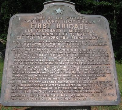
Twelfth Corps First Division
First Brigade
Col. Archibald L. McDougall
5th. 20th. Connecticut, 3d. Maryland
123d. 145th. New York, 46th. Penna. Infantry
July 1 Marched from Littlestown and when within two miles of Gettysburg advanced on Wolf Hill then occupied by a Confederate force. Retired and bivouacked until morning.
July 2 Crossed Rock Creek in the morning and formed in two lines on Culp's Hill to the right of Second Division. The rear line behind a stone wall the front line forty yards in front where breastworks were immediately constructed. Late in the day went to support of Third Corps line and after dark returned and found the works and woods in rear in possession of Major Gen. Johnson's Confederate Division.
July 3 At daylight the Brigade with the Artillery and Infantry of the Corps attacked Major Gen. Johnson's Division which had been reinforced from Major Gen. Early's and Major Gen. Rodes's Divisions and at 10.30 a.m. recaptured the works after a fierce contest in the afternoon sent to the support of Second Corps.
July 4 The 123d New York, 5th Conn. and 46th Penna. with the regiments of Third Brigade and a Battery made a reconnaissance in the morning in front and to the town of Gettysburg under Col. S. Colgrove and Major Gen. H.W. Slocum and found no Confederate forces.
Casualties. Killed 1 Officer 11 men. Wounded 4 officers 56 men. Captured or missing 1 officer 7 men. Total 80.
Erected 1912 by Gettysburg National Military Park Commission.
Topics. This memorial is listed in this topic list: War, US Civil. A significant historical date for this entry is July 2, 1863.
Location. 39° 48.962′ N, 77° 13.08′ W. Marker is near Gettysburg, Pennsylvania, in Adams County. It is in Cumberland Township. Memorial is on Slocum Avenue, on the right when traveling west. Located on the lower crest of Culp's Hill in Gettysburg National Military Park. Touch for map. Marker is in this post office area: Gettysburg PA 17325, United States of America. Touch for directions.
Other nearby markers. At least 8 other markers are within walking distance of this marker. First Division (a few steps from this marker); 20th Connecticut Volunteers (a few steps from this marker); 3d Maryland Infantry (a few steps from this marker); 5th Connecticut Infantry (within shouting distance of this marker); 29th Pennsylvania Infantry (within shouting distance of this marker); 123rd New York Infantry (within shouting distance of this marker); 2nd Maryland Infantry (within shouting distance of this marker); Twelfth Corps (about 300 feet away, measured in a direct line). Touch for a list and map of all markers in Gettysburg.
Also see . . . Report of Col. Archibald L. McDougall
Photographed By Craig Swain, September 17, 2008
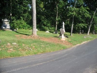
2. First Brigade Tablet
On July 2, the front rank of the brigade, including the 123rd New York, 20th Connecticut, and 46th Pennsylvania, were posted to the northeast (left side of road in this view) of what is today Slocum Avenue. At the time of the battle, this was the edge of an open field. Behind the tablet is the 3rd Maryland (right) and 20th Connecticut (left) Monuments.
July 3.--An attack was made in the morning upon the enemy in our intrenchments both by infantry and artillery. The Twentieth Connecticut Volunteers were advanced into the woods in front of our troops, where the enemy had posted himself, and to which point was evidently advancing more forces. Lieutenant-Colonel Wooster, who was in command of this regiment, had a difficult and responsible duty to perform. He was not only required to keep the enemy in check, but encountered great difficulty, while resisting the enemy, in protecting himself against the fire of our own artillery, aimed partly over his command at the enemy in and near our intrenchments. His greatest embarrassment was, the farther he pushed the enemy the more directly he was placed under the fire of our own guns. Some of his men became severely wounded by our artillery fire. (Submitted on November 17, 2008, by Craig Swain of Leesburg, Virginia.)
Photographed By Craig Swain, September 17, 2008
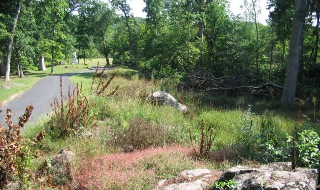
3. Second Rank Positons on July 2
The back rank of the Brigade, consisting of the 5th Connecticut, 145th New York, and 3rd Maryland, stood along a stone wall bordering Pardee Field. The wall is obscured in this view by deadfall on the immediate right, but can be seen in the distance along Slocum Avenue. Monuments for some of the Brigade's regiments are seen on the left of the road - the 145th New York and 46th Pennsylvania.
Photographed By Craig Swain, September 17, 2008
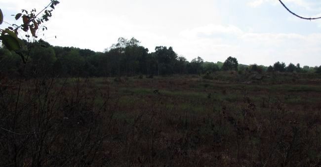
4. McDougall's Brigade Position on July 3
From near the 33rd Wisconsin Monument, looking west. McDougall's Brigade was posted in this open field on the morning of July 3, in position to contain any advance of the Confederate forces while Colgrove's Brigade attempted to reoccupy the Federal breastworks on the lower crest of Culp's Hill. While tree growth since the battle and residential buildings have blocked the views, in 1863 the Federals here had a clear view of the lower slope and Spangler's Meadow.
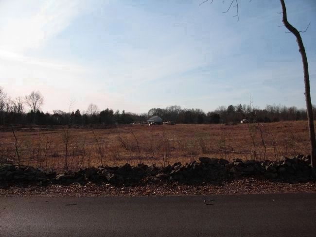
Photographed By Craig Swain, February 21, 2009
5. McDougall's Brigade Position on July 3
An updated view of the photo above, showing the results of the tree clearing. The stone wall running along Colgrove Avenue (foreground here) approximates the brigade line on the morning of July 3. The white barn in the far center is a short distance from the Baltimore Pike. Along the Pike two Federal Batteries (Rugg's and Kinzie's), firing across McDougall's Brigade front, had a clear field of fire to the area of Spangler's Spring.
Credits. This page was last revised on February 7, 2023. It was originally submitted on November 17, 2008, by Craig Swain of Leesburg, Virginia. This page has been viewed 1,083 times since then and 41 times this year. Photos: 1, 2, 3. submitted on November 17, 2008, by Craig Swain of Leesburg, Virginia. 4. submitted on November 16, 2008, by Craig Swain of Leesburg, Virginia. 5. submitted on March 22, 2009, by Craig Swain of Leesburg, Virginia.
