Maysville in Mason County, Kentucky — The American South (East South Central)
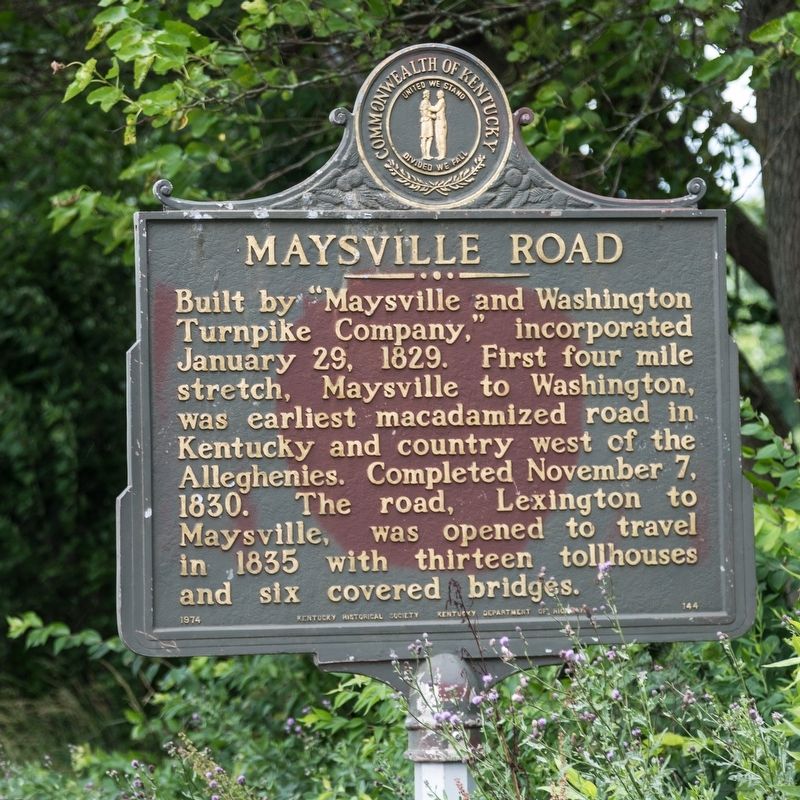
Maysville Road
Erected 1974 by Kentucky Historical Society and Kentucky Department of Highways. (Marker Number 144.)
Topics and series. This historical marker is listed in this topic list: Roads & Vehicles. In addition, it is included in the Kentucky Historical Society series list. A significant historical date for this entry is January 29, 1829.
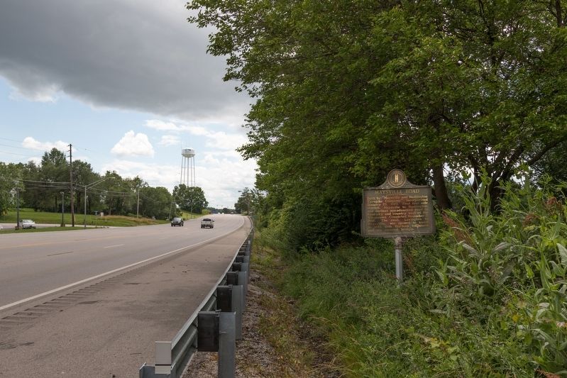
Location. 38° 38.537′ N, 83° 46.891′ W. Marker is in Maysville, Kentucky, in Mason County. Marker is on Maysville Road (U.S. 68) west of Jersey Ridge Road, on the right when traveling west. Touch for map. Marker is in this post office area: Maysville KY 41056, United States of America. Touch for directions.
Other nearby markers. At least 8 other markers are within walking distance of this marker. Stanley F. Reed (1884-1980) (approx. 0.3 miles away); Elisha Green (approx. ¾ mile away); The Peers House (approx. ¾ mile away); The Richeson House (approx. ¾ mile away); Lewis Collins' House (approx. 0.8 miles away); Maysville Academy (approx. 0.8 miles away); Phillips' Folly (approx. 0.9 miles away); Alanant-O-Wamiowee (approx. 0.9 miles away). Touch for a list and map of all markers in Maysville.
Regarding Maysville Road. Today’s US Route 68 roughly follows the original turnpike from Maysville to Lexington.
Also see . . . Maysville, Washington, Paris and Lexington Turnpike Road Company. “The route went southwest from Maysville, Kentucky an important port on the Ohio River following the former buffalo trace and Native American trail to Lexington, Kentucky. It was called both the Maysville Road and the Limestone Road. It was maintained by the various counties through which it passed with local labor from the county levies. The road was rough and during certain seasons practically impassable.” (Submitted on July 9, 2019.)
Credits. This page was last revised on July 9, 2019. It was originally submitted on July 9, 2019, by J. J. Prats of Powell, Ohio. This page has been viewed 367 times since then and 42 times this year. Photos: 1, 2. submitted on July 9, 2019, by J. J. Prats of Powell, Ohio.

