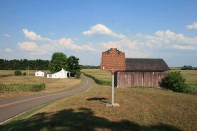
Near Circleville in Pickaway County, Ohio — The American Midwest (Great Lakes)
Grenadier Squaw Village / Cornstalk Town
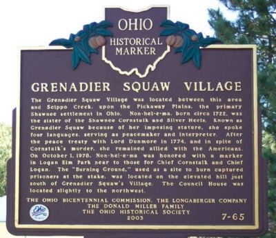
Grenadier Squaw Village
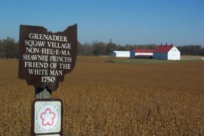
The Grenadier Squaw Village was located between this area and Scippo Creek, upon the Pickaway Plains, the primary Shawnee settlement in Ohio. Non-hel-e-ma, born circa 1722, was the sister of the Shawnee Cornstalk and Silver Heels. Known as Grenadier Squaw because of her imposing stature, she spoke four languages, serving as peacemaker and interpreter. After the peace treaty with Lord Dunmore in 1774, and in spite of Cornstalk's murder, she remained allied with the Americans. On October 1, 1978, Non-hel-e-ma was honored with a marker in Logan Elm Park near to those for Chief Cornstalk and Chief Logan. The “Burning Ground,” used as a site to burn captured prisoners at the stake, was located on the elevated hill just south of Grenadier Squaw's Village. The Council House was located slightly to the northwest.
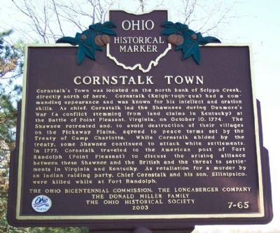
Cornstalk Town
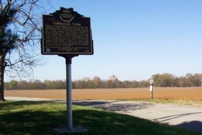
Cornstalk's Town was located on the north bank of Scippo Creek, directly north of here. Cornstalk (Keigh-tugh-qua) had a commanding appearance and was known for his intellect and oration skills. As chief, Cornstalk led the Shawnees during Dunmore's War (a conflict stemming from land claims in Kentucky) at the Battle of Point Pleasant, Virginia, on October 10, 1774. The Shawnee retreated and, to avoid destruction of their villages on the Pickaway Plains, agreed to peace terms set by the Treaty of Camp Charlotte. While Cornstalk abided by the treaty, some Shawnee continued to attack white settlements. In 1777, Cornstalk traveled to the American post of Fort Randolph (Point Pleasant) to discuss the arising alliance between these Shawnee and the British and the threat to settlements in Virginia and Kentucky. As retaliation for a murder by an Indian raiding party, Chief Cornstalk and his son, Ellinipsico, were killed while at Fort Randolph.
Erected 2003 by Ohio Bicentennial Commission, The Longaberger Company, The Donald Miller Family, and The Ohio Historical Society. (Marker Number 7-65.)
Topics and series. This historical marker is listed in these topic lists: Colonial Era • Native Americans • Peace • Settlements & Settlers. In addition, it is included in the Ohio Historical Society / The Ohio History Connection series list. A significant historical month for this entry is October 1832.
Location. 39° 31.852′ N, 82° 57.633′ W. Marker is near Circleville, Ohio, in Pickaway County. Marker is on Emerson Road (Ohio Route 48) 0.4 miles east of U.S. 23, on the right when traveling east. Marker is about four miles south of Circleville. Touch for map. Marker is in this post office area: Circleville OH 43113, United States of America. Touch for directions.
Other nearby markers. At least 8 other markers are within 2 miles of this marker, measured as the crow flies. Site of Logan Elm (approx. 1˝ miles away); John Boggs Memorial (approx. 1˝ miles away); Capt. Michael Cresap (approx. 1˝ miles away); Among Those Present (approx. 1˝ miles away); Grenadier Squaw (Non-hel-e-ma) (approx. 1˝ miles away); Cornstalk (approx. 1˝ miles away); Monument to Logan (approx. 1˝ miles away); Chief Logan / Logan Elm (approx. 1˝ miles away). Touch for a list and map of all markers in Circleville.
Credits. This page was last revised on December 2, 2019. It was originally submitted on November 18, 2008, by William Fischer, Jr. of Scranton, Pennsylvania. This page has been viewed 4,104 times since then and 106 times this year. Photos: 1, 2, 3, 4. submitted on November 18, 2008, by William Fischer, Jr. of Scranton, Pennsylvania. 5. submitted on September 8, 2012, by Dale K. Benington of Toledo, Ohio. • Bill Pfingsten was the editor who published this page.
