Manheim Township near Lancaster in Lancaster County, Pennsylvania — The American Northeast (Mid-Atlantic)
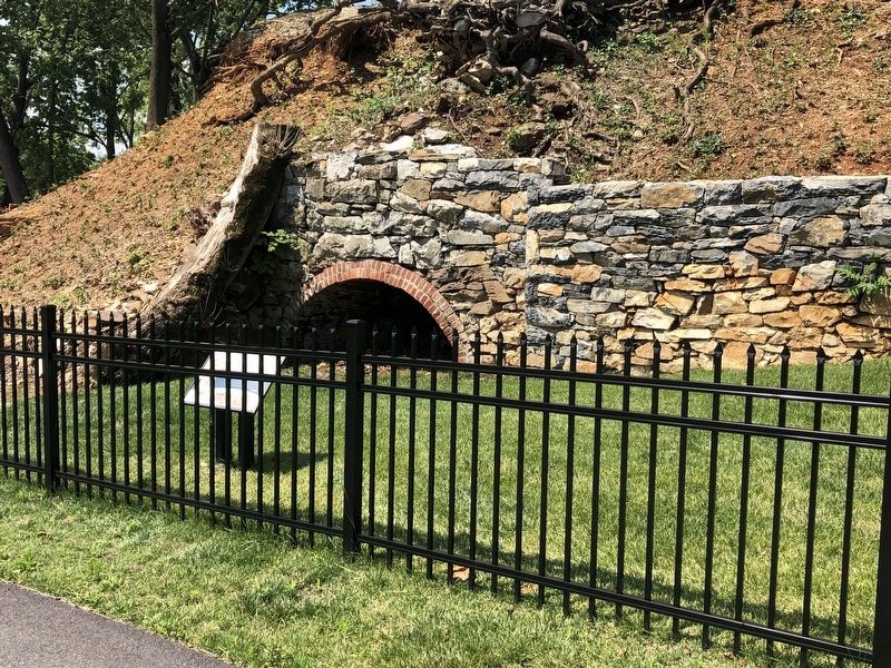
Belmont Lime kiln
circa 1876
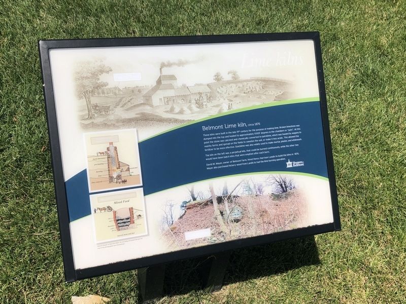
The kiln on the left was a perpetual kiln, that could be burned continuously, while the other two would have been batch kilns that were emptied after each burn.
David M. Mayer, owner of Belmont Farm, hired Henry Harrison Landis to build the kilns in 1876. Mayer also purchased hickory wood from Landis to fuel the lime burning operation.
Erected by Shoppes at Belmont.
Topics. This historical marker is listed in these topic lists: Agriculture • Industry & Commerce. A significant historical year for this entry is 1876.
Location. 40° 3.958′ N, 76° 18.641′ W. Marker is near Lancaster, Pennsylvania, in Lancaster County.
this page online

Regionally, this marker is in South-Central Pennsylvania, specifically in Pennsylvania Dutch Country, and in the Susquehanna Valley. It is also in the American Northeast and in the Mid-Atlantic. Globally, it is in North America, the Western Hemisphere, the Western World, and the Anglosphere. Historically, it finds itself in what was once the Haudenosaunee (Iroquois) Confederacy and also one of the original Thirteen Colonies.
Other nearby markers. At least 8 other markers are within walking distance of this marker: Belmont Quarry (within shouting distance of this marker); Mayer Cemetery (about 700 feet away, measured in a direct line); David M. Mayer House (approx. 0.2 miles away); Thaddeus Stevens Bridge (approx. 0.8 miles away); Roll of Honor (approx. 0.9 miles away); Vietnam and Korean War Memorial (approx. 0.9 miles away); World War I Memorial (approx. 0.9 miles away); Rossmere Base Ball Park
Credits. This page was last revised on February 15, 2026. It was originally submitted on July 13, 2019, by Devry Becker Jones of Washington, District of Columbia. This page has been viewed 612 times since then and 71 times this year. Photos: 1, 2. submitted on July 13, 2019, by Devry Becker Jones of Washington, District of Columbia.
