Near Salyersville in Magoffin County, Kentucky — The American South (East South Central)
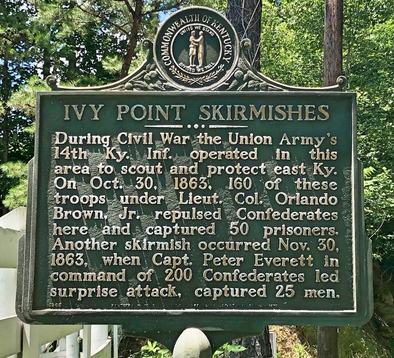
Ivy Point Skirmishes
Erected 1966 by Kentucky Historical Society, Kentucky Department of Highways. (Marker Number 901.)
Topics and series. This historical marker is listed in this topic list: War, US Civil. In addition, it is included in the Kentucky Historical Society series list. A significant historical date for this entry is October 30, 1863.
Location. 37° 44.785′ N, 83° 4.806′ W. Marker is near Salyersville, Kentucky, in Magoffin County. Marker is on West Maple Street (U.S. 460) north of Licking Station Road, on the left when traveling north. Touch for map. Marker is at or near this postal address: West Maple Street, Salyersville KY 41465, United States of America. Touch for directions.
Other nearby markers. At least 8 other markers are within 15 miles of this marker, measured as the crow flies. First Settlement (within shouting distance of this marker); a different marker also named First Settlement (about 800 feet away, measured in a direct line); Legends in Blue and Gray (approx. 0.7 miles away); County Named, 1860 (approx. 0.8 miles away); Wm. "Uncle Billie" Adams (approx. 0.8 miles away); Reuben Patrick Grave (approx. 4.6 miles away); Civil War Action (approx. 8.2 miles away); Boone Salt Springs (approx. 14.6 miles away). Touch for a list and map of all markers in Salyersville.
Also see . . . Wikipedia article on the Battle of Salyersville (Ivy Point Hill skirmishes). (Submitted on July 15, 2019, by Mark Hilton of Montgomery, Alabama.)
Credits. This page was last revised on March 29, 2021. It was originally submitted on July 15, 2019, by Mark Hilton of Montgomery, Alabama. This page has been viewed 543 times since then and 34 times this year. Photos: 1, 2. submitted on July 15, 2019, by Mark Hilton of Montgomery, Alabama.

