Near Nancy in Pulaski County, Kentucky — The American South (East South Central)
Respite at Moulden's Hill
Mill Springs Battlefield
| — | National Historic Landmark | — |
Photographed by Mark Hilton, July 12, 2019
1. Respite at Moulden's Hill Marker
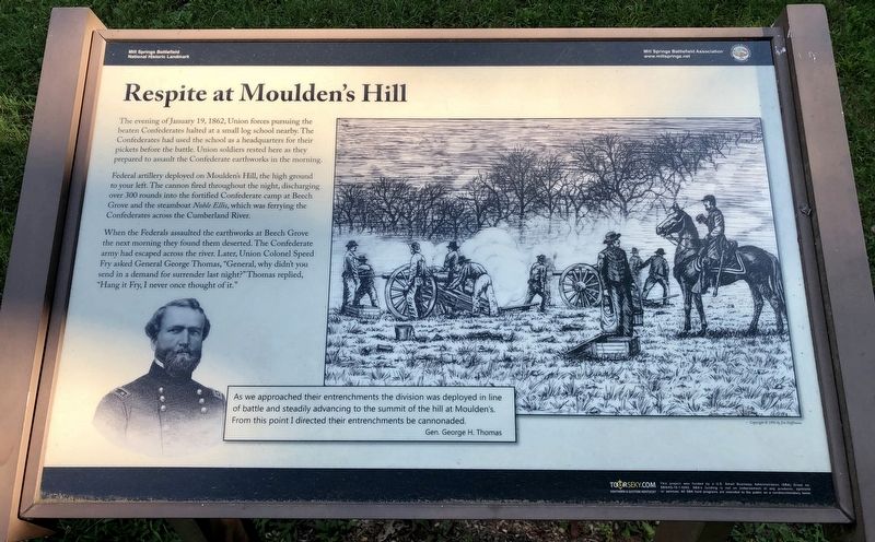
The evening of January 19, 1862, Union forces pursuing the beaten Confederates halted at a small log school nearby. The Confederates had used the school as a headquarters for their pickets before the battle. Union soldiers rested here as they prepared to assault the Confederate earthworks in the morning.
Federal artillery deployed on Moulden's Hill, the high ground to your left. The cannon fired throughout the night, discharging over 300 rounds into the fortified Confederate camp at Beech Grove and the steamboat Noble Ellis, which was ferrying the Confederates across the Cumberland River.
When the Federals assaulted the earthworks at Beech Grove the next morning they found them deserted. The Confederate army had escaped across the river. Later, Union Colonel Speed Fry asked General George Thomas,"General, why didn't you send in a demand for surrender last night?" Thomas replied, "Hang it Fry, I never once thought of it."
Inset drawings:
As we approached their entrenchments the division was deployed in line of battle and steadily advancing to the summit of the hill at Moulden's. From this point I directed their
this page online
Gen. George H. Thomas
Erected 2014 by Mill Springs Battlefield Association.
Topics and series. This historical marker is listed in these topic lists: Landmarks • War, US Civil. In addition, it is included in the National Historic Landmarks series list. A significant historical date for this entry is January 19, 1862.
Location. 36° 57.694′ N, 84° 46.85′ W. Marker is near Nancy, Kentucky, in Pulaski County. It is on Mill Springs-Battlefield Road 0.3 miles south of Muskett Road, on the right when traveling south. Touch for map. Marker is at or near this postal address: Mill Springs-Battlefield Road, Nancy KY 42544, United States of America. Touch for directions.

Regionally, this marker is in Kentucky’s Lake Cumberland Region. It is also in the American South, specifically in the Upper South, in Appalachia, and specifically in Southern Appalachia. Globally, it is in North America, the Western Hemisphere, the Western World, and the Anglosphere. Historically, it finds itself in what was once the territory of the Mississippian Culture and also the Antebellum South.
Other nearby markers. At least
Photographed by Mark Hilton, July 12, 2019
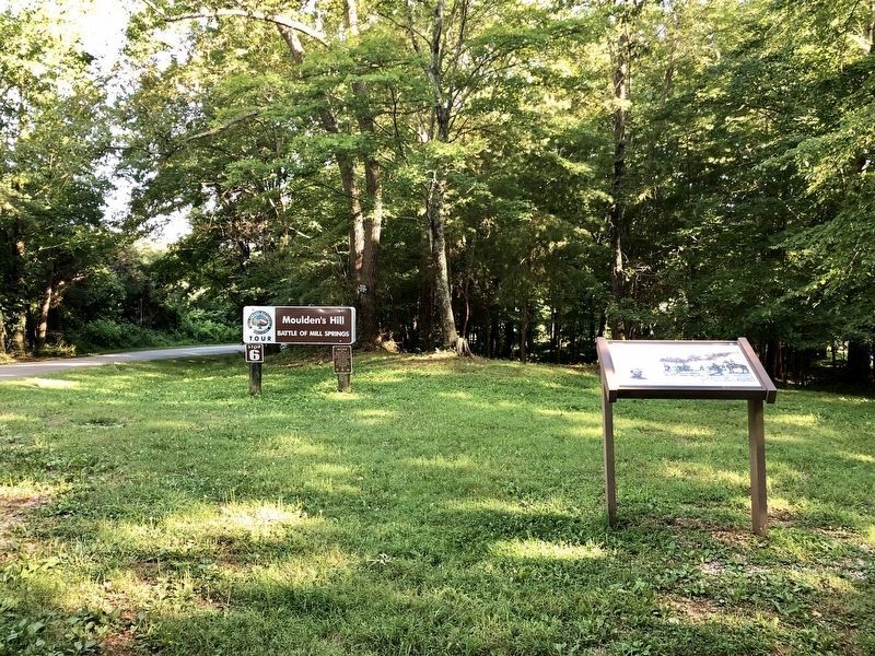
2. Marker at the Mill Springs Battlefield Tour Stop #6.
Other markers no longer nearby. Moulden's Hill (was a few steps from this marker but has been replaced with another marker now near it); a different marker also named Zollie's Den (was approx. 0.7 miles away but has been replaced with another marker now near it); Noble Ellis - Sternwheeler that Saved an Army (was approx. 1.4 miles away but has been replaced with another marker now near it).
Also see . . . Battle of Mills Spring. Wikipedia entry (Submitted on October 30, 2022, by Larry Gertner of New York, New York.)
Credits. This page was last revised on October 30, 2022. It was originally submitted on July 25, 2019, by Mark Hilton of Montgomery, Alabama. This page has been viewed 383 times since then and 23 times this year. Photos: 1, 2. submitted on July 25, 2019, by Mark Hilton of Montgomery, Alabama.
