Nahuizalco, Sonsonate, El Salvador — Central America (West Coast)
Nahuizalco
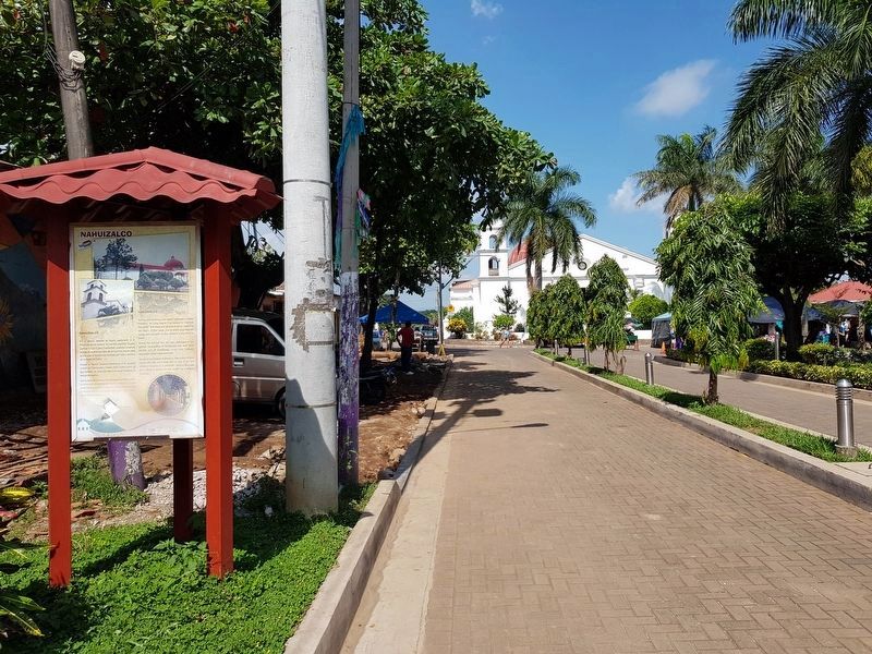
El rótulo histórico está compuesto de tres paneles
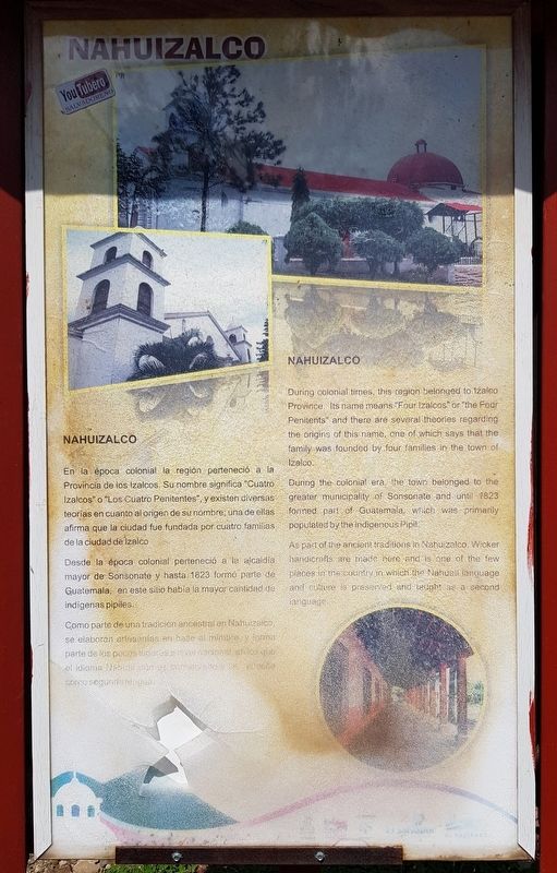
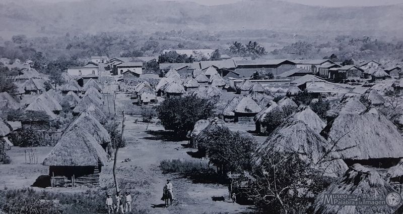
En la época colonial la región perteneció a la Provincia de los Izalcos. Su nombre significa “Cuatro Izalcos” o “Los Cuatro Penitentes”, y existen diversas teorías en cuanto al origen de su nombre; una de ellas afirma que la ciudad fue fundada por cuatro familias de la ciudad de Izalco.
Desde la época colonial perteneció a la alcaldía mayor de Sonsonate y hasta 1823 formó parte de Guatemala, en este sitio había la mayor cantidad de indigenas pipiles.
Como parte de una tradición ancestral en Nahuizalco, se elaboran artesanías en base al mimbre y forma parte de los pocos lugares a nivel nacional en los que el idioma Nahuat y su cultura se preserva y enseña como segunda lengua.
Tierra folclórica
Los Historiantes
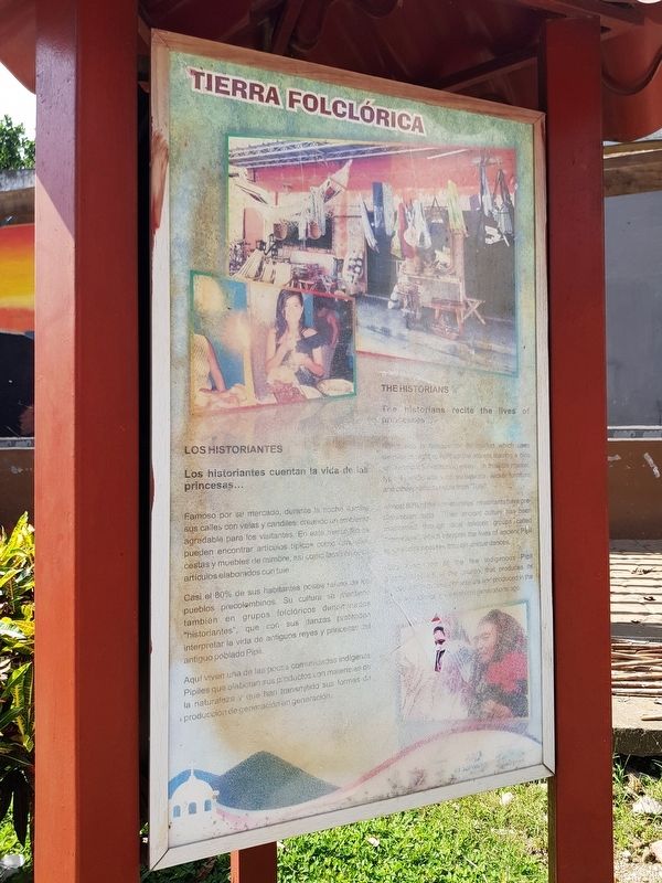
Los historiantes cuentan la vida de las princesas...
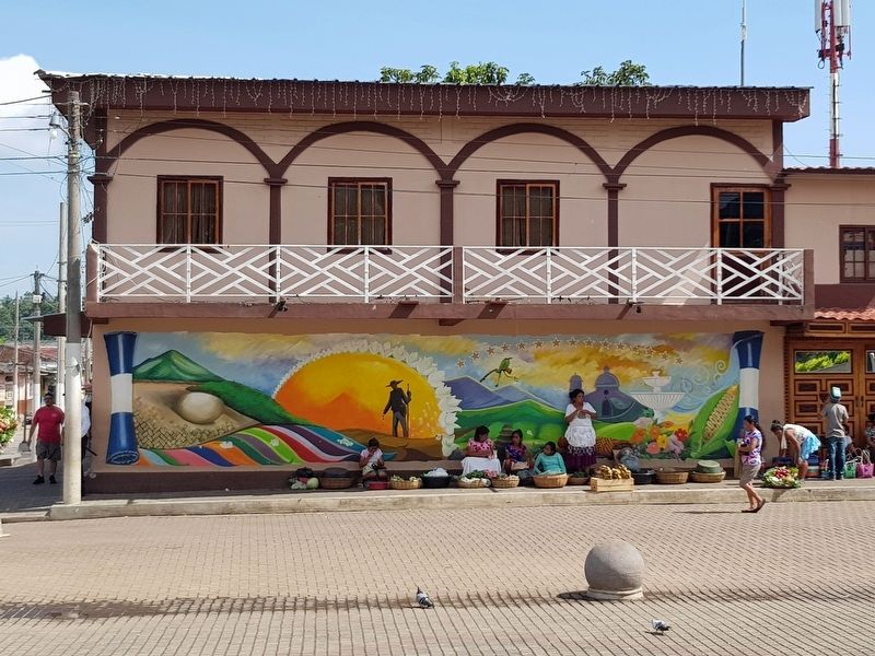
Famoso por su mercado, durante la noche ilumina sus calles con velas y candiles, creando un ambiente agradable para los visitantes. En este mercado se pueden encontrar artículos típicos como comidas, cestas y muebles de mimbre, así como también artículos elaborados con tule.
Casi el 80% de sus habitantes posea raíces de los pueblos precolombinos. Su cultura se mantiene también en grupos folclóricos denominados “historiantes”, que con sus danzas pretenden interpretar la vida de antiguos reyes y princesas del antiguo poblado Pipil.
Aquí viven una de las pocas comunidadas indígenas Pipiles que elaboran sus productos con materiales de la naturaleza y que han transmitido sus formas de producción de generación en generación.
Ruta Colonial y de los Volcanes
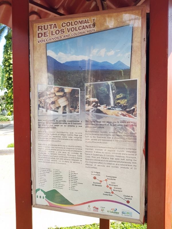
Esta ruta turística te permite experimentar y conocer los principales volcanes de El Salvador, los pueblos que están en su entorno y sus antiguas costumbres.
Itinerario turistico multidestino que recorre Centroamérica siguiendo el antiguo Camino Real que construyeron los españoles sobre rutas indígenas preexistentes, paralelas y transversales a las cordilleras volcánicas de la costa pacifica.
Esta ruta es considerada dentro de la industria turística como el ejemplo mas importante de integración turística regional, ya que permite admirar de forma simultanea su naturaleza, volcanes y una serie de ciudades de Guatemala, El Salvador, Honduras, Nicaragua, Costa Rica y Panamá que fueron construidas durante la época de la colonia española. Con este esfuerzo integrado, se cuenta, a nivel nacional, con la oferta de servicios y productos turisticos de 33 municipios.
Listado de lugares asociados en El Salvador y el resto de América Central
This marker is made up of three panels
Nahuizalco
During colonial times, this region belonged to Izalco Province. Its name means “Four Izalcos” or “the Four Penitents” and there are several theories regarding the origins of this name, one of which says that the family was founded by four families in the town of Izalco.
During the colonial era, the town belonged to the greater municipality of Sonsonate and until 1823 formed part of Guatemala, which was primarily populated by the indigenous Pipil.
As part of the ancient traditions in Nahuizalco, wicker handicrafts are made here and is one of the few places in the country in which the Nahuat language and culture is preserved and taught as a second language.
A Land of Folklore and Culture
The Historians
The historians recite the lives of princesses…
Nahuizalco is famous for its market which uses candles at night to light up the streets leaving a nice environment for visitors to enjoy. In this little market typical handicrafts, such as baskets, wicker furniture and other products made from “Tule.”
Almost 80% of the communities’ inhabitants
have pre-Colombian roots. Their ancient culture has been maintained through local folkloric groups called “historians”, which interpret the lives of ancient Pipil kings and princesses through unique dances.
Nahuizalco is one of the few indigenous Pipil communities in the country that produces its handicrafts from natural materials and produced in the same way as in generations ago.
Volcanoes and Colonial Route
This tourist route will allow you to know the most important volcanoes of El Salvador, their towns and ancient culture.
Multidestination touristic schedule that runs through Central America following the old Camino Real that was built by the Spaniards over a preexisting indigenous route, parallel and transversal to the volcanic mountain chains of the pacific coast.
This route is considered in the tourist industry as the most important example of regional touristic integration because it allows its nature, volcanoes and a series of towns in Guatemala, El Salvador, Honduras, Nicaragua Costa Rica and Panama that were built during the Spaniard colonial era to be admired simultaneously. With this integrated effort, it's relied on, at a national level, the offerings of services and touristic products of 33 municipalities.
List of associated places in El Salvador and the rest of Central America
Topics. This historical
marker is listed in these topic lists: Colonial Era • Industry & Commerce • Native Americans. A significant historical year for this entry is 1823.
Location. 13° 46.883′ N, 89° 44.274′ W. Marker is in Nahuizalco, Sonsonate. Marker is on 3a Calle Poniente just east of 3a Avenida Sur, on the left when traveling east. Touch for map. Marker is in this post office area: Nahuizalco, Sonsonate 00308, El Salvador. Touch for directions.
Other nearby markers. At least 8 other markers are within 23 kilometers of this marker, measured as the crow flies. Oscar Arnulfo Romero (within shouting distance of this marker); Parish Church of Saint John the Baptist (about 90 meters away, measured in a direct line); General Manuel José Arce (approx. 6.8 kilometers away); Rafael Campo (approx. 6.8 kilometers away); The Cathedral of Sonsonate and the 2001 Earthquakes (approx. 6.9 kilometers away); Monsignor Oscar Arnulfo Romero Galdámez (approx. 6.9 kilometers away); The Ataco Catholic Church and 2001 Earthquake (approx. 15.6 kilometers away in Ahuachapán); Salvador Antonio Gómez Góchez (approx. 21.6 kilometers away in Ahuachapán). Touch for a list and map of all markers in Nahuizalco.
Credits. This page was last revised on August 12, 2019. It was originally submitted on August 9, 2019, by J. Makali Bruton of Accra, Ghana. This page has been viewed 322 times since then and 15 times this year. Photos: 1, 2, 3, 4, 5, 6. submitted on August 9, 2019, by J. Makali Bruton of Accra, Ghana.
