Near Petersburg in Dinwiddie County, Virginia — The American South (Mid-Atlantic)
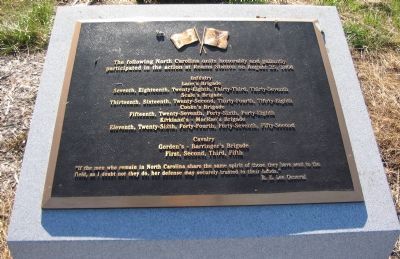
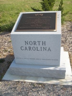
North Carolina
participated in the action at Reams Station on August 25, 1864
Infantry
Lane's Brigade
Seventh, Eighteenth, Twenty-Eighth, Thirty-Third, Thirty-Seventh
Scale's Brigade
Thirteenth, Sixteenth, Twenty-Second, Thirty-Fourth, Thirty-Eighth
Cooke's Brigade
Fifteenth, Twenty-Seventh, Forty-Sixth, Forty-Eighth
Kirkland's - MacRae's Brigade
Eleventh, Twenty-Sixth, Forty-Fourth, Forty-Seventh, Fifty-Second
Cavalry
Gorden's - Barringer's Brigade
First, Second, Third, Fifth
"If the men who remain in North Carolina share the same spirit of those they have sent to the field, as I doubt not they do, her defense may securely trusted to their hands."
R.E. Lee General
Erected by N. C. Division, Sons of Confederate Veterans.
Topics and series. This historical marker is listed in this topic list: War, US Civil. In addition, it is included in the Sons of Confederate Veterans/United Confederate Veterans series list. A significant historical date for this entry is August 25, 1864.
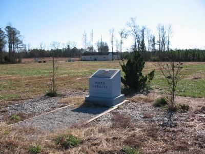
Location. 37° 5.646′ N, 77° 25.362′ W. Marker is near Petersburg, Virginia, in Dinwiddie County. Marker can be reached from the intersection of Reams Drive (County Route 606) and Halifax Road (County Route 604), on the right when traveling west. Located in Civil War Preservation Trust's Reams Station Battlefield. Touch for map. Marker is in this post office area: Petersburg VA 23805, United States of America. Touch for directions.
Other nearby markers. At least 8 other markers are within 5 miles of this marker, measured as the crow flies. Second Battle Of Reams Station (within shouting distance of this marker); a different marker also named Second Battle Of Reams Station (within shouting distance of this marker); Fighting At Reams Station (about 300 feet away, measured in a direct line); a different marker also named Second Battle Of Reams Station (about 700 feet away); Ream's Station (approx. 0.2 miles away); Second Battle of Reams Station (approx. 0.2 miles away); a different marker also named Reams Station (approx. 4.1 miles away); The Petersburg Railroad (approx. 4˝ miles away). Touch for a list and map of all markers in Petersburg.
Also see . . .
1. Ream's Station. National Park Service site detailing the phases of the battle. (Submitted on November 23, 2008, by Craig Swain of Leesburg, Virginia.)
2. Reams Station Preservation Efforts. The Civil War Preservation Trust continues their work ensuring the battlefield at Reams Station is preserved. This site offers not only maps and additional information about the battle, but "clean" copies of the markers on site. Look on the right under Slideshows for the
Reams Station Interpretive Trail. (Submitted on November 25, 2008, by Craig Swain of Leesburg, Virginia.)
Photographed By Craig Swain, November 22, 2008
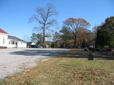
5. Cooke's Brigade
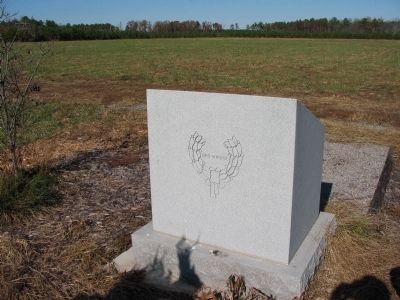
Looking to the east behind the Oak Grove Church. Cooke's Brigade broke through the Federal defenses along the Weldon Railroad and rolling up the flanks of the defenders. The North Carolina troops formed a line extending to the east of the church from these grounds.
Credits. This page was last revised on March 20, 2024. It was originally submitted on November 23, 2008, by Craig Swain of Leesburg, Virginia. This page has been viewed 1,598 times since then and 26 times this year. Photos: 1. submitted on November 23, 2008, by Craig Swain of Leesburg, Virginia. 2. submitted on December 27, 2008, by Bill Coughlin of Woodland Park, New Jersey. 3, 4, 5. submitted on November 23, 2008, by Craig Swain of Leesburg, Virginia.
