Near Petersburg in Dinwiddie County, Virginia — The American South (Mid-Atlantic)
The Battle of Reams Station
Oak Grove United Methodist Church
Photographed by Craig Swain, November 22, 2008
1. The Battle of Reams Station - Oak Grove Church Marker
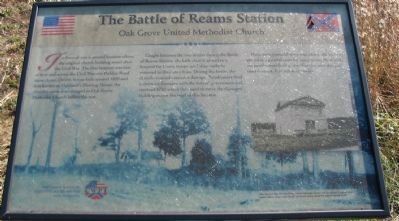
Caught between two armies during the Battle of Reams Station, the little church served as a hospital for Union troops until they could be removed to their own lines. During the battle, the church received extensive damage. Parishioners filed a claim for damages with the federal government and received $750 which they used to move the damaged building across the road to this location.
Here, after a second story was added, the building served as a general store for many years. Meanwhile the parishioners built a new church where this one used to stand. It is still active today.
Erected by Civil War Preservation Trust.
Topics. This historical marker is listed in these topic lists: Religion & Religious Structures • War, US Civil. A significant historical year for this entry is 1820.
Location. Marker has been reported
this page online
We have been informed that this marker is no longer there and will not be replaced. This page is an archival view of what was.
Regionally, this marker was in Virginia’s Piedmont, in Southside Virginia, and specifically in Central Virginia. It was also in the American South and specifically in the Upper South. Globally, it was in North America, the Western Hemisphere, the Western World, and the Anglosphere. Historically, it found itself in what was once the territory of the Mississippian Culture, one of the original Thirteen Colonies, one of the Confederate States of America, and the Antebellum South.

Other nearby markers. At

Other markers no longer nearby. The Battle of Reams Station (was about 300 feet away, measured in a direct line but has been permanently removed); a different marker also named The Battle of Reams Station (was about 700 feet away but has been permanently removed); a different marker also named Ream's Station (was about 800 feet away but has been confirmed missing); a different marker also named The Battle of Reams Station (was approx. 0.2 miles away but has been permanently removed).
More about this marker.
Photographed by Craig Swain, November 22, 2008
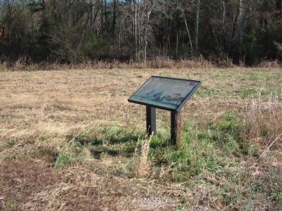
3. Oak Grove United Methodist Church Wayside
Also see . . .
1. Reams Station. National Park Service site detailing the phases of the battle. (Submitted on November 23, 2008, by Craig Swain of Leesburg, Virginia.)
2. Reams Station Preservation Efforts. The Civil War Preservation Trust continues their work ensuring the battlefield at Reams Station is preserved. This site offers not only maps and additional information about the battle, but "clean" copies of the markers on site. Look on the right under Slideshows for the Reams Station Interpretive Trail. (Submitted on November 25, 2008, by Craig Swain of Leesburg, Virginia.)
Photographed by Craig Swain, November 22, 2008
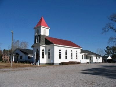
4. Oak Grove United Methodist Church
The original church was a landmark in the June 22 skirmish, the June 29 battle, and the August 25 battle around Reams Station. A new church was built on the foundation of the wartime church. When the new church was built, planks from the original showed musket ball holes and embedded canister balls.
Credits. This page was last revised on March 20, 2024. It was originally submitted on November 23, 2008, by Craig Swain of Leesburg, Virginia. This page has been viewed 2,833 times since then and 40 times this year. Photos: 1. submitted on November 23, 2008, by Craig Swain of Leesburg, Virginia. 2. submitted on March 11, 2009, by Craig Swain of Leesburg, Virginia. 3, 4. submitted on November 23, 2008, by Craig Swain of Leesburg, Virginia.
