Near Kanarraville in Iron County, Utah — The American Mountains (Southwest)
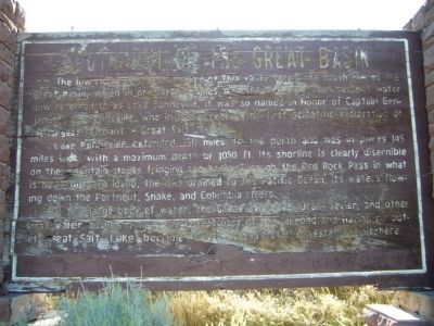
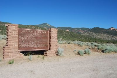
South Rim of the Great Basin
Lake Bonneville extended 350 miles to the north and was in places 145 miles wide, with a maximum depth of 1050 ft. Its shoreline is clearly discernible on the mountain slopes fringing the basin. Through the Red Rock Pass in what is now southern Idaho, the lake drained into the Pacific Ocean, its waters flowing down the Portneuf, Snake, and Columbia Rivers.
Of this large body of water, the Great Salt Lake, Utah, Sevier, and other small lakes remain. Lying in the lowest part of the lake bed and having no outlet, Great Salt Lake has become the “Dead Sea” of the Western Hemisphere.
Erected by Utah State Road Commission.
Topics. This historical marker is listed in this topic list: Natural Features. A significant historical year for this entry is 1833.
Location. 37° 34.612′ N, 113° 9.679′ W. Marker is near Kanarraville, Utah, in Iron County. Marker is on Old U.S. 91, 2.9 miles Kanarraville , on the left when traveling south. Touch for map. Marker is in this post office area: Cedar City UT 84720, United States of America. Touch for directions.
Other nearby markers. At least 5 other markers are within 8 miles of this marker, measured as the crow flies. Fort Kanarra (approx. 3 miles away); Hamilton Fort (approx. 3.9 miles away); The Casting of the Lots (approx. 7.6 miles away); Old Brickyards (approx. 7.9 miles away); Fort Harmony (approx. 8 miles away).
Additional commentary.
1. Great and interesting
That’s a great piece of history that I’m glad to find out about. Thanks for posting it.
— Submitted July 7, 2007, by Charles Uibel of Salt Lake City, Utah.
Credits. This page was last revised on June 16, 2016. It was originally submitted on June 27, 2007, by Dawn Bowen of Fredericksburg, Virginia. This page has been viewed 1,876 times since then and 35 times this year. Photos: 1. submitted on June 27, 2007, by Dawn Bowen of Fredericksburg, Virginia. 2. submitted on September 13, 2012, by Bill Kirchner of Tucson, Arizona. 3, 4. submitted on June 27, 2007, by Dawn Bowen of Fredericksburg, Virginia. • J. J. Prats was the editor who published this page.


