Centreville in Queen Anne's County, Maryland — The American Northeast (Mid-Atlantic)
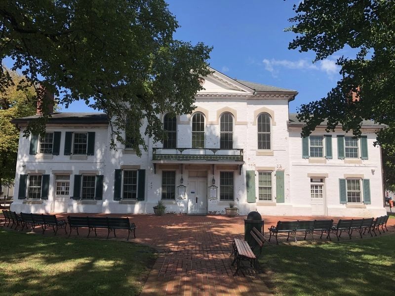
The Queen Anne's County Courthouse

Photographed By Devry Becker Jones (CC0), August 24, 2019
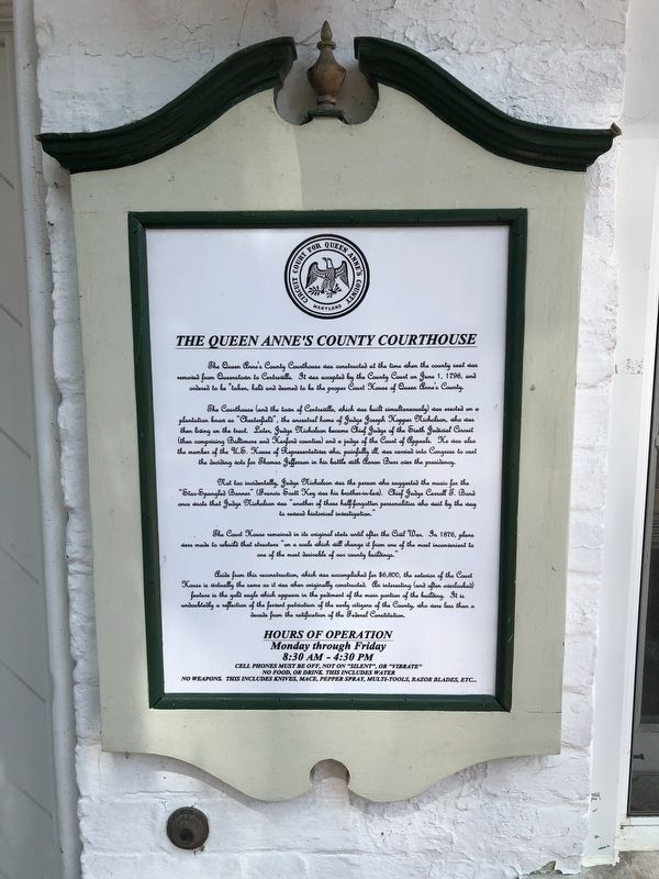
1. The Queen Anne's County Courthouse Marker
The Courthouse (and the town of Centreville, which was built simultaneously) was erected on a plantation know as "Chesterfield", the ancestral home of Judge Joseph Hopper Nicholson, who was then living on the tract. Later, Judge Nicholson became Chief Judge of the Sixth Judicial Circuit (then comprising Baltimore and Harford counties) and a judge of the Court of Appeals. He was also the member of the U.S. House of Representatives who, painfully ill, was carried into Congress to cast the deciding vote for Thomas Jefferson in his battle with Aaron Burr over the presidency.
Not too incidentally, Judge Nicholson was the person who suggested the music for the "Star-Spangled Banner" (Francis Scott Key was his brother-in-law). Chief Judge Carroll T. Bond once wrote that Judge Nicholson was "another of those half-forgotten personalities who wait by the way to reward historical investigation."
The Court House remained in its original state until after the Civil War. In 1876, plans were made to rebuild that structure "on a scale which will change it from one of the most inconvenient to one of the most desirable of our county buildings."
Aside from this reconstruction, which was accomplished for $6,800, the exterior of the Court House is virtually the same as it was when originally constructed. An interesting (and often overlooked) feature is the gold eagle which appears in the pediment of the main portion of the building. It is undoubtedly a reflection of the fervent patriotism of the early citizens of the County, who were less than a decade from the ratification of the Federal Constitution.
Erected by Circuit Court for Queen Anne's County, Maryland.
Topics and series. This historical marker is listed in these topic lists: Arts, Letters, Music • Law Enforcement • Patriots & Patriotism • Settlements & Settlers. In addition, it is included in the Former U.S. Presidents: #03 Thomas Jefferson series list. A significant historical date for this entry is June 1, 1796.
Location. 39° 2.712′ N, 76° 3.928′ W. Marker is in Centreville, Maryland, in Queen Anne's County. Marker is on Broadway just west of Commerce Street (Maryland Route 213), on the left when traveling west. Touch for map. Marker is at or near this postal address: 100 Courthouse Square, Centreville MD 21617, United States of America. Touch for directions.
Other nearby markers. At least 8 other markers are within walking distance of this marker. Short History of Centreville (a few steps from this marker);
Credits. This page was last revised on November 22, 2019. It was originally submitted on August 25, 2019, by Devry Becker Jones of Washington, District of Columbia. This page has been viewed 171 times since then and 10 times this year. Photos: 1, 2. submitted on August 25, 2019, by Devry Becker Jones of Washington, District of Columbia.
