St. Michaels in Talbot County, Maryland — The American Northeast (Mid-Atlantic)
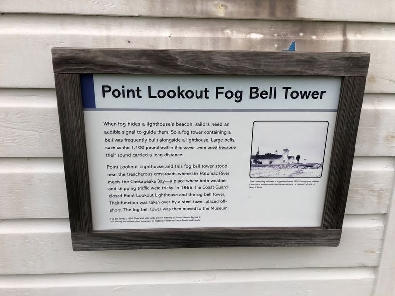
Point Lookout Fog Bell Tower
When fog hides a lighthouse's beacon, sailors need an audible signal to guide them. So a fog tower containing a bell was frequently built alongside a lighthouse. Large bells, such as the 1,100 pound bell in this tower were used because their sound carried a long distance.
Point Lookout Lighthouse and this fog bell tower stood near the treacherous crossroads where the Potomac River meets the Chesapeake Bay—a place where both weather and shipping traffic were tricky. In 1965, the Coast Guard closed Point Lookout Lighthouse and the fog bell tower. Their function was taken over by a steel tower placed offshore. The fog bell tower was then moved to the Museum.
Erected by Chesapeake Bay Maritime Museum.
Topics and series. This historical marker is listed in these topic lists: Notable Buildings • Waterways & Vessels. In addition, it is included in the Lighthouses series list. A significant historical year for this entry is 1965.
Location. 38° 47.255′ N, 76° 13.174′ W. Marker is in St. Michaels, Maryland, in Talbot County. Marker is on Mill Street just east of Burns Street, on the right when traveling east. Touch for map. Marker is at or near this postal address: 213 North Talbot Street, Saint Michaels MD 21663, United States of America. Touch for directions.
Other nearby markers. At least 8 other markers are within walking distance of this marker. Iconic Chesapeake Light (a few steps from this marker); Last Bell Foundry (a few steps from this marker); Heard Through the Fog (a few steps from this marker); Tolchester Beach Bandstand (a few steps from this marker); Delaware (a few steps from this marker); Hooper Strait Lighthouse (a few steps from this marker); How the Screwpile Lighthouse Got Its Name (within shouting distance of this marker); Hooper Straight Light's Twin (within shouting distance of this marker). Touch for a list and map of all markers in St. Michaels.
Related marker. Click here for another marker that is related to this marker. This marker has replaced the linked marker.
Credits. This page was last revised on June 28, 2023. It was originally submitted on August 26, 2019, by Devry Becker Jones of Washington, District of Columbia. This page has been viewed 118 times since then and 11 times this year. Photo 1. submitted on August 26, 2019, by Devry Becker Jones of Washington, District of Columbia.
