Downtown in Baton Rouge in East Baton Rouge Parish, Louisiana — The American South (West South Central)
Fort San Carlos
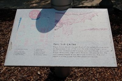
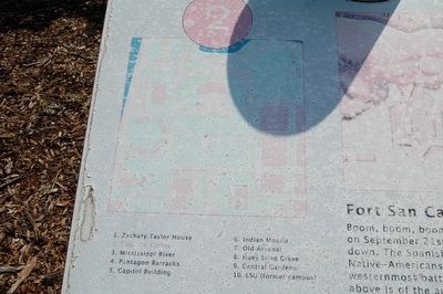
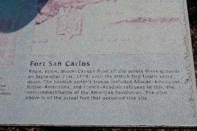
Boom, boom, boom! Cannon fired all day across these grounds on September 21st, 1779, until the British flag finally came down. The Spanish victor's troops included African-Americans, Native-Americans, and French-Acadian refugees, in this, the westernmost battle of the American Revolution. The plan above is of the actual fort that occupied the site. (Marker Number 2.)
Topics. This historical marker is listed in these topic lists: African Americans • Forts and Castles • Native Americans • War, US Revolutionary. A significant historical month for this entry is September 1858.
Location. 30° 27.281′ N, 91° 11.371′ W. Marker is in Baton Rouge, Louisiana, in East Baton Rouge Parish. It is in Downtown. Marker can be reached from the intersection of North 3rd Street and Spanish Town Road, on the left when traveling north. Touch for map. Marker is at or near this postal address: 900 N 3rd St, Baton Rouge LA 70802, United States of America. Touch for directions.
Other nearby markers. At least 8 other markers are within walking distance of this marker. A different marker also named Fort San Carlos (a few steps from this marker); Sigma Iota (a few steps from this marker); The Mississippi River (within shouting distance of this marker); The Amédé Ardoin Lemon Tree (within shouting distance of this marker); Pentagon Barracks (within shouting distance of this marker); Bogalusa to Baton Rouge March (about 300 feet away, measured in a direct line); Pentagon Buildings (about 400 feet away); Zachary Taylor (about 400 feet away). Touch for a list and map of all markers in Baton Rouge.
More about this marker. Marker is number 2 of 10 of a series of walking tour markers on the Louisiana State Capitol grounds.
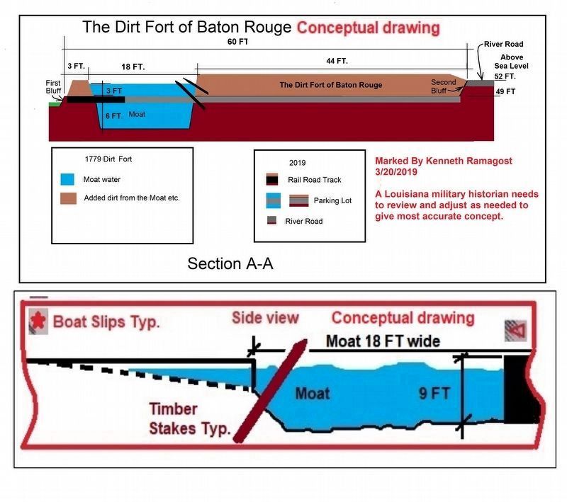
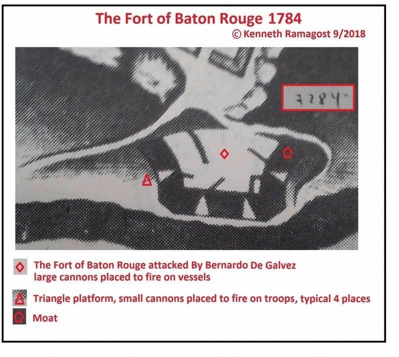
Regarding Fort San Carlos. (1779-1794, 1810), Baton Rouge. The French built the first fort here to subdue the local Indians (name and date?), but the British took control in 1764 and built Fort Richmond (1764-1768). Patriot forces took the rebuilt fort in 1778 (Fort New Richmond), but were captured by the British. The fort had an 18-foot wide and nine-foot deep moat, with 13 guns. It was located near present-day Boyd Ave. (Spanish Town Road) and Lafayette Street. The Spanish took the town and fort in 1779, rebuilt it as a new six-pointed star-shaped 16-gun fort, and by 1781 controlled all of West Florida. The English and American settlers rebelled in 1810 and proclaimed the "West Florida Republic" (or "Baton Rouge Republic"). The US took possession one month later. Compiled by Pete Payette - ©2003 American Forts Network
Related markers. Click here for a list of markers that are related to this marker. To better understand the relationship, study each marker in the order shown.
Also see . . .
1. Fort New Richmond. Wikipedia (Submitted on August 23, 2015.)
2. Eastern half of fort San Carlos in bricks with the point of the fort viewable. Google Map showing eastern half of fort San Carlos in bricks with the point of the fort viewable. Center of the fort shows a circle and may imply the dirt fort. (Submitted on October 26, 2018, by Kenneth Ramagost of Unknown, Louisiana.)
3. Pentagon Barracks. Excavation of Pentagon Barracks and Fort San Carlos with artifacts. (Submitted on March 24, 2019, by Kenneth Ramagost of Unknown, Louisiana.)
4. W. Florida Republic. History of Fort San Carlos and West Florida Republic (Submitted on March 26, 2019, by Kenneth Ramagost of Unknown, Louisiana.)
5. Spain and the American Revolution. Museum of the American Revolution website entry (Submitted on November 1, 2022, by Larry Gertner of New York, New York.)
Photographed By Kenneth Ramagost
5. Fort San Carlos Marker
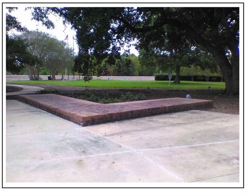
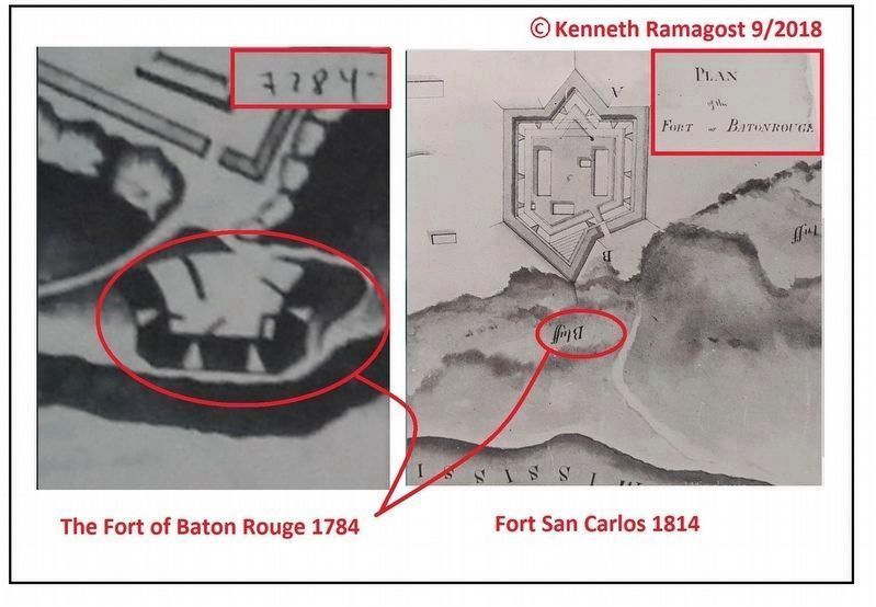
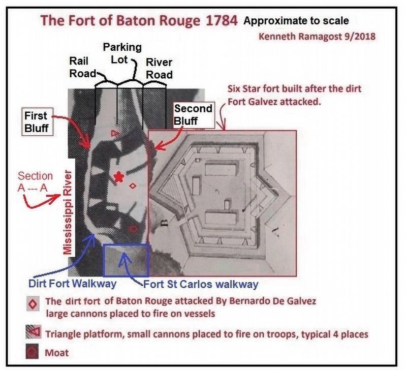
Location of the dirt fort, The Fort of Baron Rouge with respect to Fort San Carlos. Note the dirt fort was located in the parking lot across the River Road from Fort San Carlos. The dirt fort is overlaid on Fort San Carlos and the right walkways to the Mississippi River were matched in the blue square for magnitude scaling and location of both forts. See Google Map link Item 2 for overhead view.
Credits. This page was last revised on December 26, 2023. It was originally submitted on August 22, 2015. This page has been viewed 1,960 times since then and 57 times this year. Last updated on August 28, 2019. Photos: 1, 2, 3. submitted on August 22, 2015. 4. submitted on October 26, 2018, by Kenneth Ramagost of Unknown, Louisiana. 5, 6. submitted on March 21, 2019, by Kenneth Ramagost of Unknown, Louisiana. 7. submitted on August 28, 2019, by Kenneth Ramagost of Unknown, Louisiana. 8, 9. submitted on September 10, 2018, by Kenneth Ramagost of Unknown, Louisiana. • Bill Pfingsten was the editor who published this page.
