Oakley in Cassia County, Idaho — The American West (Mountains)
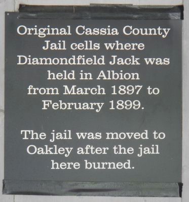
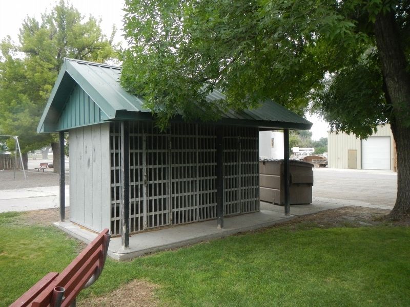
Cassia County Jail
The jail was moved to Oakley after the jail here burned.
Topics. This historical marker is listed in this topic list: Law Enforcement. A significant historical month for this entry is February 1899.
Location. 42° 14.545′ N, 113° 53.057′ W. Marker is in Oakley, Idaho, in Cassia County. Marker is on Blaine Avenue near West Main 2000 South, on the left when traveling south. Touch for map. Marker is in this post office area: Oakley ID 83346, United States of America. Touch for directions.
Other nearby markers. At least 8 other markers are within 17 miles of this marker, measured as the crow flies. Oakley Tabernacle (a few steps from this marker); City of Rocks (approx. 2.2 miles away); A Pleasant Place (approx. 15.1 miles away); California Trail -- Silent City of Rocks (approx. 15.2 miles away); Distant Views (approx. 15.3 miles away); Fading Away (approx. 15.3 miles away); Pinnacle Pass (approx. 15.6 miles away); California Trail -- Pinnacle Pass (approx. 16.2 miles away). Touch for a list and map of all markers in Oakley.
More about this marker. The jail cells are in Oakley City Park.
Also see . . . Diamondfield Jack. Wikipedia entry (Submitted on November 1, 2022, by Larry Gertner of New York, New York.)
Credits. This page was last revised on November 1, 2022. It was originally submitted on August 29, 2019, by Barry Swackhamer of Brentwood, California. This page has been viewed 188 times since then and 20 times this year. Photos: 1, 2, 3. submitted on August 29, 2019, by Barry Swackhamer of Brentwood, California.


