Ticonderoga in Essex County, New York — The American Northeast (Mid-Atlantic)
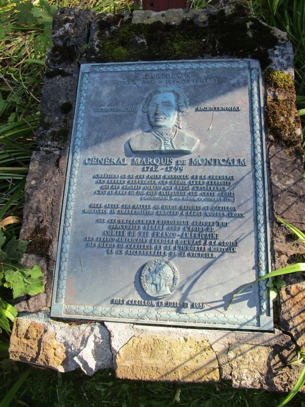
Carillon, July 8-1758 - 1958-13 Juillet
Bicentenaire Bicentennial
| — | General Marquis de Montcalm 1712-1759 | — |
Photographed by Anton Schwarzmueller, August 24, 2019
1. Carillon, July 8-1758 - 1958-13 Juillet Marker
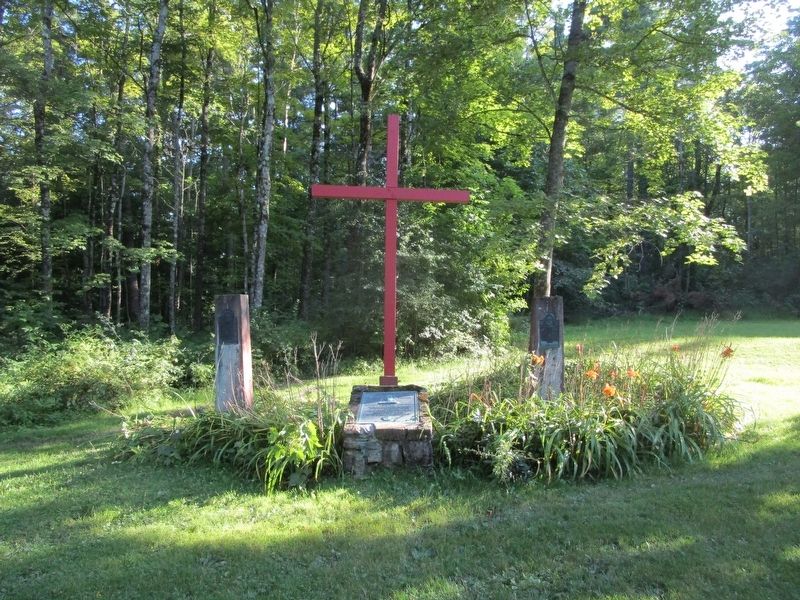
Here after the battle on these heights of Carillon, Montcalm in thanksgiving erected a large wooden cross.
Sur cet emplacement historique aujourd ‘hui sactuaire venere sous l’egide du Comite de Vie Franco-Americaine. Les Franco-Americains rendent homage a la gloire des heros de Carilon et de l’immortel Montcalm en ce bicentenaire de sa victoire.
Erected 1958 by Societe Historique Franco-Americaine.
Topics. This historical marker is listed in this topic list: War, French and Indian.
Location. 43° 50.929′ N, 73° 23.713′ W. Marker is in Ticonderoga, New York, in Essex County. It is on Sandy Redout Road 0.3 miles east of Fort Ticonderoga Road (New York State Route 74), on the right when traveling east. Marker is along the exit road for Fort Ticonderoga State Historic Site and is immediately behind the "Near This Spot Stood Montcalm" marker.
this page online

Regionally, this marker is in Upstate New York, in the Adirondacks & North Country, and in the Champlain Valley. It is also in the American Northeast and in the Mid-Atlantic. Globally, it is in North America, the Great North Woods, the Western Hemisphere, the Western World, and the Anglosphere. Historically, it finds itself in what was once the Viceroyalty of New France, New Netherland, and one of the original Thirteen Colonies.
Other nearby markers. At least 8 other markers are within walking distance of this marker: The French Lines & Carillon Battlefield (about 400 feet away, measured in a direct line); The Carillon Battlefield (about 500 feet away); “The Black Watch” (about 500 feet away); The French Lines (about 500 feet away); Near this spot stood Montcalm (about 700 feet away); George Augustus Viscount Howe (approx. 0.2 miles away); Hut Sites (approx. 0.2 miles away); a different marker also named “The Black Watch” (approx. 0.2 miles away). Touch for a list and map of all markers in Ticonderoga.
Photographed by Anton Schwarzmueller, August 24, 2019
2. Carillon, July 8-1758 - 1958-13 Juillet Marker
Photographed by Anton Schwarzmueller, August 24, 2019
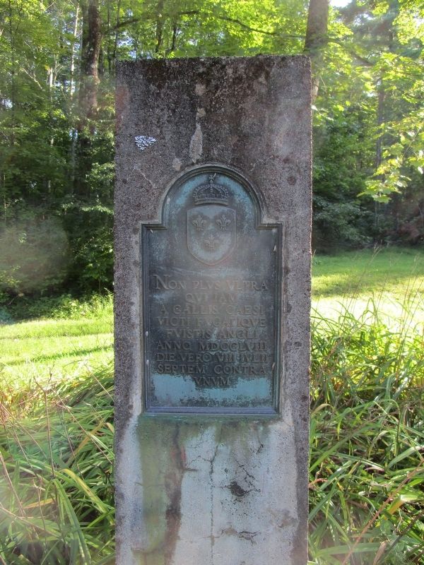
3. Left Tablet
Photographed by Anton Schwarzmueller, August 24, 2019
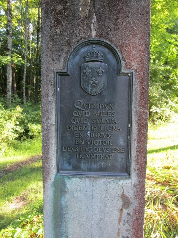
4. Right tablet
Credits. This page was last revised on August 29, 2019. It was originally submitted on August 29, 2019, by Anton Schwarzmueller of Wilson, New York. This page has been viewed 1,511 times since then and 1,042 times this year. Photos: 1, 2, 3, 4. submitted on August 29, 2019, by Anton Schwarzmueller of Wilson, New York.
