North Beach in Calvert County, Maryland — The American Northeast (Mid-Atlantic)
Beach & Pier
Picturing the Past
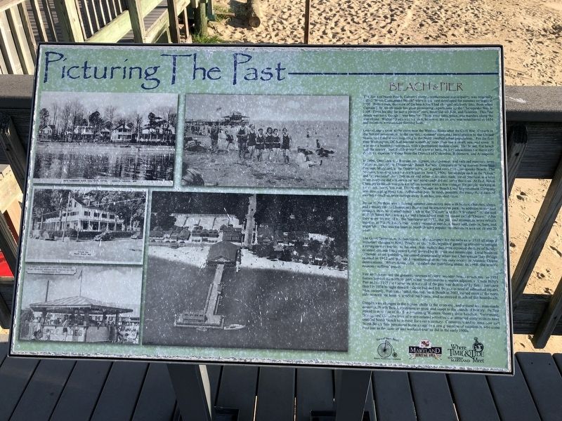
Great changes came to the cities near the Western Shore after the Civil War. Growth of the federal government in the capital, increased European immigration to the United States, and freed slaves migrating to the North swelled urban populations. For the first time Washington, DC had become something more than just a small, seasonal town. It was now a bustling metropolis with a permanent middle class. The broad, flat beach and the scenery that Smith described were to become key attractions
this page online
In 1896, Otto Mears, a Russian immigrant, entrepreneur, and railroad magnate from Colorado, formed the Chesapeake Beach Railway Company to bring tourists from Seat Pleasant, Maryland, at the District Line, to "a grand resort" at Chesapeake Beach. The 50-cents, hour-long train service began on June 9, 1900. Steamships such as the "Dixie" and "Dreamland" from Baltimore and other cities also made travel practical at a time when everyone did not own a car and good roads did not serve this area. At first, North Chesapeake beach was just a roadless hamlet with a few cottages for people working at the resort. Soon, however, The North Chesapeake Beach Land Improvement Company was developing these lots. Affordable parcels made possible for many the dream of owning a small summer cottage away from hot, crowded cities.
By the 1920s there was a thriving summer community where with homes, churches, shops, and a trolley line to Chesapeake Beach and its amusement park. In addition to summer cottages, there were small hotels such as the "Calvert"
The Great Depression, the hurricane, and bankruptcy for the railway in 1935 all shaped important changes to North Beach. In the 1940s, legalized gambling attractions brought a resurgence of tourism to the area. Automobile day-trips replaced the type of family-oriented, extended-stay resort travel favored by the train and steamships. Local business dependence on gambling increased dramatically when the Chesapeake Bay Bridge opened in 1952 and provided vacationing motorists easy access to Atlantic Ocean destinations. When Annapolis repealed the gambling statue in 1968, the town's economy suffered greatly.
Fire and storms are the greatest enemies of older, wooden beach structures. In 1951 flames leveled the northern part of the entertainment complex adjacent to Uncle Billy's Pier and in 1975 the restaurant at the end of the pier was destroyed by fire. Hurricane Hazel in 1954 brought down the dance hall and left the pier in need of substantial repairs. Most recently, Hurricane Isabel flooded North Beach in 2003, ruined most of the north side waterfront homes, eroded the beach, and destroyed much of the boardwalk.
Despite vast changes in the region, shifts in the economy, and natural and man-made disasters, North Beach continues to grow and adapt to the march of history. its fine fishing, and the same love of water-related activities that attracted early visitors have enabled North Beach to survive for over a century. Commuters and retirees now call North Beach their permanent home alongside a new generation of vacationers who come here just as the summer and weekend tourists did in the early 1900s.
Erected by Town of North Beach Historic Preservation Commission, Maryland Heritage Area, Southern Maryland.
Topics. This historical marker is listed in these topic lists: Colonial Era • Exploration • Railroads & Streetcars • Waterways & Vessels. A significant historical date for this entry is June 9, 1900.
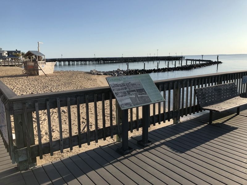
Location. 38° 42.33′ N, 76° 31.9′ W. Marker is in North Beach, Maryland, in Calvert County. It is at the intersection of Bay Avenue and 3rd Street, on the right when traveling north on Bay Avenue. Touch for map. Marker is at or near this postal address: 4118 3rd Street, North Beach MD 20714, United States of America. Touch for directions.

Regionally, this marker is in Southern Maryland. It is also in the American South, specifically in the Upper South, in the Mid-Atlantic, in the Tidewater, in the Chesapeake Bay Region, and on the Eastern Seaboard. Globally, it is in the North Atlantic Region, North America, the Western Hemisphere, the Western World, and the Anglosphere. Historically, it finds itself in what was once one of the original Thirteen Colonies and also the Antebellum South.
Other nearby markers. At least 8 other markers are within walking distance of this marker: North Beach Boardwalk (within shouting distance of this marker); The Town of North Beach (about 400 feet away, measured in a direct line); Russell David Hall (about 500 feet away); Beach Buccaneers (about 500 feet away); North Beach Pier (about 500 feet away); Working Watermen (about 500 feet away); Lt Brendan Looney (about 600 feet away); The Bay Bridge (about 700 feet away). Touch for a list and map of all markers in North Beach.
Credits. This page was last revised on August 30, 2019. It was originally submitted on August 30, 2019, by Devry Becker Jones of Washington, District of Columbia. This page has been viewed 1,196 times since then and 70 times this year. Photos: 1, 2. submitted on August 30, 2019, by Devry Becker Jones of Washington, District of Columbia.
