Solomons in Calvert County, Maryland — The American Northeast (Mid-Atlantic)
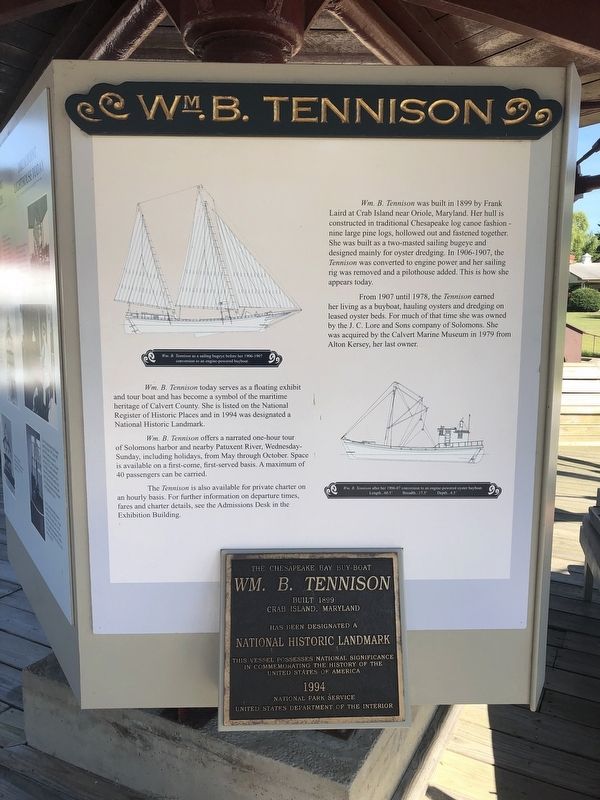
Wm. B. Tennison
From 1907 until 1978, the Tennison earned her living as a buyboat, hauling oysters and dredging on leased oyster beds. For much of that time, she was owned by the J. C. Lore and Sons company of Solomons. She was acquired by the Calvert Marine Museum in 1979 from Alton Kersey, her last owner.
Wm. B. Tennison today serves as a floating exhibit and tour boat and has become a symbol of the maritime heritage of Calvert County. She is listed on the National Register of Historic Places and in 1994 was designated a National Historic Landmark.
Wm. B. Tennison offers a narrated one-hour tour of Solomons harbor and nearby Patuxent River, Wednesday-Sunday, including holidays, from May through October. Space is available on a first-come, first-served basis. A maximum of 40 passengers can be carried.
The Tennison is also available for private charter on an hourly basis. For further information on departure times, fares and charter details, see the Admissions Desk in the Exhibition building.
[Plaque at the bottom of the sign:]
Wm. B. Tennison
Built 1899
Crab Island, Maryland
has been designated a
National Historic Landmark
This vessel possesses national significance
in commemorating the history of the
United States of America
1994
National Park Service
United States Department of the Interior
Erected by Calvert Marine Museum.
Topics and series. This historical marker is listed in these topic lists: Animals • Industry & Commerce • Landmarks • Waterways & Vessels. In addition, it is included in the National Historic Landmarks series list. A significant historical year for this entry is 1899.
Location. 38° 19.872′ N, 76° 27.804′ W. Marker is in Solomons, Maryland, in Calvert County. Marker can be reached from Solomons Island Road South (Maryland Route 2) south of Thomas Johnson Road, on the left when traveling south. Touch for map. Marker is at or near this postal address: 14200 Solomons Island Road South, Solomons MD 20688, United States of America. Touch for directions.
Other nearby markers. At least 8 other markers are within walking distance of this marker. Welcome to Drum Point Lighthouse (here, next to this marker); Calvert Marine Museum's Dee of St. Mary's (here, next to this marker); The Business End of a Screwpile (here, next to this marker); Power Bateau (a few steps from this marker); a different marker also named Wm. B. Tennison (a few steps from this marker); This flagpole (a few steps from this marker); Sailing Bateau Witch of the Wave (a few steps from this marker); Spirit (within shouting distance of this marker). Touch for a list and map of all markers in Solomons.
Related marker. Click here for another marker that is related to this marker. This marker has replaced the linked marker.
Credits. This page was last revised on August 31, 2019. It was originally submitted on August 31, 2019, by Devry Becker Jones of Washington, District of Columbia. This page has been viewed 163 times since then and 19 times this year. Photo 1. submitted on August 31, 2019, by Devry Becker Jones of Washington, District of Columbia.
