Solomons in Calvert County, Maryland — The American Northeast (Mid-Atlantic)
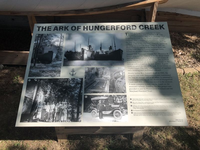
The Ark of Hungerford Creek
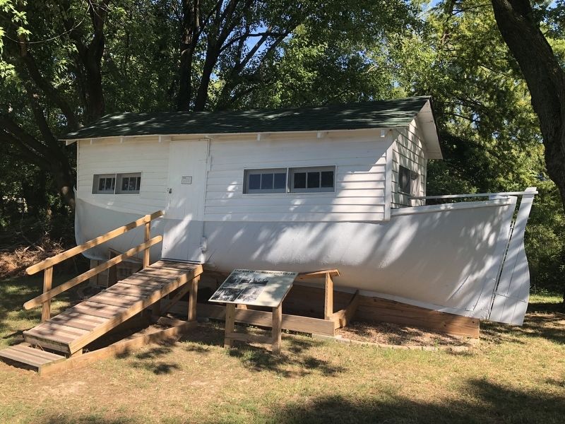
Around 1935, Episcopal minister Rev. Benjamin B. Lovett acquired this lifeboat from the Mount Vernon and had it hauled ashore at his weekend retreat on nearby Hungerford Creek. It was his idea to create a miniature biblical ark by building a house on the lifeboat with a chapel in the bow section. A guest room occupied the rest of the boat. It was known as "Faith Chapel–The Ark," and a number of baptisms and a wedding were performed onboard.
Shortly before Rev. Lovett's death in 1943, the property was sold. Successive owners maintained the Ark for storage and as an office. It remained a feature and curiosity on the shores of Hungerford Creek until 2016, when it was moved to the museum. A more complete history can be found on the museum's website. Funding for this project was provided in part by Preservation Maryland and the Maryland Historical Trust.
Erected by Calvert Marine Museum.
Topics. This historical marker is listed in these topic lists: Churches & Religion • War, World I • Waterways & Vessels. A significant historical year for this entry is 1906.
Location. 38° 19.824′ N, 76° 27.86′ W. Marker is in Solomons, Maryland, in Calvert County. Marker can be reached from Solomons Island Road South (Maryland Route 2) south of Thomas Johnson Road, on the left when traveling south. Touch for map. Marker is at or near this postal address: 14200 Solomons Island Road South, Solomons MD 20688, United States of America. Touch for directions.
Other nearby markers. At least 8 other markers are within walking distance of this marker. Waterman's Shed (within shouting distance of this marker); Drum Point Lighthouse (within shouting distance of this marker); Volunteer (about 300 feet away, measured in a direct line); Sewell Draketail Workboat (about 400 feet away); Built for Work — Built for Pleasure (about 400 feet away); Benning Crab Skiff (about 400 feet away); Humphreys Rowing Skiff (about 400 feet away); Spirit (about 400 feet away). Touch for a list and map of all markers in Solomons.
Credits. This page was last revised on August 31, 2019. It was originally submitted on August 31, 2019, by Devry Becker Jones of Washington, District of Columbia. This page has been viewed 117 times since then and 9 times this year. Photos: 1, 2. submitted on August 31, 2019, by Devry Becker Jones of Washington, District of Columbia.

