Blacksburg in York County, South Carolina — The American South (South Atlantic)
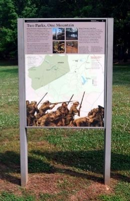
Two Parks, One Mountain
Kings Mountain National Military Park
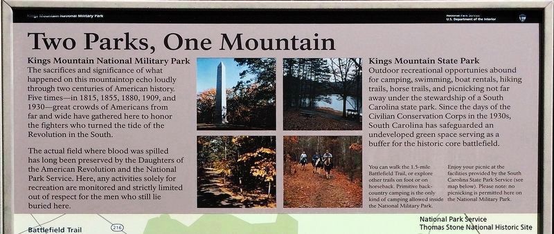
The sacrifices and significance of what happened on this mountaintop echo loudly through two centuries of American history. Five times—in 1815, 1855, 1880, 1909, and 1930—great crowds of Americans from far and wide have gathered here to honor the fighters who turned the tide of the Revolution in the South.
The actual field where blood was spilled has long been preserved by the Daughters of the American Revolution and the National Park Service. Here, any activities solely for recreation are monitored and strictly limited out of respect for the men who still like buried here.
Kings Mountain State Park
Outdoor recreational opportunities abound for camping, swimming, boat rentals, hiking trails, horse trails, and picnicking not for away under the stewardship of a South Carolina state park. Since the days of the Civilian Conservation Corps in the 1930's, South Carolina has safeguarded and undeveloped green space serving as a buffer for the historic core battlefield.
(captions)
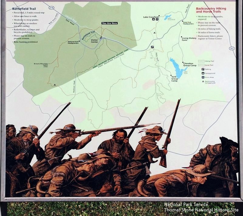
You can walk the 1.5 mile Battlefield Trail, or explore other trails on foot or on horseback. Primitive backcountry camping is the only kind of camping allowed inside the National Military Park.
Enjoy your picnic at the facilities provided by the South Carolina State Park Service (see map below). Please note: no picnicking is permitted here on the National Military Park.
Battlefield Trail
• Paved trail, 1.5 miles round-trip
• Allow one hour to walk.
• Moderate to steep grades
• Wheelchairs and strollers use caution
• Rollerblades, scooters and bicycles prohibited
• Please stay on trails to prevent erosion
• Relic hunting prohibited
Backcountry Hiking and Horse Trails
• Moderate to steep grades, unpaved
• Please stay on the trails to prevent erosion.
• 16 miles of hiking trails
• 16 miles of horse trails
• Backcountry hikers, please register at Visitor Center.
Erected by Kings Mountain National Military Park - National Park Service - U.S. Department of the Interior.
Topics and series. This historical marker is listed in these topic lists: Parks & Recreational Areas • War, US Revolutionary. In addition, it is included in the Civilian Conservation Corps (CCC) series list.
Location. 35° 8.48′ N, 81° 22.569′ W. Marker is in Blacksburg, South Carolina, in York County. Marker can be reached from Park Road, on the right when traveling east. The marker is located on
the north side of the park's parking lot. Touch for map. Marker is at or near this postal address: 2625 Park Road, Blacksburg SC 29702, United States of America. Touch for directions.
Other nearby markers. At least 8 other markers are within walking distance of this marker. God Save the King! (about 300 feet away, measured in a direct line); Liberty! (about 300 feet away); Carolina Backwoodsmen (about 400 feet away); Kings Mountain Battlefield Trail (about 500 feet away); Americans Vanquished (about 500 feet away); Fighting in a Forest Primeval (about 600 feet away); American Victors (about 600 feet away); Major Winston's (approx. 0.2 miles away). Touch for a list and map of all markers in Blacksburg.
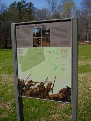
More about this marker. The lower portion of the marker is a map shows the two parks and identifies roads, trails and other key locations (Apple Road, Backcountry Campground, Battlefield Trail, Browns Mountain, Campground, Cherokee Group Camp, Colonial Road, HIking Trail, Horse Trail, Lake Crawford, Lake York, Living History Farm, National Park Headquarters, Park Road, Picnic Area, Piedmont Road, Rock House Road, State Park Headquarters, Visitor Center, York Group Camp).
Also see . . .
1. Kings Mountain National Military Park (National Park Service). Thomas Jefferson called it "The turn of the tide of success." (Submitted on September 4, 2010, by Brian Scott of Anderson, South Carolina.)
2. Kings Mountain National Military Park (Wikipedia). Kings Mountain National Military Park is a National Military Park near Blacksburg, South Carolina, along the North Carolina/South Carolina border. (Submitted on September 4, 2010, by Brian Scott of Anderson, South Carolina.)
3. Kings Mountain State Park (Wikipedia). Kings Mountain State Park is a South Carolina state park located in the Piedmont region of South Carolina. (Submitted on September 4, 2010, by Brian Scott of Anderson, South Carolina.)
4. Kings Mountain National Military Park (South Carolina Department of Archives and History). The Battle at Kings Mountain, fought between British loyalist forces and American patriots on October 7, 1780, ended a string of British successes in the Carolinas and Georgia. (Submitted on September 4, 2010, by Brian Scott of Anderson, South Carolina.)
5. Kings Mountain State Park Historic District (South Carolina Department of Archives and History). The Kings Mountain State Park Historic District is significant for its association with the Civilian Conservation Corps (CCC) and other New Deal conservation programs in South Carolina and the material legacy they left behind. (Submitted on September 4, 2010, by Brian Scott of Anderson, South Carolina.)
6. Kings Mountain National Military Park, Historic Resource Study (pdf file). National
Park Service (Submitted on September 1, 2019.)
7. Daughters of the American Revolution (Wikipedia). The Daughters of the American Revolution (DAR) is a lineage-based membership organization of women dedicated to promoting historic preservation, education, and patriotism. (Submitted on September 4, 2010, by Brian Scott of Anderson, South Carolina.)
8. Civilian Conservation Corps (Wikipedia). The Civilian Conservation Corps (CCC) was a public work relief program for unemployed men age 18-24, providing unskilled manual labor related to the conservation and development of natural resources in rural areas of the United States from 1933 to 1942. (Submitted on September 4, 2010, by Brian Scott of Anderson, South Carolina.)
National Park Service, Thomas Stone National Historic Site, May 28, 2019
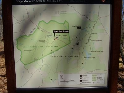
5. Two Parks, One Mountain Marker: Close up of map.
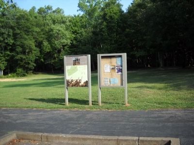
Viewing north towards marker.
The map shows the two parks and identifies roads, trails and other key locations (Apple Road, Backcountry Campground, Battlefield Trail, Browns Mountain, Campground, Cherokee Group Camp, Colonial Road, HIking Trail, Horse Trail, Lake Crawford, Lake York, Living History Farm, National Park Headquarters, Park Road, Picnic Area, Piedmont Road, Rock House Road, State Park Headquarters, Visitor Center, York Group Camp).
Credits. This page was last revised on November 27, 2020. It was originally submitted on April 5, 2009, by Stanley and Terrie Howard of Greer, South Carolina. This page has been viewed 1,322 times since then and 34 times this year. Last updated on September 1, 2019. Photos: 1. submitted on April 5, 2009, by Stanley and Terrie Howard of Greer, South Carolina. 2, 3. submitted on September 4, 2010, by Brian Scott of Anderson, South Carolina. 4, 5. submitted on September 1, 2019. 6. submitted on September 4, 2010, by Brian Scott of Anderson, South Carolina. 7. submitted on August 22, 2010, by Bill Coughlin of Woodland Park, New Jersey. 8. submitted on April 5, 2009, by Stanley and Terrie Howard of Greer, South Carolina. 9. submitted on September 4, 2010, by Brian Scott of Anderson, South Carolina. • Bernard Fisher was the editor who published this page.
