St. Mary's City in St. Mary's County, Maryland — The American Northeast (Mid-Atlantic)
Welcome to the Chapel Field
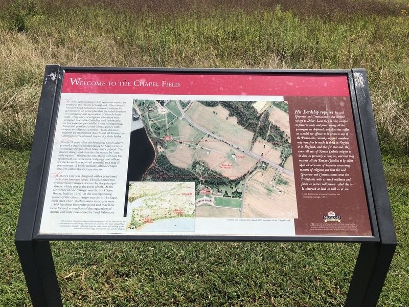
In 1634, approximately 140 colonists arrived to establish the colony of Maryland. The colony's founder, Lord Baltimore, intended to base his government on principles that included freedom of conscience and separation of church from state. His policy of religious toleration was designed to enable Catholics and Protestants to live together peacefully. From its beginning, Maryland practiced a very liberal policy with respect to religious activities. Taxes did not support an established church and all Trinitarian Christians were allowed to practice their faiths.
Nearly 35 years after founding, Cecil Calvert granted a charter incorporating St. Mary's City to encourage the growth of Maryland's capital. The charter designated that the city was to be "one mile square." Within the city, along with lots for residential use, were inns, lodgings, and offices for clerks and lawyers—all essential to a seat of government. A brick, Roman Catholic chapel also fell within the city's perimeter.
St. Mary's City was designed with a plan based on Italian baroque ideas. This plan was two symmetrical triangles, formed by the principal streets, which met at the town center. At the far corner of one triangle was the brick State House, built in 1676. At the corresponding corner of the other triangle was the brick chapel, built circa 1667. Both massive structures were 1,400 feet from the center point and may have been located as symbols of the separation of church and state envisioned by Lord Baltimore.
His Lordship requires his said Governor and Commissioners that in their voyage to Mary Land they be very careful to preserve unity and peace among all the passengers on shipboard, and that they suffer no scandal nor offence to be given to any of the Protestants, whereby any just complaint may hereafter be maid by them in Virginia or in England, and that for that end, they cause all acts of Roman Catholic religion to be done as privately as may be, and that they instruct the Roman Catholics to be silent upon all occasions of discourse concerning matters of religion; and that the said Governor and Commissioners treat the Protestants with as much mildness and favor as justice will permit. And this to be observed at land as well as at sea.
Lord Baltimore's instructions for the founding voyage, 1633.
Erected by Historic St. Mary's City.
Topics. This historical marker is listed in these topic lists: Churches & Religion • Colonial Era • Settlements & Settlers. A significant historical year for this entry is 1634.
Location. 38° 10.958′ N, 76° 25.739′
Other nearby markers. At least 8 other markers are within walking distance of this marker. The Calvert Family and the Founding of Maryland (within shouting distance of this marker); An Experiment with Liberty of Conscience (within shouting distance of this marker); An End of Freedom but Persistence of Faith (within shouting distance of this marker); The Chapel Architecture (within shouting distance of this marker); The Brick Chapel's History (within shouting distance of this marker); The "Priests' House" (within shouting distance of this marker); Sacred Ground and Holy Buildings (within shouting distance of this marker); "…buried…in a most solemn manner" (within shouting distance of this marker). Touch for a list and map of all markers in St. Mary's City.
Credits. This page was last revised on November 10, 2021. It was originally submitted on September 2, 2019, by Devry Becker Jones of Washington, District of Columbia. This page has been viewed 151 times since then and 16 times this year. Photos: 1, 2. submitted on September 2, 2019, by Devry Becker Jones of Washington, District of Columbia.

