
Rockville in Montgomery County, Maryland — The American Northeast (Mid-Atlantic)
Montgomery Avenue and Washington Street
Lost Rockville - 1801 to 1850
Photographed by Tom Fuchs, April 1, 2006
1. Mongomery Avenue and Washington Street Marker
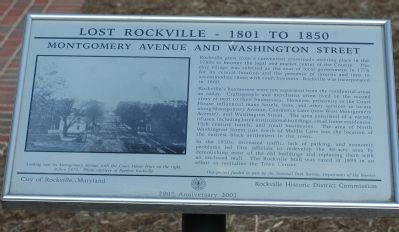
Rockville grew from a convenient crossroads meeting place in the 1750s to become the legal and market center of the county. The tiny village was selected as the seat of local government in 1776 for its central location and the presence of taverns and inns to accommodate those with court business. Rockville was incorporated in 1860.
Rockville's businesses were not separated from the residential areas as today. Craftspeople and merchants often lived on the second story or next to their businesses. However, proximity to the Court House influenced many hotels, inns, and businesses to locate along Montgomery Avenue, Commerce Lane (now West Montgomery Avenue), and Washington Street. The area consisted of a variety of uses, including brick institutional buildings, small frame residences, 19th century hotels, and small businesses. The area of North Washington Street just north of Middle Lane was the location of the earliest black settlement in the town.
In the 1950s, increased traffic, lack of parking, and economic problems led City officials to redevelop the 46-acre area by demolishing most of the old buildings and replacing
this page online
Erected 2001 by City of Rockville, Maryland, and the Rockville Historic District Commission.
Topics and series. This historical marker is listed in this topic list: Political Subdivisions. In addition, it is included in the Maryland, Lost Rockville – 1801 to 1850 series list. A significant historical year for this entry is 1750.
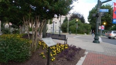
Location. This marker has been replaced by another marker nearby. It was located near 39° 5.061′ N, 77° 9.167′ W. Marker was in Rockville, Maryland, in Montgomery County. It was on Washington Street north of E. Montgomery Avenue (Courthouse Square), on the right when traveling north. Marker is at Courthouse Square. Touch for map. Marker was in this post office area: Rockville MD 20850, United States of America. Touch for directions.

Regionally, this marker was in the Washington Metropolitan Area. It was also in the American Mid-Atlantic. Globally, it was in North America, the Western Hemisphere, the Western World, and the Anglosphere. Historically, it found itself in what was once
Photographed by Tom Fuchs, April 1, 2006
2. The Potomac River Water Facility 1958 Marker
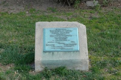
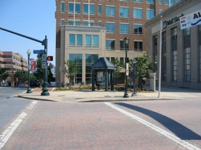
At this point the Potomac River Water Facility, constructed by the City of Rockville, was dedicated to the public use october 1958. This marker is across the street from the Montgomery Avenue and Washington Street marker.
Other nearby markers. At least 8 other markers are within walking distance of this location: Rockville Business District (here, next to this marker); Hungerford Tavern (about 300 feet away, measured in a direct line); Father Divine Birthplace (about 300 feet away); Hungerford Tavern Site (about 300 feet away); a different marker also named Gibbs v. Broome, et al. / 1931 Courthouse (about 300 feet away); a different marker also named Red Brick Courthouse (about 300 feet away); Rockville Town Square (about 400 feet away); a different marker also named Hungerford Tavern (about 400 feet away). Touch for a list and map of all markers in Rockville.
Other markers no longer nearby. Gibbs v. Broome, et al. / 1931 Courthouse (was about 300 feet away but has been replaced with another marker now near it); Red Brick Courthouse (was about 300 feet away but has been replaced with another marker now near it); Rockville (was about 400 feet away but has been replaced with another marker now near it).
More about this marker. This marker is titled "Rockville Business
Photographed by Richard E. Miller, June 14, 2011
3. Montgomery Avenue and Washington Street Marker
Also see . . . Rockville History. City website entry:
Links to three walking tours (Submitted on March 28, 2022, by Larry Gertner of New York, New York.)
Photographed by Craig Swain, July 7, 2007
4. Marker in the Plaza at Corner of Montgomery and Washington
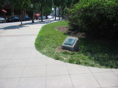
Photographed by Craig Swain, July 7, 2007
5. Location of Water Facility Marker
Credits. This page was last revised on March 21, 2026. It was originally submitted on April 5, 2006, by Tom Fuchs of Greenbelt, Maryland. This page has been viewed 2,682 times since then and 74 times this year. Last updated on September 3, 2019, by Allen C. Browne of Silver Spring, Maryland. Photos: 1, 2. submitted on April 5, 2006, by Tom Fuchs of Greenbelt, Maryland. 3. submitted on June 16, 2011, by Richard E. Miller of Oxon Hill, Maryland. 4, 5. submitted on July 7, 2007, by Craig Swain of Leesburg, Virginia. • Bill Pfingsten was the editor who published this page.
