St. Mary's City in St. Mary's County, Maryland — The American Northeast (Mid-Atlantic)
Witness to History
Discovering
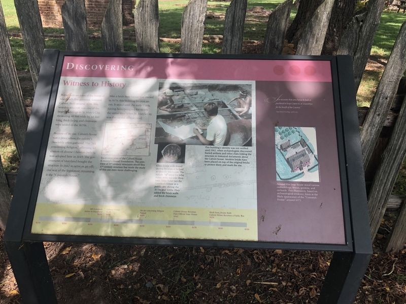
Because of its size, Calvert's home was a place where the colony's Assembly often gathered. The "Act concerning Religion," affirming toleration of diverse Christian beliefs, was adopted here in 1649. The government of Maryland bought the structure in 1662 to serve as an official seat of the legislature, renaming it the "Country's House."
After a brick State House was erected in 1676, this building became an inn. It stood until the early 1700s, having been occupied for nearly the entire time when St. Mary's City was the capital of Maryland.
[Captions:]
Excavation plan of the Calvert House (Country's House) foundation. The presence of 19th-century structures of this 17th-century structure has made the study of this site even more challenging.
Glass bottle seals found during excavation helped to identify this house. The initials "JB" stand for John Baker. With his wife Elizabeth, John Baker ran the Country's House as a public inn during the 1670s and 1680s. They added the brick walls and brick chimneys.
This building's identity was not verified until 1982, when archaeologists discovered buried artifacts and other clues linking the structure to historical documents about the Calvert house. Modern bricks have been placed on top of the original bricks to prevent them and mark the site.
[Timeline:]
1634 140 Colonists Arrive in Maryland
1636 Calvert House Built
1649 An Act concerning Religion Passed
1662 Calvert House Becomes First Official State House
1676 Brick State House Built Calvert House Becomes a Public Inn
[Aside:]
"...it is necessary that some house be built or purchased to keepe Courts in, or Assemblyes for the benefit of the Country."
Upper House Proceedings, April 5, 1662
Around this large house stood various outbuildings, fences, gardens, and orchards. This illustration, based on archaeological evidence, hints at the likely appearance of the "Country's House" around 1675.
Erected by Historic
this page online
Topics. This historical marker is listed in these topic lists: Colonial Era • Government & Politics • Industry & Commerce • Notable Buildings. A significant historical date for this entry is April 5, 1662.
Location. 38° 11.053′ N, 76° 25.985′ W. Marker is in St. Mary's City, Maryland, in St. Mary's County. It is on Aldermanbury Street Footpath just west of Middle Street Path, on the right when traveling west. Touch for map. Marker is in this post office area: Saint Marys City MD 20686, United States of America. Touch for directions.

Regionally, this marker is in Southern Maryland. It is also in the American South, specifically in the Upper South, in the Mid-Atlantic, in the Tidewater, in the Chesapeake Bay Region, and on the Eastern Seaboard. Globally, it is in the North Atlantic Region, North America, the Western Hemisphere, the Western World, and the Anglosphere. Historically, it finds itself in what was once one of the original Thirteen Colonies and also the Antebellum South.
Other nearby markers. At least 8 other markers are within walking distance of this marker: A Time of Troubles (within
Credits. This page was last revised on September 3, 2019. It was originally submitted on September 3, 2019, by Devry Becker Jones of Washington, District of Columbia. This page has been viewed 343 times since then and 19 times this year. Photos: 1, 2. submitted on September 3, 2019, by Devry Becker Jones of Washington, District of Columbia.
