St. Mary's City in St. Mary's County, Maryland — The American Northeast (Mid-Atlantic)
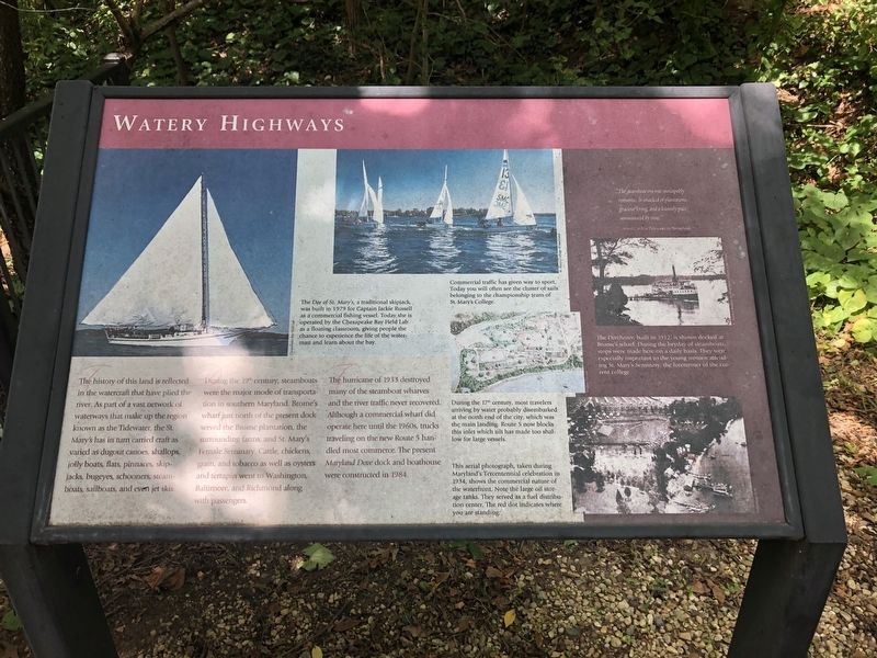
Watery Highways
During the 19th century, steamboats were the major mode of transportation in southern Maryland. Brome's wharf jut north of the present dock served the Brome plantation, the surrounding farms, and St. Mary's Female Seminary. Cattle, chickens, grain, and tobacco as well as oysters and terrapin went to Washington, Baltimore, and Richmond along with passengers.
The hurricane of 1933 destroyed many of the steamboat wharves and the river traffic never recovered. Although a commercial wharf did operate here until the 1960s, trucks traveling on the new Route 5 handled most commerce. The present Maryland Dove dock and boathouse were constructed in 1984.
[Captions:]
The Dee of St. Mary's, a traditional skipjack was built in 1979 for Captain Jackie Russell as a commercial fishing vessel. Today she is operated by the Chesapeake Bay Field Lab as a floating classroom, giving people the chance to experience the life of the waterman and learning about the bay.
Commercial traffic has given way to sport. Today you will often see the cluster of sails belonging to the championship teams of St. Mary's College.
During the 17th century, most travelers arriving by water probably disembarked at the north end of the city, which was the main landing. Route 5 now blocks this inlet which silt has made too shallow for large vessels.
This aerial photograph, taken during Maryland's Tercentennial celebration in 1934, shows the commercial nature of the waterfront. Note the large oil storage tanks. They served as a fuel distribution center. The red dot indicates where you are standing.
"The steamboat era was inescapably romantic. It smacked of plantations, gracious living, and a leisurely pace unmeasured by time."
David C. Hollyon Tidewater by Steamboat
The Dorchester, built in 1912, is shown docked at Brome's wharf. During the heyday of steamboats, stops were made here on a daily basis. They were especially important to the young women attending St. Mary's Seminary, the forerunner of the current college.
Erected by Historic St. Mary's City.
Topics. This historical marker is listed in these topic lists: Education • Industry & Commerce
Location. 38° 11.167′ N, 76° 26.088′ W. Marker is in St. Mary's City, Maryland, in St. Mary's County. Marker can be reached from Old State House Road west of Point Lookout Road (Maryland Route 5), on the left when traveling north. Touch for map. Marker is at or near this postal address: 47414 Old State House Road, Saint Marys City MD 20686, United States of America. Touch for directions.
Other nearby markers. At least 8 other markers are within walking distance of this marker. Welcome to the Waterfront (within shouting distance of this marker); "have Their houses near the Watters" (within shouting distance of this marker); "…for the good and happy Government" (within shouting distance of this marker); Upon This Shore (within shouting distance of this marker); Welcome to the Maryland Dove (within shouting distance of this marker); Taking Sail, Taking Chances (within shouting distance of this marker); Out the Door (within shouting distance of this marker); In 1648 Margaret Brent Asks for “Vote…And Voyce” (within shouting distance of this marker). Touch for a list and map of all markers in St. Mary's City.
Credits. This page was last revised on September 4, 2019. It was originally submitted on September 4, 2019, by Devry Becker Jones of Washington, District of Columbia. This page has been viewed 102 times since then and 8 times this year. Photos: 1, 2. submitted on September 4, 2019, by Devry Becker Jones of Washington, District of Columbia.

