Resaca in Gordon County, Georgia — The American South (South Atlantic)
Battle of Resaca
May 14, 1864
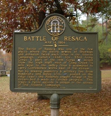
Photographed by David Seibert, November 14, 2008
1. Battle of Resaca Marker
The Battle of Resaca was one of the few places where the entire armies of Sherman and Johnston faced each other in the Atlanta Campaign. Judah's (2nd) Div., 23rd Army Corps & part of the 14th Corps [US] moved from the high bluff west of Camp Creek ¾ mile west to the valley floor & attempted to carry Confederate works east of the stream.
Met by blazing musketry & artillery fire from Hindman's and Bates Divs. [CS], posted on the ridge (east) the Federals sought refuge in the stream-bed & made no further progress. This tragic & futile episode is unique in the annals of the Atlanta Campaign.
Erected 1997 by Georgia Department of Natural Resources. (Marker Number 064-7.)
Topics and series. This historical marker is listed in this topic list: War, US Civil. In addition, it is included in the Georgia Historical Society series list.
Location. 34° 36.223′ N, 84° 56.948′ W. Marker is in Resaca, Georgia, in Gordon County. It is at the intersection of U.S. 41 and Confederate Cemetery Road, on the right when traveling north on U.S. 41. Touch for map. Marker is in this post office
this page online

Regionally, this marker is in the Mountains. It is also in the American South, specifically in the Deep South, in Appalachia, and specifically in Southern Appalachia. Globally, it is in North America, the Western Hemisphere, the Western World, and the Anglosphere. Historically, it finds itself in what was once the original Cherokee Nation, the territory of the Mississippian Culture, one of the original Thirteen Colonies, one of the Confederate States of America, and the Antebellum South.
Other nearby markers. At least 8 other markers are within walking distance of this marker: Atlanta Campaign (within shouting distance of this marker); The Resaca Confederate Cemetery (within shouting distance of this marker); Mary Jane Green (approx. 0.3 miles away); Confederate Cemetery Resaca (approx. 0.3 miles away); Mary J. Green (approx. 0.3 miles away); Miss Mary Green (approx. 0.3 miles away); a different marker also named Battle of Resaca (approx. 0.4 miles away); Battle of Resaca, Georgia (approx. half a mile away). Touch for a list and map of all markers in
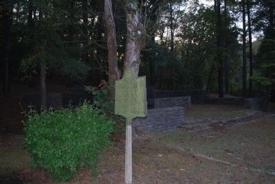
Photographed by Brandon Fletcher, October 11, 2008
2. Battle of Resaca Marker
Credits. This page was last revised on November 27, 2020. It was originally submitted on November 27, 2008, by David Seibert of Sandy Springs, Georgia. This page has been viewed 2,223 times since then and 32 times this year. Photos: 1. submitted on November 27, 2008, by David Seibert of Sandy Springs, Georgia. 2. submitted on July 21, 2015, by Brandon Fletcher of Chattanooga, Tennessee. • Craig Swain was the editor who published this page.
