
Calhoun in Gordon County, Georgia — The American South (South Atlantic)
Johnston's Rear Guard Stops McPherson
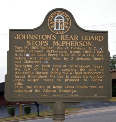
Photographed by David Seibert, November 14, 2008
1. Johnston's Rear Guard Stops McPherson Marker
May 16, 1864, Walker's div. of Hardee's A.C. [CS], having delayed McPherson's troops (15th & 16th A.C.) [US], at Lay's Ferry ( 3.25 mi. N.W.) the day before, was joined here by 2 division ~ Bate's and Cleburne's [CS].
Deploying on both sides of Oothcalooga creek, the left of the line covering the road to Adairsville, Hardee ~ facing N. & W. ~ held McPherson's forces throughout the day to enable the Confederate wagon trains to proceed to Adairsville.
This, the Battle of Rome Cross ~ Roads, was an episode of the Atlanta Campaign.
Erected 1953 by Georgia Historical Commission. (Marker Number 064-18.)
Topics and series. This historical marker is listed in this topic list: War, US Civil. In addition, it is included in the Georgia Historical Society series list. A significant historical date for this entry is May 16, 1864.
Location. 34° 29.731′ N, 84° 57.897′ W. Marker is in Calhoun, Georgia, in Gordon County. It is on Oothcalooga Street (Georgia Route 53) 0 miles west of Chrest Drive, on the left when traveling west. The Marker is located just northeast of the bridge over Oothcalooga Creek. Touch for map. Marker is in this post office
this page online

Regionally, this marker is in Georgia’s Mountains. It is also in the American South, specifically in the Deep South, in Appalachia, and specifically in Southern Appalachia. Globally, it is in North America, the Western Hemisphere, the Western World, and the Anglosphere. Historically, it finds itself in what was once the original Cherokee Nation, the territory of the Mississippian Culture, one of the original Thirteen Colonies, one of the Confederate States of America, and the Antebellum South.
Other nearby markers. At least 8 other markers are within 3 miles of this marker, measured as the crow flies: Roland Hayes (approx. 0.6 miles away); The Calhoun Depot (approx. 0.8 miles away); a different marker also named Calhoun Depot (approx. 0.8 miles away); Gordon County (approx. 0.9 miles away); Calhoun, Ga, May 18, 1864. (approx. one mile away); Battle of Lay's Ferry (approx. 2.1 miles away); Richard Peters Plantation (approx. 2.3 miles away); Historic Liberty Cumberland Presbyterian Church (approx. 2.4 miles away). Touch for a list and map of all

Photographed by David Seibert, November 14, 2008
2. Johnston's Rear Guard Stops McPherson Marker
The bridge over Oothcalooga Creek can be seen to the left.
Credits. This page was last revised on November 25, 2020. It was originally submitted on November 28, 2008, by David Seibert of Sandy Springs, Georgia. This page has been viewed 1,593 times since then and 41 times this year. Photos: 1, 2. submitted on November 28, 2008, by David Seibert of Sandy Springs, Georgia. • Craig Swain was the editor who published this page.
