Near Kingston in Bartow County, Georgia — The American South (South Atlantic)
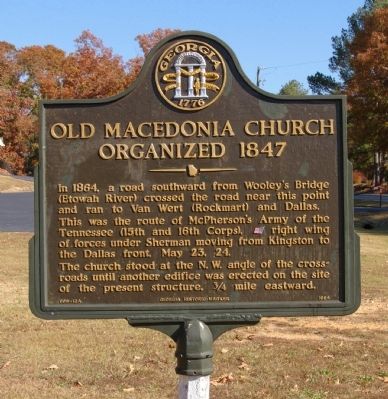
Old Macedonia Church Organized 1847
Photographed by David Seibert, November 9, 2008
1. Old Macedonia Church Organized 1847 Marker
This was the route of McPherson's Army of the Tennessee (15th and 16th Corps.), [US] right wing of forces under Sherman moving from Kingston to the Dallas front, May 23, 24.
The church stood at the N.W. angle of the crossroads until another edifice was erected on site of the present structure, 3/4 mile eastward.
Erected 1984 by Georgia Department of Natural Resources. (Marker Number 008-12A.)
Topics and series. This historical marker is listed in these topic lists: Religion & Religious Structures • War, US Civil. In addition, it is included in the Georgia Historical Society series list. A significant historical date for this entry is May 23, 1864.
Location. 34° 10.453′ N, 84° 58.759′ W. Marker is near Kingston, Georgia, in Bartow County. It is at the intersection of Euharlee Road and Macedonia Road, on the right when traveling west on Euharlee Road. Touch for map. Marker is in this post office area: Kingston GA 30145, United States of America. Touch for directions.

Regionally, this
this page online
Other nearby markers. At least 8 other markers are within 5 miles of this marker, measured as the crow flies: The Story of Old Hardin Bridge (approx. 3.2 miles away); Black Pioneers Cemetery (approx. 3.2 miles away); Euharlee Creek Covered Bridge (approx. 3½ miles away); Melvinia Shields (approx. 4.3 miles away); Unknown Confederate Dead (approx. 4.3 miles away); Queen Chapel Methodist Church Cemetery (approx. 4.3 miles away); Woolley's Bridge (approx. 4½ miles away); Milam's Bridge (approx. 4½ miles away). Touch for a list and map of all markers in Kingston.
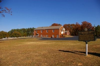
Photographed by David Seibert, November 9, 2008
2. Old Macedonia Church Organized 1847 Marker and Church
Credits. This page was last revised on March 8, 2019. It was originally submitted on November 28, 2008, by David Seibert of Sandy Springs, Georgia. This page has been viewed 1,947 times since then and 36 times this year. Photos: 1, 2. submitted on November 28, 2008, by David Seibert of Sandy Springs, Georgia. • Craig Swain was the editor who published this page.
