Port Hastings in Inverness County, Nova Scotia — The Atlantic Provinces (North America)
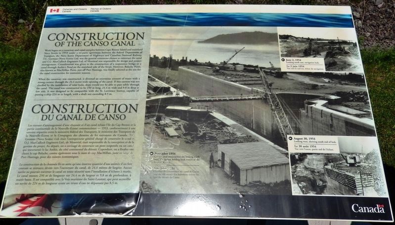
Construction of the Canso Canal / Construction du Canal de Canso
Inscription.
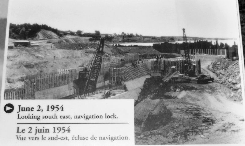
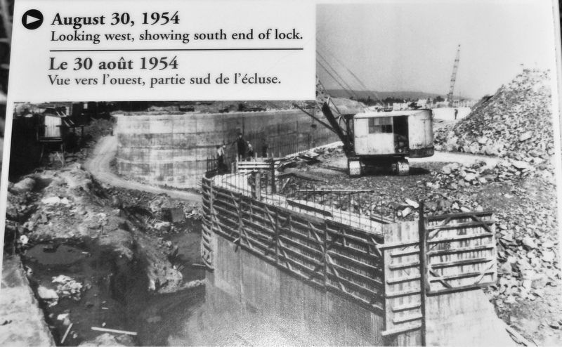
Work began on a causeway and canal complex between Cape Breton Island and mainland Nova Scotia in 1953 under a tri-party agreement between the federal Department of Transport, the Nova Scotia Department of Highways and Canadian National Railway. T.C. Gorman (Nova Scotia) Ltd. was the general contractor chosen to construct the canal and O.J. MacCulloch Engineers Ltd. of Montreal was responsible for design and project management. Consideration was given to the construction of a suspension bridge or a canal through Archie's Pond on the mainland side of the Strait. However, Balache Point, also known as MacMillan Point, just off Port Hastings, was finally selected as the site for the canal construction for economic reasons.
When the causeway was constructed, it diverted an enormous amount of water with a strong current through the 24.4 metre-wide opening of the canal. If this current was not checked by the installation of tidal locks, ships would not be able to pass safely through the canal. The canal was constructed to be 250 m long, 24.4 m wide and 9.8 m deep at low tide. It was designed to be compatible with the St. Lawrence Seaway, capable of passing a ship 224 m in length, with a draft not exceeding 8.5 m.
Les travaux d'aménagement d'une chaussée et d'un canal reliant l'île du Cap-Breton et la partie continentale de la Nouvelle-Écosse commencèrent en 1953, conformément à une entente tripartite entre le ministère fédéral des Transports, le ministère des Transports de la Nouvelle-Écosse et la Compagnie des chemins de fer nationaux du Canada. T.C. Gorman (Nova Scotia) Ltd. était l'entrepreneur général chargé de construire le canal et O.J. MacCulloch Engineers Ltd., de Montréal, était responsable de la conception et de la gestion du projet. Au départ, on a envisagé de construire un pont suspendu ou un canal qui traverserait le lac Archie, du côté continental du détroit. Cependant, on a finalement choisi le cap Balache, connu également sous le nom d cap MacMillan, juste au large de Port Hastings, pour des raisons économiques.
La construction de la chaussée fit en sorte qu'une énorme quantité d'eau animée d'un fort courant se retrouva déviée vers l'ouverture du canal, de 24,4 mètres de largeur. Aucun navire ne pouvait traverser le canal en toute sécurité sans l'installation d'écluses à marée. Le canal mesure 250 m de longueur sur 24,4 m de largeur et 9,8 m de profondeur, à marée basse. Il est compatible avec la Voie maritime du Saint-Laurent,
qui peut accueillir un navire de 224 m de longueur ayant un tirant d'eau ne dépassant pas 8,5 m.
Erected by Fisheries and Oceans Canada / Pêches et Océans Canada.
Topics. This historical marker is listed in these topic lists: Bridges & Viaducts • Man-Made Features • Waterways & Vessels. A significant historical year for this entry is 1953.
Location. 45° 38.883′ N, 61° 24.744′ W. Marker is in Port Hastings, Nova Scotia, in Inverness County. Marker can be reached from Trans Canada Highway (National Route 104) half a kilometer west of Ceilidh Trail (Route 19), on the right when traveling west. Marker is located in the Celtic Shores Coastal Trail interpretive plaza and trailhead, on the east side of the Canso Causeway. Touch for map. Marker is in this post office area: Port Hastings NS B9A 1J8, Canada. Touch for directions.
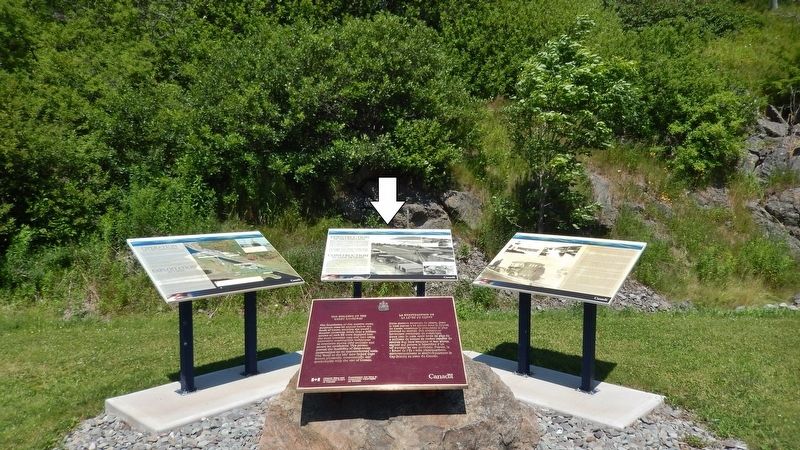
Other nearby markers. At least 4 other markers are within walking distance of this marker. History of the Canso Canal / Historique du Canal de Canso (here, next to this marker); Operation of the Canso Canal / Exploitation du Canal (here, next to this marker); The Building of the Canso Causeway / La Construction de la Levée de Canso (here, next to this marker); Canso Causeway (a few steps from this marker).
Related markers. Click here for a list of markers that are related to this marker. Canso Canal & Causeway
Also see . . .
Strait of Canso (Wikipedia). The Strait of Canso is a long thin channel approximately 17 miles long and 1 mile wide. It is extremely deep at 200+ feet. The Canso Canal allows ships to pass through the causeway, and this can accommodate any vessel capable of transiting the St. Lawrence Seaway. (Submitted on December 20, 2019, by Cosmos Mariner of Cape Canaveral, Florida.)
Credits. This page was last revised on December 20, 2019. It was originally submitted on September 9, 2019, by Cosmos Mariner of Cape Canaveral, Florida. This page has been viewed 195 times since then and 16 times this year. Photos: 1. submitted on September 11, 2019, by Cosmos Mariner of Cape Canaveral, Florida. 2, 3, 4. submitted on September 16, 2019, by Cosmos Mariner of Cape Canaveral, Florida.


