Kosciusko in St. Louis, Missouri — The American Midwest (Upper Plains)
Capture of Camp Jackson
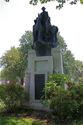
Photographed by Mike Camero, July 1, 2011
1. Front of Monument
To Commemorate The capture of Camp Jackson - May 10 1861 - By - The Missouri Volunteers:
First Regiment Infantry - Colonel Frank Blair,
Second Regiment Infantry - Colonel Henry Bernsyein,
Third Regiment Infantry - Colonel Franz Sigel,
Fourth Regiment Infantry - Colonel Nicholas Schuettner,
First Reg US Reserve Corps - Col Henry Almstedt,
Second Reg US Reserve Corps - Col Henry Kallman,
Third Reg US Reserve Corps - Col John Mcneil,
Fourth Reg US Reserve Corps - Col B Gratz Brown,
Fifth Reg US Reserve Corps - Col Charles G. Stifel,
Erected 1929 by the Camp Jackson Union Soldiers
Monument Association -
Rev Frank G Beardsley - Ph D D TD - President,
Albert Von Hoffman - Treasurer,
Theo H Mohr - Secretary,
Major Leo Rassieur - Honorary President,
Mrs Jessie Sherman - First Vice President,
Mrs Mary E Conpath - Second Vice President,
Mrs Nellie Becktold - Fourth Vice President,
John W. Lanley - Fifth Vice President,
Mrs M Neubauer - Asst Treasurer
Erected 1929 by Camp Jackson Union Soldiers Monument Association.
Topics. This historical marker is listed in this topic list: War, US Civil. A significant historical month for this entry is May 1792.
Location. Marker has been reported missing. It was located near 38° 35.684′ N, 90° 12.635′ W. Marker was in St. Louis, Missouri. It was in Kosciusko. It was at the intersection of Broadway Boulevard and Arsenal Street on Broadway Boulevard. Monument is located in Lyon Park on Broadway Boulevard across from the Budweiser Brewery. Touch for map. Marker was in this post office area: Saint Louis MO 63118, United States of America. Touch for directions.

Regionally, this marker was in the American Midwest, in the Lewis & Clark Corridor, in the Corn Belt,
this page online
Other nearby markers. At least 8 other markers are within walking distance of this location: St. Louis Arsenal (a few steps from this marker); Nathaniel Lyon (about 500 feet away, measured in a direct line); Historic Site Brewhouse (approx. 0.2 miles away); a different marker also named St. Louis Arsenal (approx. 0.2 miles away); Main Office Building (approx. 0.2 miles away); Clydesdale Stable (approx. 0.3 miles away); A Wealthy Suburb (approx. 0.3 miles away); This cake commemorates (approx. 0.3 miles away). Touch for a list and map of all markers in St. Louis.
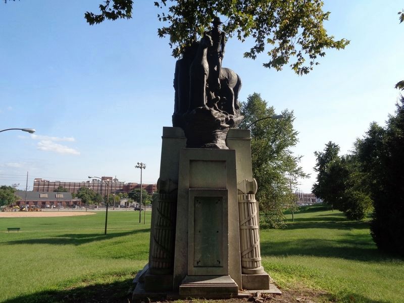
More about this marker. The statue atop the monument features General Lyon. In the late 1930s, the monument was relocated to Lyon Park from its former site at Grand and West Pine Boulevards.
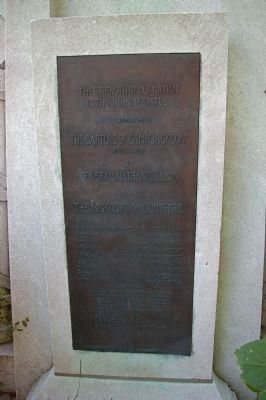
Photographed by Mike Camero, July 1, 2011
2. Plaque on Front of Monument
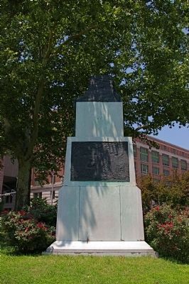
Photographed by Mike Camero, July 1, 2011
3. Back of Monument
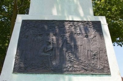
Photographed by Mike Camero, July 1, 2011
4. Plaque on back of Monument
Photographed by Jason Voigt, September 6, 2019
5. Capture of Camp Jackson Marker
Note missing marker....
Credits. This page was last revised on January 30, 2023. It was originally submitted on July 3, 2011, by Mike Camero of Edwardsville, Illinois. This page has been viewed 1,925 times since then and 81 times this year. Last updated on September 9, 2019, by Jason Voigt of Glen Carbon, Illinois. Photos: 1, 2, 3, 4. submitted on July 3, 2011, by Mike Camero of Edwardsville, Illinois. 5. submitted on September 9, 2019, by Jason Voigt of Glen Carbon, Illinois. • Bill Pfingsten was the editor who published this page.
