Venice in Madison County, Illinois — The American Midwest (Great Lakes)
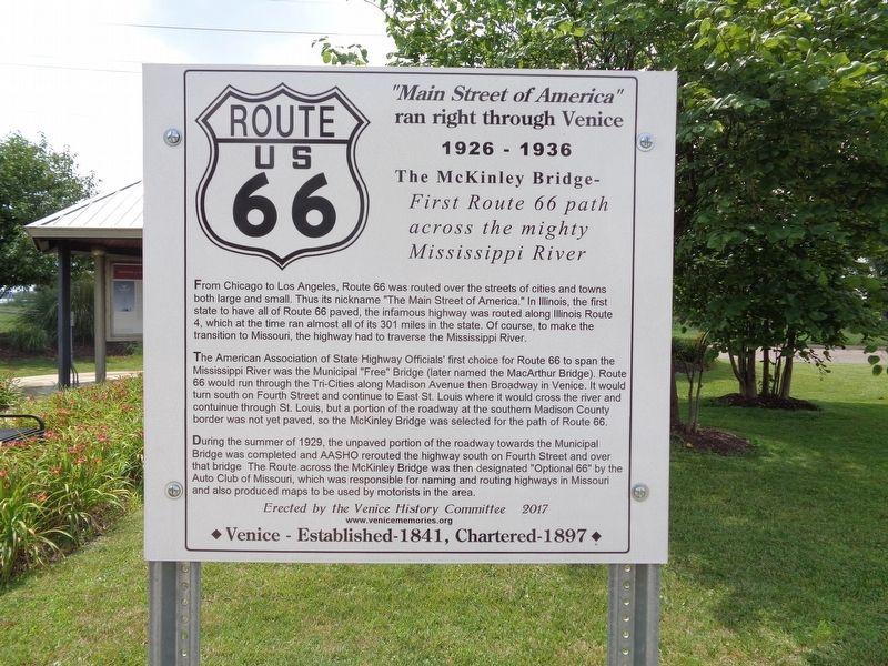
Main Street of America ran right through Venice
1926-1936
| — | The McKinley Bridge - First Route 66 path across the mighty Mississippi River | — |
Photographed by Jason Voigt, July 9, 2019
1. Main Street of America ran right through Venice Marker
The American Association of State Highway Officials' first choice for Route 66 to span the Mississippi River was the Municipal "Free" Bridge (later named the MacArthur Bridge). Route 66 would run through the Tri-Cities along Madison Avenue then Broadway in Venice. It would turn south on Fourth Street and continue to East St. Louis where it would cross the river and contuinue through St. Louis, but a portion of the roadway at the southern Madison County border was not yet paved, so the McKinley Bridge was selected for the path of Route 66.
During the summer of 1929, the unpaved portion of the roadway towards the Municipal Bridge was completed and AASHO rerouted the highway south on Fourth
this page online
Erected 2017 by Venice History Committee.
Topics and series. This historical marker is listed in these topic lists: Bridges & Viaducts • Roads & Vehicles. In addition, it is included in the U.S. Route 66 series list.
Location. 38° 40.082′ N, 90° 10.474′ W. Marker is in Venice, Illinois, in Madison County. It is on Main Street, on the right when traveling south. The marker is located at McKinley Bridge Roadside Park, which is off of Illinois Route 3. When leaving Illinois and approaching McKinley Bridge, the park is located on the left side of the road. The park is usually identified with its large "Three Rings Salute to Steel Sculpture". Touch for map. Marker is in this post office area: Venice IL 62090, United States of America. Touch for directions.

Regionally, this
Photographed by Jason Voigt, July 9, 2019
2. McKinley Bridge
Route 66, 1926-1929
Other nearby markers. At least 8 other markers are within 2 miles of this marker, measured as the crow flies: War Memorial (approx. 0.4 miles away); Venice High School Bell (approx. 0.6 miles away); Freedom Village (approx. ¾ mile away); The Lewis and Clark Expedition Across Missouri (approx. 1.1 miles away in Missouri); Our Story (approx. 1.7 miles away in Missouri); Murphy-Blair National Historic District (approx. 1.8 miles away in Missouri); Mounds Heritage Trail (approx. 1.8 miles away in Missouri); Le Grange de Terre (Big Mound) (approx. 1.8 miles away in Missouri).
Other markers no longer nearby. Mary Meachum Freedom Crossing (was approx. 1.1 miles away in Missouri but has been confirmed missing); Coast Guard Rest Stop (was approx. 1.1 miles
Photographed by Jason Voigt, July 9, 2019
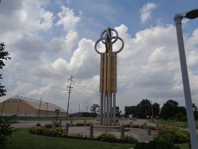
3. The Salute to Steel Sculpture
This is the sign to look for when locating the park that contains the marker.
More about this marker. The sign was dedicated on November 3, 2017. Members of the Venice History Committee as well as most of Venice's representatives (including Mayor Tyrone Echols and Police Chief Theodore Adams) were in attendance.
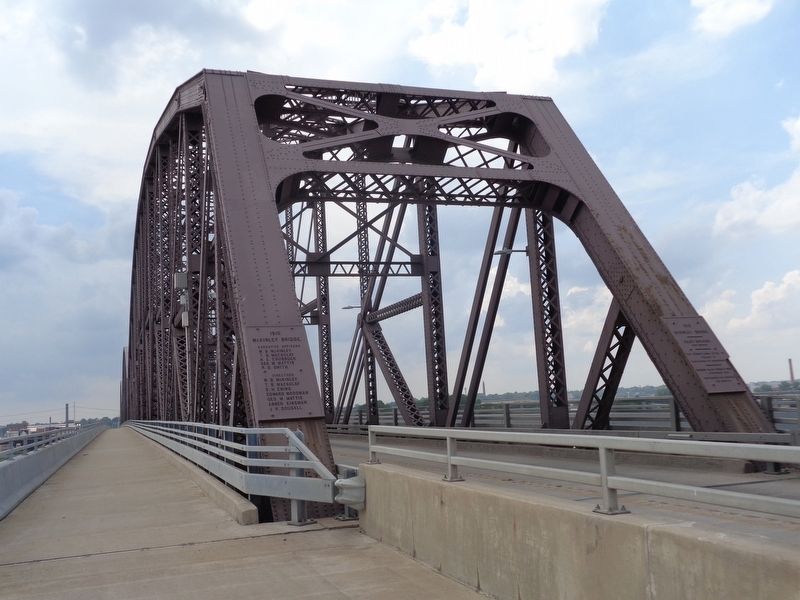
Regarding Main Street of America ran right through Venice. The McKinley Bridge, named for its builder, William B. McKinley (not the late U.S. President), has had a long history. It was first completed and opened in 1910, and as the sign states, it once carried Route 66 for four years. When the nearby Chain of Rocks Bridge was completed in 1929, Route 66 would be re-routed. The McKinley Bridge would continue to carry traffic from Venice to north St. Louis until 2001, due to decades of disrepair. After years of repair, the bridge would be re-opened to traffic in late 2007. In addition, a biking/pedestrian lane was added to the bridge.
Also see . . . Route 66 in Venice, Illinois. The Venice History Committee's website has a page where it talks more about Route 66 and how it passed through Venice. (Submitted on September 11, 2019, by Jason Voigt of Glen Carbon, Illinois.)
Credits. This page was last revised on October 14, 2019. It was originally submitted on September 11, 2019, by Jason Voigt of Glen Carbon, Illinois. This page has been viewed 530 times since then and 54 times this year. Photos: 1, 2, 3. submitted on September 11, 2019, by Jason Voigt of Glen Carbon, Illinois. • Andrew Ruppenstein was the editor who published this page.
