Cartersville in Bartow County, Georgia — The American South (South Atlantic)
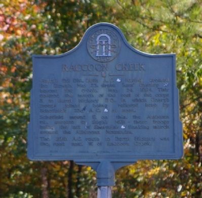
Raccoon Creek
Schofield moved E. on this, the Alabama rd., enroute to Sligh's Mill - these troops being the left of Sherman's [US] flanking March around the Allatoona Mountains.
The 20th A.C. route to Hickory was the road next W. of Raccoon Creek.
Erected 1953 by Georgia Historical Commission. (Marker Number 008-25.)
Topics and series. This historical marker is listed in this topic list: War, US Civil. In addition, it is included in the Georgia Historical Society series list. A significant historical date for this entry is May 23, 1880.
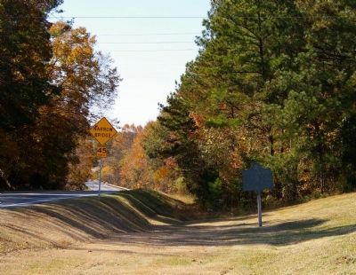
Location. 34° 6.948′ N, 84° 53.189′ W. Marker is in Cartersville, Georgia, in Bartow County. Marker is on Rockmart Highway (Georgia Route 113) 0.1 miles west of Kincannon Road SW, on the right when traveling west. The Marker is located in front of the Raccoon Creek Baptist Church. Touch for map. Marker is in this post office area: Cartersville GA 30120, United States of America. Touch for directions.
Other nearby markers. At least 8 other markers are within 6 miles of this marker, measured as the crow flies. The Army of the Cumberland at Stilesboro (approx. 1.9 miles away); Stilesboro Academy (approx. 2 miles away); Etowah Valley Plantation (approx. 2˝ miles away); Milam's Bridge (approx. 2˝ miles away); Euharlee Creek Covered Bridge (approx. 3.2 miles away); Black Pioneers Cemetery (approx. 3˝ miles away); Etowah (Tumlin) Mounds (approx. 4.6 miles away); The Story of Old Hardin Bridge (approx. 5˝ miles away). Touch for a list and map of all markers in Cartersville.
Credits. This page was last revised on March 8, 2019. It was originally submitted on November 29, 2008, by David Seibert of Sandy Springs, Georgia. This page has been viewed 2,165 times since then and 46 times this year. Photos: 1, 2. submitted on November 29, 2008, by David Seibert of Sandy Springs, Georgia. • Craig Swain was the editor who published this page.

