Vieux-Québec-Cap-Blanc-colline Parlementaire in Communauté-Urbaine-de-Québec, — Central Canada (French-Canadian)
Le Siège de Québec, 1759 / The Siege of Québec, 1759
Inscription.
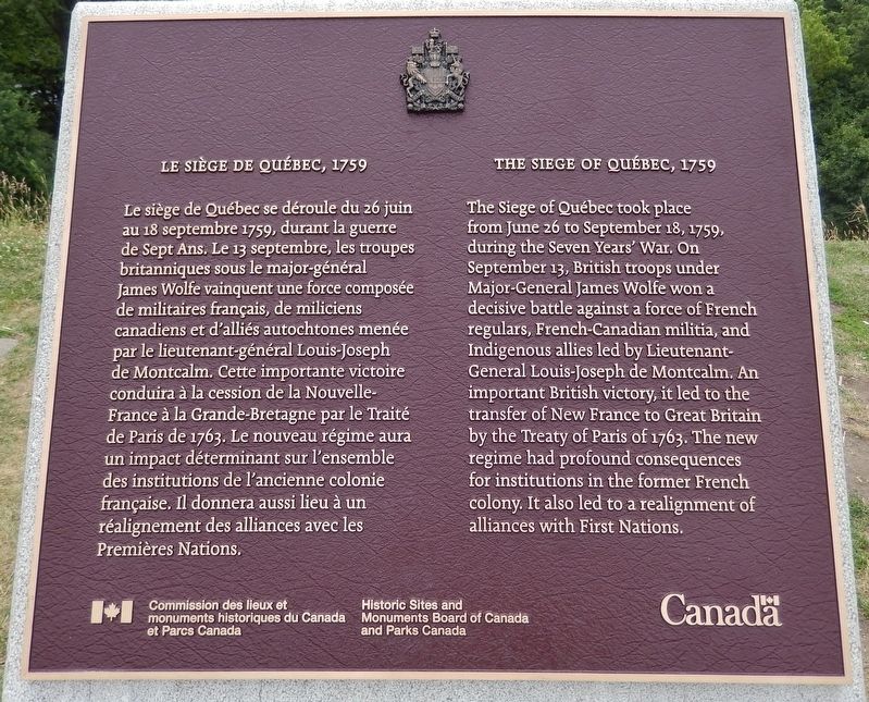
Le siège de Québec se déroule du 26 juin au 18 septembre 1759, durant la guerre de Sept Ans. Le 13 septembre, les troupes britanniques sous le major-général James Wolfe vainquent une force composée de militaires français, de miliciens canadiens et d'alliés autochtones menée par le lieutenant-général Louis-Joseph de Montcalm. Cette importante victoire conduira à la cession de la Nouvelle-France à la Grande-Bretagne par le Traité de Paris de 1763. Le nouveau régime aura un impact déterminant sur l'ensemble des institutions de l'ancienne colonie française. Il donnera aussi lieu à un réalignement des alliances avec les Premières Nations.
The Siege of Québec took place from June 26 to September 18, 1759, during the Seven Years' War. On September 13, British troops under Major-General James Wolfe won a decisive battle against a force of French regulars, French-Canadian militia, and Indigenous allies led by Lieutenant-General Louis-Joseph de Montcalm. An important British victory, it led to the transfer of New France to Great Britain by the Treaty of Paris of 1763. The new regime had profound consequences for institutions in the former French colony. It also led to a realignment of alliances with First Nations.
Erected by Commission des lieux et monuments historiques du Canada et Parcs Canada/Historic Sites and Monuments Board of Canada and Parks Canada.
Topics and series. This historical marker is listed in these topic lists: Colonial Era • Wars, Non-US. In addition, it is included in the Canada, Historic Sites and Monuments Board series list. A significant historical date for this entry is June 26, 1759.
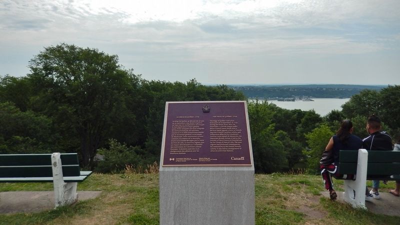
Location. 46° 48.225′ N, 71° 12.914′ W. Marker is in Québec, in Communauté-Urbaine-de-Québec. It is in Vieux-Québec-Cap-Blanc-colline Parlementaire. Marker can be reached from Avenue George VI, 0.2 kilometers east of Avenue Taché, on the left when traveling west. Marker is located along the Plains of Abraham walking path, about 100 yards south of Avenue George VI, between park benches, overlooking the St. Lawrence River. Touch for map. Marker is in this post office area: Québec G1R, Canada. Touch for directions.
Other nearby markers. At least 8 other markers are within walking distance of this marker. A Golf Club on the Plains of Abraham (about 150 meters away, measured in a direct line); Do You Know Joan of Arc? (about 180 meters away); O Canada! (about 180 meters away); Martello Towers in Quebec / Tours Martello de Québec (approx. 0.2
kilometers away); Québec Martello Towers (approx. 0.3 kilometers away); Montcalm (approx. 0.3 kilometers away); Martello Towers / Tours Martello (approx. 0.3 kilometers away); The Grande Allée Drill Hall (approx. 0.3 kilometers away). Touch for a list and map of all markers in Québec.
Also see . . . Siege of Quebec, 25 June-18 September 1759. The British plan for the capture of Quebec involved three separate armies, each traveling by a different route, intended to converge at Quebec in overwhelming numbers. However, of the three, only the force under James Wolfe, which was sent by boat up the St. Lawrence River, actually arrived at the city. When Wolfe arrived at Quebec, he found the French prepared. Quebec was a natural fortress, on the north bank of the St. Lawrence, and protected by cliffs and ravines. The siege settled into a stalemate until the decisive Battle of the Heights of Abraham, in which the French garrison was routed. The city surrendered on 18 September 1759, ending any realistic French chances of maintaining their presence in Canada. (Submitted on September 14, 2019, by Cosmos Mariner of Cape Canaveral, Florida.)
Credits. This page was last revised on February 9, 2023. It was originally submitted on September 13, 2019, by Cosmos Mariner of Cape Canaveral, Florida. This page has been viewed 256 times since then and 32 times this year. Photos: 1, 2. submitted on September 14, 2019, by Cosmos Mariner of Cape Canaveral, Florida.

