Barney Circle in Southeast Washington in Washington, District of Columbia — The American Northeast (Mid-Atlantic)
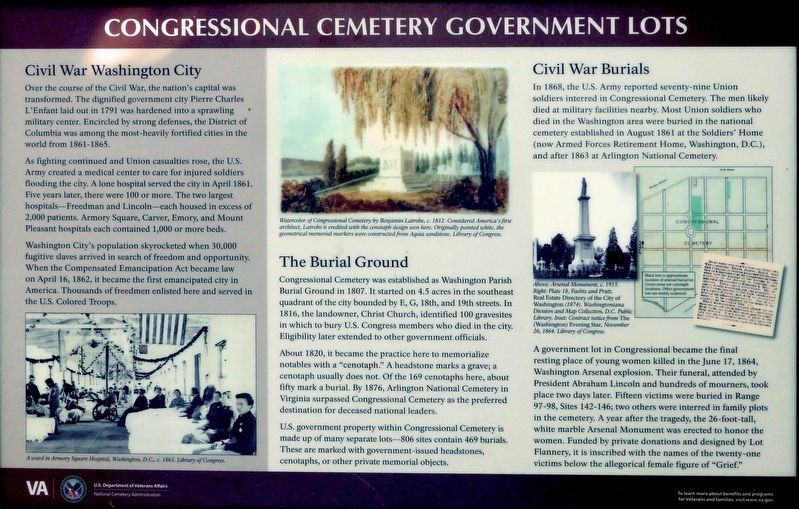
Congressional Cemetery Government Lots
Photographed by Allen C. Browne, September 12, 2019
1. Congressional Cemetery Government Lots Marker
Civil War Washington City
Over the course of the Civil War, the nation's capital was transformed. The dignified government city Pierre Charles L' Enfant laid out in 1791 was hardened into a sprawling military center. Encircled by strong defenses, the District of Columbia was among the most-heavily fortified cities in the world from 1861-1865.
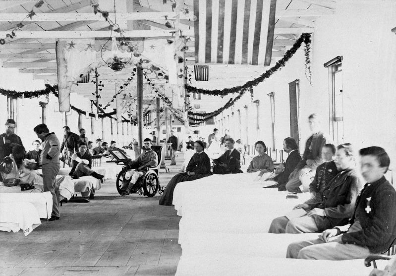
As fighting continued and Union casualties rose, the U.S. Army created a medical center to care for injured soldiers flooding the city. A lone hospital served the city in April 1861. Five years later, there were 100 or more. The two largest hospitals—Freedman and Lincoln—each housed in excess of 2,000 patients. Armory Square, Carver, Emory, and Mount Pleasant hospitals each contained 1,000 or more beds.
Washington City's population skyrocketed when 30,000 fugitive slaves arrived in search of freedom and opportunity. When the Compensated Emancipation Act became law on April 16, 1862, it became the first emancipated city in America. Thousands of freedmen enlisted here and served in the U.S. Colored Troops.
The Burial Ground
Congressional Cemetery was established
this page online
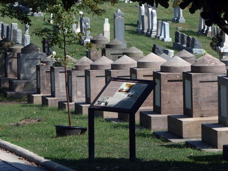
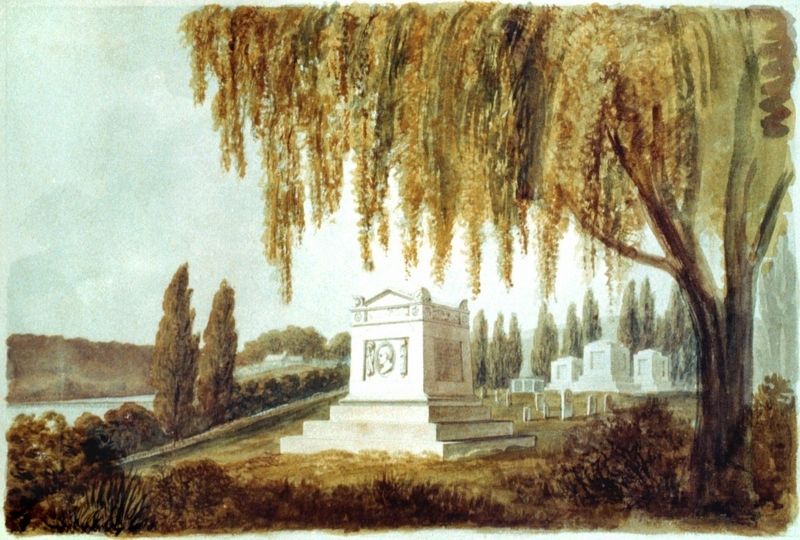
Eligibility later extended to other government officials. About 1820, it became the practice here to memorialize notables with a “cenotaph.” A headstone marks a grave; a cenotaph usually does not. Of the 169 cenotaphs here, about fifty mark a burial. By 1876, Arlington National Cemetery in Virginia surpassed Congressional Cemetery as the preferred destination for deceased national leaders.
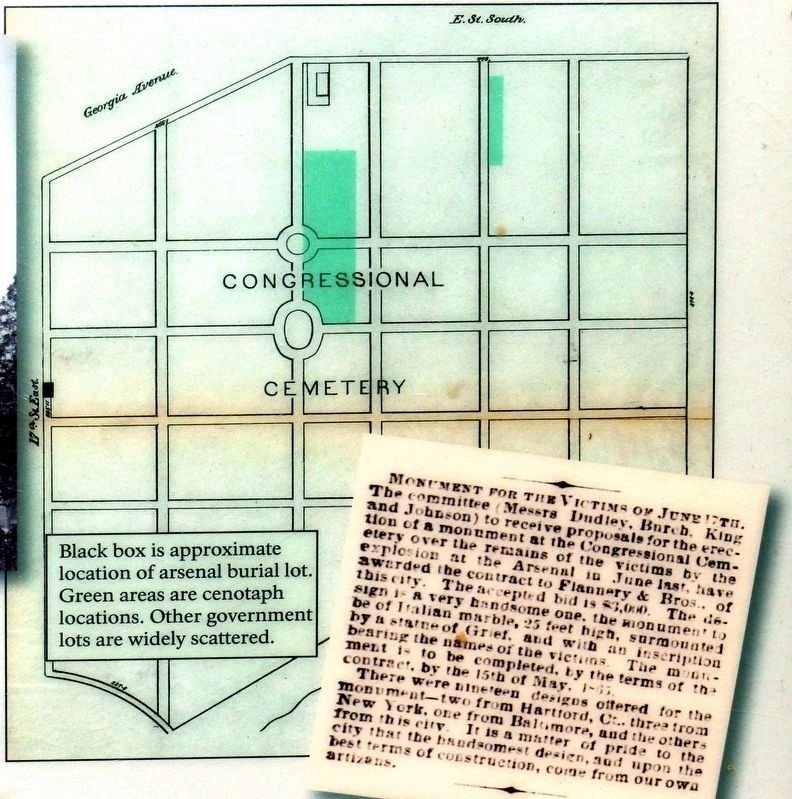
U.S. government property within Congressional Cemetery is made up of many separate lots—806 sites contain 469 burials. These are marked with government-issued headstones, cenotaphs, or other private memorial objects.
Civil War Burials
In 1868, the U.S. Army reported seventy-nine Union soldiers interred in Congressional Cemetery. The men likely died at military facilities nearby. Most Union soldiers who died in the Washington area were buried in the national
Photographed by Allen C. Browne, September 12, 2019
2. Congressional Cemetery Government Lots Marker
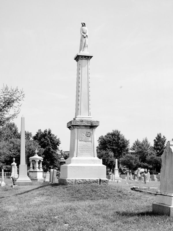
A government lot in Congressional became the final resting place of young women killed in the June 17, 1864, Washington Arsenal explosion. Their funeral, attended by President Abraham Lincoln and hundreds of mourners, took place two days later. Fifteen victims were buried in Range 97-98, Sites 142-146; two others were interred in family plots in the cemetery. A year after the tragedy, the 26-foot-tall, white marble Arsenal Monument was erected to honor the women. Funded by private donations and designed by Lot Flannery, it is inscribed with the names of the twenty-one victims below the allegorical female figure of “Grief”.
Erected by U.S. Department of Veterans Affairs, National Cemetery Administration.
Topics and series. This historical marker is listed in these topic lists: Cemeteries & Burial Sites • War, US Civil. In addition, it is included in the National Cemeteries series list.
Location. 38° 52.874′ N, 76° 58.706′ W.
Library of Congress
3. A ward in Armory Square Hospital, Washington, DC, c1863

Regionally, this marker is in the Washington Metropolitan Area. It is also in the American Northeast, in the Upper South, in the Mid-Atlantic, in the Tidewater, and in the Chesapeake Bay Region. Globally, it is in North America, the Western Hemisphere, the Western World, and the Anglosphere.
Other nearby markers. At least 8 other markers are within walking distance of this marker: Gadsby Vault (within shouting distance of this marker); The Public Vault (within shouting distance of this marker); Lee Dittman Shapiro 1949-1987 / James T. Lindelof 1957-1987 (within shouting distance of this marker); Adelaide Johnson (within shouting distance of this marker); Commemorating The American Revolutionary Service of General Peterson Goodwyn
Library of Congress
4. Watercolor of Congressional Cemetery by Benjamin Latrobe, c. 1812.
Considered America's first architect, Latrobe is credited with the cenotaph design seen here. Originally painted white, the geometrical memorial markers were constructed from Aquia Sandstone.
Library of Congress
5. Arsenal Monument
Recreation of c. 1913 Photograph - Monument in Memory of the Twenty-One Young Women Who Were Killed as the Result of an Explosion In The U.S. Arsenal (Now War College) - Congressional Cemetery.
Photographed by Allen C. Browne, September 12, 2019
6. Congressional Cemetery Map
Black Box is approximate location of arsenal burial lot. Green areas are cenotaph locations. Other government lots are widely scattered.
Faehtz and Pratt Real Estate Directory of the City of Washington, 1874 Washingtonia Division and Map Collection D.C. Public Library.Close-up of map on marker
Faehtz and Pratt Real Estate Directory of the City of Washington, 1874 Washingtonia Division and Map Collection D.C. Public Library.
Library of Congress (Chroncling America)
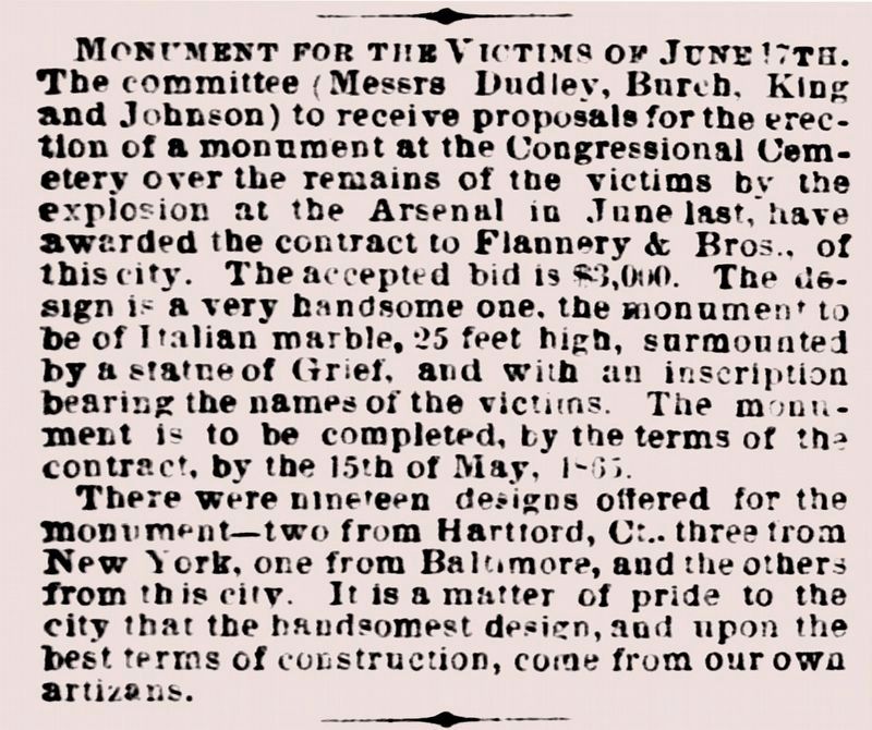
7. Monument For the Victims of June 17th.
The committee (Messrs Dudley, Burch, King and Johnson) to receive proposals for the erection of a monument at the Congressional Cemetery over the remains of the victims by the explosion at the Arsenal in June last, have awarded the contract to Flannery & Bros. of this city. The accepted bid is $3,000. The design is a very handsome one, the monument to be of Italian marble, 25 feet high, surmounted by a statue of Grief, and with an inscription bearing the names of the victims. The monument to be completed, by the terms of the contract by the 15th of May 1865.
There were nineteen designs offered for the monument -- two from Hartford, Ct., three from New York, on from Baltimore, and the others from this city. It is a matter of pride to the city that the handsomest design, and upon the best terms of construction, come from our own artizens.
-- Contract notice from The (Washington) Evening Star, November 26, 1864.
There were nineteen designs offered for the monument -- two from Hartford, Ct., three from New York, on from Baltimore, and the others from this city. It is a matter of pride to the city that the handsomest design, and upon the best terms of construction, come from our own artizens.
-- Contract notice from The (Washington) Evening Star, November 26, 1864.
Credits. This page was last revised on January 30, 2023. It was originally submitted on September 13, 2019, by Allen C. Browne of Silver Spring, Maryland. This page has been viewed 573 times since then and 54 times this year. Photos: 1. submitted on September 13, 2019, by Allen C. Browne of Silver Spring, Maryland. 2. submitted on September 16, 2019, by Allen C. Browne of Silver Spring, Maryland. 3, 4, 5, 6, 7. submitted on September 13, 2019, by Allen C. Browne of Silver Spring, Maryland. • Bernard Fisher was the editor who published this page.
