Franklin in Williamson County, Tennessee — The American South (East South Central)
The Carter Farm
The Federal Counterattack
— Tennessee Civil War National Heritage Area —
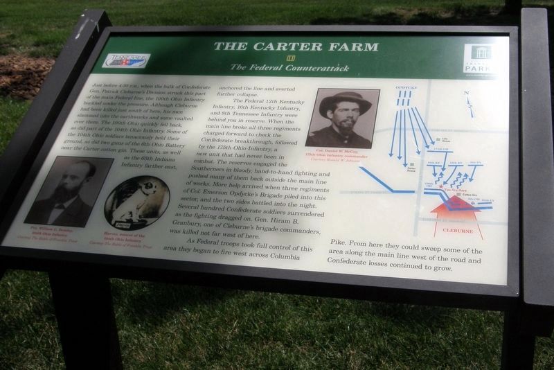
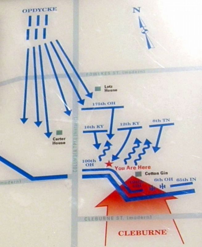
The Federal 12th Kentucky Infantry, 16th Kentucky Infantry, and 8th Tennessee Infantry were behind you in reserve. When the main line broke all three regiments charged forward to check the Confederate breakthrough, followed by the 175th Ohio Infantry, a new unit that had never been in combat. The reserves engaged the Southerners in bloody, hand-to-hand fighting and pushed many of them back outside the main line of works. More help arrived when three regiments of Col. Emerson Opdyke’s Brigade (sic) piled into this sector, and the two sides battled into the night. Several hundred Confederate soldiers surrendered as the fighting dragged on. Gen. Hiram B. Granbury, one of Cleburne’s brigade commanders, was killed not far west from here.
As Federal troops took full control of this area they began to fire west across Columbia Pike. From here they could sweep some of the area along the main line west of the road and Confederate losses continued to grow.
Erected by Historic Franklin Parks.
Topics. This historical marker is listed in this topic list: War, US Civil. A significant historical date for this entry is November 30, 1964.
Location. 35° 54.973′ N, 86° 52.361′ W. Marker is in Franklin, Tennessee, in Williamson County. Marker is on Columbia Avenue near Strahl Street. Touch for map. Marker is in this post office area: Franklin TN 37064, United States of America. Touch for directions.
Other nearby markers. At least 8 other markers are within walking distance of this marker. A different marker also named The Carter Farm (a few steps from this marker); a different marker also named The Carter Farm (a few steps from this marker); a different marker also named The Carter Farm (within shouting distance of this marker); a different marker also named The Carter Farm (within shouting distance of this marker); a different marker also named The Carter Farm (within shouting distance of this marker); a different marker also named The Carter Farm (within shouting distance of this marker); a different marker also named The Carter Farm
(within shouting distance of this marker); Main Entrenchment Federal Battle Line (within shouting distance of this marker). Touch for a list and map of all markers in Franklin.
Credits. This page was last revised on July 27, 2022. It was originally submitted on September 14, 2019, by Larry Gertner of New York, New York. This page has been viewed 201 times since then and 21 times this year. Last updated on September 16, 2019, by Larry Gertner of New York, New York. Photos: 1, 2, 3, 4, 5, 6. submitted on September 14, 2019, by Larry Gertner of New York, New York. • Bernard Fisher was the editor who published this page.


