St. Ignace in Mackinac County, Michigan — The American Midwest (Great Lakes)
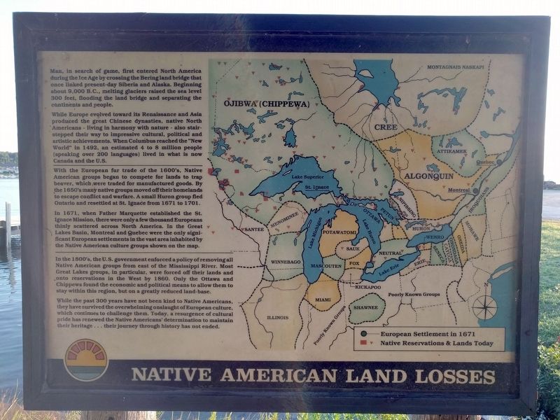
Native American Land Losses
Man, in search of game, first entered North America during the Ice Age by crossing the Bering land bridge that once linked present-day Siberia and Alaska. Beginning about 9,000 B.C., melting glaciers raised the sea level 300 feet, flooding the land bridge and separating the continents and people.
While Europe evolved toward its Renaissance and Asia produced the great Chinese dynasties, native North Americans - living in harmony with nature - also stair-stepped their way to impressive cultural, political and artistic achievements. When Columbus reached the "New World" in 1492, an estimated 4 to 8 million people (speaking over 200 languages) lived in what is now Canada and the U.S.
With the European fur trade of the 1600's, Native American groups began to compete for lands to trap beaver, which were traded for manufactured goods. By the 1650's many native groups moved off their homelands to escape conflict and warfare. A small Huron group fled Ontario and resettled at St. Ignace from 1671 to 1701.
In 1671, when Father Marquette established the St. Ignace Mission, there were only a few thousand Europeans thinly scattered across North America. In the Great Lakes Basin, Montreal and Quebec were the only significant European settlements in the vast area inhabited by the Native American culture groups shown on the map.
In the 1800's, the U.S. government enforced a policy of removing all Native American groups from east of the Mississippi River. Most Great Lakes groups, in particular, were forced off their lands and onto reservations in the West by 1860. Only the Ottawa and Chippewa found the economic and political means to allow them to stay within this region, but on a greatly reduced land-base.
While the past 300 years have not been kind to Native Americans, they have survived the overwhelming onslaught of European culture, which continues to challenge them. Today, a resurgence of cultural pride has renewed the Native Americans' determination to maintain their heritage . . . their journey through history has not ended.
Topics. This historical marker is listed in this topic list: Native Americans. A significant historical year for this entry is 1492.
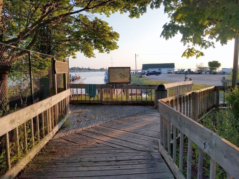
Location. 45° 52.157′ N, 84° 43.675′ W. Marker is in St. Ignace, Michigan, in Mackinac County. Marker can be reached from North State Street (Business Interstate 75) south of East Goudreau Avenue, on the right when traveling north. Marker is on the Huron Boardwalk. Touch for map. Marker is at or near this postal address: 395 North State Street, Saint Ignace MI 49781, United States of America. Touch for directions.
Other nearby markers. At least 8 other markers are within walking distance of this marker. Mackinaw Boat (within shouting distance of this marker); Fort de Buade (about 300 feet away, measured in a direct line); a different marker also named Mackinaw Boat (about 300 feet away); Civilian Conservation Corps (about 400 feet away); Old Mill Slip (about 500 feet away); Watery Graveyard (about 600 feet away); Commercial Fishing (about 600 feet away); Two Cultures Meet (approx. 0.2 miles away). Touch for a list and map of all markers in St. Ignace.
Credits. This page was last revised on September 17, 2019. It was originally submitted on September 17, 2019, by Joel Seewald of Madison Heights, Michigan. This page has been viewed 177 times since then and 8 times this year. Photos: 1, 2. submitted on September 17, 2019, by Joel Seewald of Madison Heights, Michigan.

