Chéticamp in Inverness County, Nova Scotia — The Atlantic Provinces (North America)
Voie ferrée et « Lu vieille Louise » / The railroad and "The Old Louise"
1910-1914
Inscription.
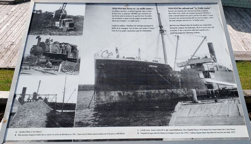
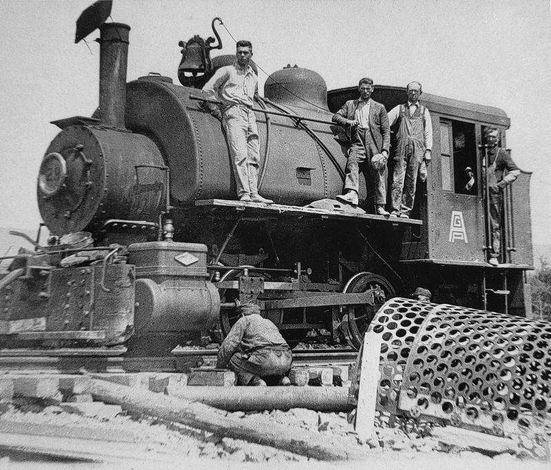
Les affaires vont bien, on décide d'agrandir. Après le décès du Père Fiset, on emprunte 100,000$ pour construire une voie ferrée entre la carrière et le quai des Fiset. On achète une locomotive à vapeur avec dix wagons de quatre tonnes chacun qu'on baptise « La vieille Louise ».
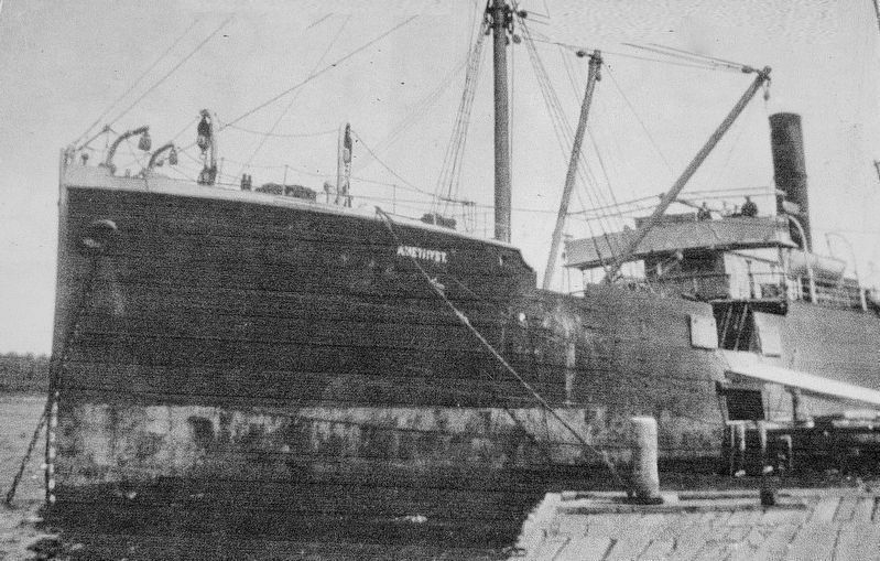
Comble de malheur, L'Améthyst fait naufrage provoquant la faillite de la compagnie. Tous les biens sont vendus à l'encan. Triste fin d'un projet si prometteur pour les Chéticantains.
Business was booming and a decision was made to expand. After Father Fiset's death, the company borrowed $100,000 to build a railroad between the quarry and the Fiset wharf. A steam locomotive was purchased along with ten four-ton wagons, which the locals jokingly referred to as "The Old Louise".
Bad luck soon followed when the Amethyst was shipwrecked forcing the company into bankruptcy. All of its assets were sold at auction. It was a sad end to what had seemed such a promising project for Chéticamp residents.
(légendes photo / photo captions: )
A. L'Améthyst / The Amethyst (background photo: Le Trois Pignons)
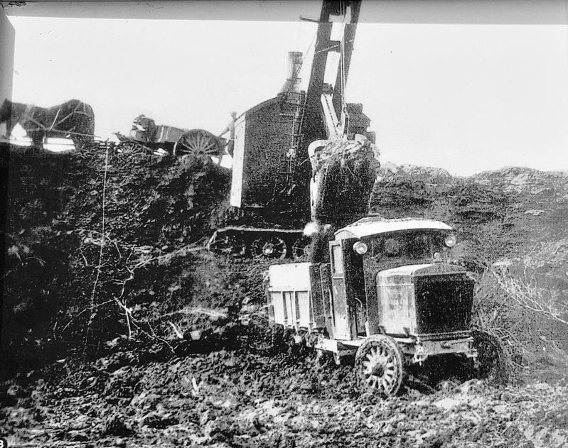
B. Pelle mécanique chargeant du plâtre dans un camion à la carrière de Belle Marche en 1930. / Steam shovel of Atlantic Gypsum loading truck in the quarry in Belle Marche 1930
C. La Vieille Louise • Gauche à droite / left to right:
Leonard Bellefoniaine, Félix à Théophile Chiasson, Pit du Dodeur Fiset, Gratien Cormier, Den a Lubin Chiasson
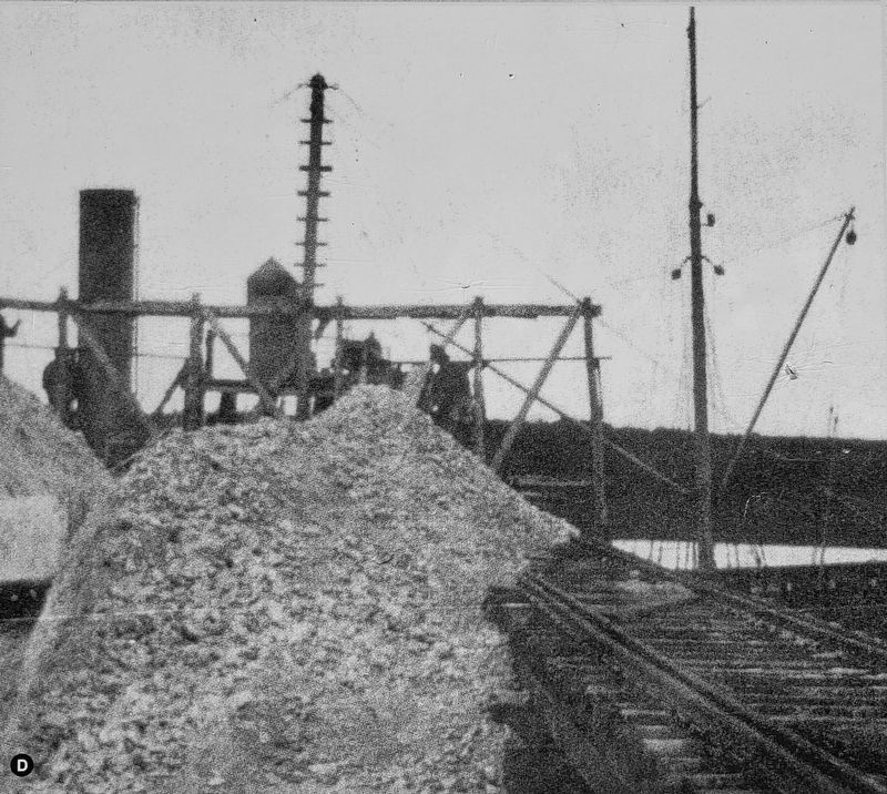
D. Chargement de gypse abord des bateaux ou le magasin Co-op est situé • 1927 / Loading of gypsum aboard ships where the Co-op store now stands • 1927
Topics. This historical marker is listed in these topic lists: Industry & Commerce • Railroads & Streetcars • Waterways & Vessels. A significant historical year for this entry is 1910.
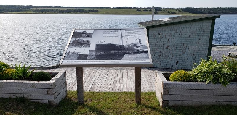
Location. 46° 37.794′ N, 61° 0.785′ W. Marker is in Chéticamp, Nova Scotia, in Inverness County. Marker can be reached from Cabot Trail just north of Barren Road, on the left when traveling north. Marker is located along the Quai Mathieu Promenade/Boardwalk, overlooking Chéticamp Harbor. Touch for map. Marker is at or near this postal address: 15273 Cabot Trail, Chéticamp NS B0E 1H0, Canada. Touch for directions.
Other nearby markers. At least 8 other markers are within walking distance of this marker. The Gypsum Mine/La Mine De Plâtre (here, next to this marker); La Bouée du havre / The Harbour Bouy (a few steps from this marker); Tunnel et Quai de la mine / Tunnel and Mine Wharf (within shouting distance of this marker); M. Joseph Macfarland / Mr. Joseph MacFarland (within shouting distance of this marker); Dés l'année suivante, en 1927 / The following year, in 1927 (within shouting distance of this marker); La fin d'un rêve / The End of a Dream (within shouting distance of this marker); Chéticamp War Memorial (approx. 0.6 kilometers away); 1790 - 1990 (approx. 0.6 kilometers away). Touch for a list and map of all markers in Chéticamp.
Related markers. Click here for a list of markers that are related to this marker. The Chéticamp Gypsum Mine
Credits. This page was last revised on February 24, 2021. It was originally submitted on September 18, 2019, by Cosmos Mariner of Cape Canaveral, Florida. This page has been viewed 142 times since then and 7 times this year. Photos: 1, 2, 3, 4, 5, 6. submitted on September 18, 2019, by Cosmos Mariner of Cape Canaveral, Florida.
