
Ottumwa in Wapello County, Iowa — The American Midwest (Upper Plains)
Dragoon Trail Historical Site Marker No. 4
Photographed by Benjamin M. Snyder, April 25, 2015
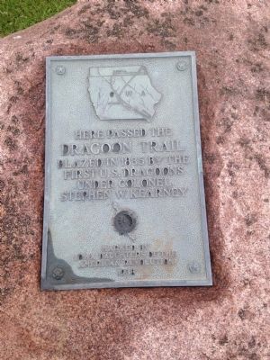
1. Dragoon Trail Historical Site Marker No. 4 Marker
Dragoon Trail
Blazed in 1835 by the
First U.S. Dragoons
under Colonel
Stephen W. Kearny
Erected 1938 by Iowa Daughters of the American Revolution.
Topics and series. This historical marker is listed in these topic lists: Exploration • Roads & Vehicles. In addition, it is included in the Daughters of the American Revolution (DAR) series list. A significant historical year for this entry is 1835.
Location. 41° 4.756′ N, 92° 24.617′ W. Marker is in Ottumwa, Iowa, in Wapello County. It is at the intersection of U.S. 63 and Angle Rd, on the right when traveling south on U.S. 63. Touch for map. Marker is at or near this postal address: 13120 Angle Rd Ottumwa IA 52501, Ottumwa IA 52501, United States of America. Touch for directions.

Regionally, this marker is in Southern Iowa. It is also in the American Midwest and in the Corn Belt. Globally, it is in North America, the Western Hemisphere, the Western World, and the Anglosphere. Historically, it finds itself in what was once the territory of the Mississippian Culture and also the Louisiana Purchase.
Other nearby markers. At least 8 other
this page online
Related markers. Click here for a list of markers that are related to this marker. To better understand the relationship, study each marker in the order shown.
Also see . . . The Mormon Trail Network. On page 425 (The Des Moines River Valley Trail) in the book "The Mormon Trail Network in Iowa 1838-1863: A New Look" (Submitted on May 4, 2015, by Benjamin M. Snyder of Ankeny, Iowa.)
Photographed by Benjamin M. Snyder, April 25, 2015
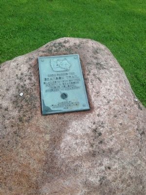
2. Dragoon Trail Historical Site Marker No. 4 Marker
Photographed by Benjamin M. Snyder, April 25, 2015
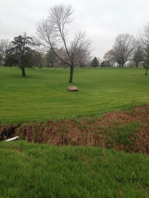
3. Dragoon Trail Historical Site Marker No. 4 Marker
Credits. This page was last revised on September 20, 2019. It was originally submitted on April 27, 2015, by Benjamin M. Snyder of Ankeny, Iowa. This page has been viewed 840 times since then and 19 times this year. Last updated on September 19, 2019, by Benjamin M. Snyder of Ankeny, Iowa. Photos: 1, 2, 3. submitted on April 27, 2015, by Benjamin M. Snyder of Ankeny, Iowa. • Bill Pfingsten was the editor who published this page.
