Near Knoxville in Marion County, Iowa — The American Midwest (Upper Plains)
Dragoon Trail Historical Site Marker No. 6
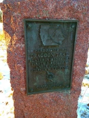
Photographed by Benjamin M. Snyder, February 2, 2014
1. Dragoon Trail Marker Marker
Dragoon Trail
Blazed in 1835 by the
First U.S. Dragoons Under Colonel
Stephen W. Kearny
Erected 1938 by Iowa Daughters of the American Revolution.
Topics and series. This historical marker is listed in these topic lists: Exploration • Roads & Vehicles. In addition, it is included in the Daughters of the American Revolution (DAR) series list. A significant historical year for this entry is 1835.
Location. 41° 23.55′ N, 93° 6.573′ W. Marker is near Knoxville, Iowa, in Marion County. It is at the intersection of State Highway 14 and Hayes Dr, on the right when traveling south on State Highway 14. Marker is facing south A gravel parking area is located to the North of the marker. Touch for map. Marker is at or near this postal address: 899 Highway 14, Knoxville IA 50138, United States of America. Touch for directions.

Regionally, this marker is in Southern Iowa. It is also in the American Midwest and in the Corn Belt. Globally, it is in North America, the Western Hemisphere, the Western World, and the Anglosphere. Historically, it finds itself in what was once the territory of the
this page online
Other nearby markers. At least 8 other markers are within 6 miles of this marker, measured as the crow flies: The Red Rock Line (approx. 1.2 miles away); Red Rock Line / Red Rock (approx. 2.7 miles away); Marion County Freedom Rock (approx. 4.8 miles away); Vietnam Memorial (approx. 4.8 miles away); Marion County Veterans Memorial (approx. 4.8 miles away); Erected to the Memory of All Departed Soldiers, Sailors and Marines (approx. 5.1 miles away); 1942 M5 - 3" Howitzer (approx. 5.1 miles away); a different marker also named The Red Rock Line (approx. 5.2 miles away). Touch for a list and map of all markers in Knoxville.
Related markers. Click here for a list of markers that are related to this marker. To better understand the relationship, study each marker in the order shown.
Also see . . . Dragoon Trail - Wikipedia. ...In 1933, the State of Iowa opened the Dragoon Trail, a scenic and historic drive along the Des Moines River. The trail follows the path of the 1st U. S. Dragoons, the country's first mounted infantry unit, on their historic march in the summer of 1835, to scout Iowa after the Black Hawk Purchase of 1832 put the area under U.S. control. The march lead to the establishment of outposts from present-day Fort Dodge and Webster City through Des Moines to Pella and Knoxville. The Trail is about 200 miles long and passes cultural, historical, natural and scenic attractions including Lake Red Rock, Ledges State Park, the Kate Shelley High Bridge and Dolliver Memorial Park. It starts with two branches originating from Fort Dodge and Webster City that join near Stratford; from there it runs through Boone and Des Moines to the Red Rock Dam between Pella and Knoxville….
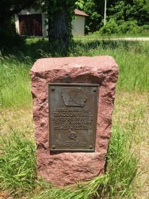
Photographed by Benjamin M. Snyder, May 31, 2015
2. Dragoon Trail Historical Site Marker No. 6 Marker

Photographed by Benjamin M. Snyder, May 31, 2015
3. Dragoon Trail Historical Site Marker No. 6 Marker
Credits. This page was last revised on September 20, 2019. It was originally submitted on April 21, 2015, by Benjamin M. Snyder of Ankeny, Iowa. This page has been viewed 1,252 times since then and 53 times this year. Last updated on September 19, 2019, by Benjamin M. Snyder of Ankeny, Iowa. Photos: 1. submitted on April 21, 2015, by Benjamin M. Snyder of Ankeny, Iowa. 2, 3. submitted on May 31, 2015, by Benjamin M. Snyder of Ankeny, Iowa. • Bill Pfingsten was the editor who published this page.
