Saint Albans Bay in St. Albans Bay in Franklin County, Vermont — The American Northeast (New England)
Lucrative Trade to Leisure Vacations/Du commerce lucratif au voyage d'agrément
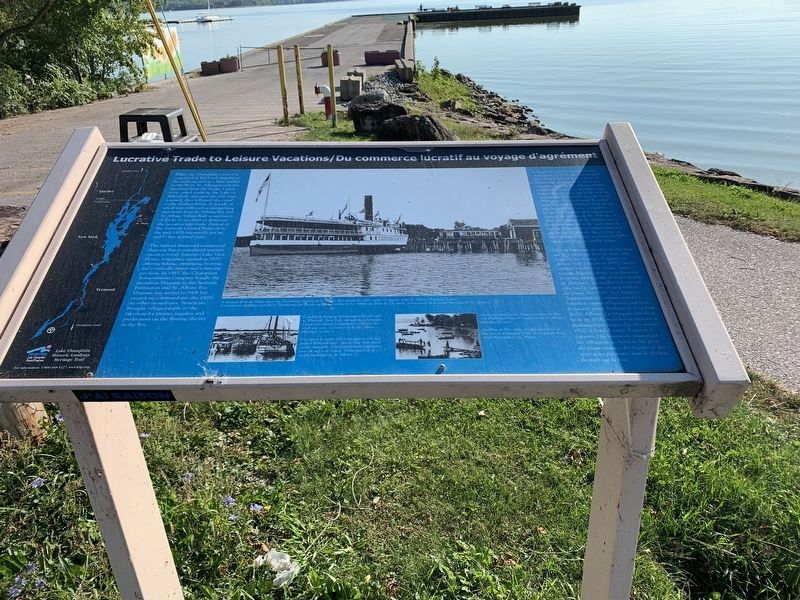
When the Champlain Canal was completed in 1823 and shipping to the south opened up a huge market to the West, St. Albans merchants benefited from the boom. Canal boats sailed south up the Lake to Whitehall, and once the sails were lowered, they followed the canal to the Hudson River. A decade of wharf wars followed as enterprising merchants from St. Albans Bay and St. Albans Village built a succession of docks in an effort to dominate the lucrative lake trade. Arrival of the Vermont Central Railroad in the mid-1800s eventually put an end to this spirited strife.
The railroad dampened commercial shipping but it stimulated summer vacation travel. Samson's Lake View House, long gone, opened in 1870 offering fishing, swimming, boating and eventually tennis and a dancing pavilion. In 1897, the Champlain Transportation Company bought the steamboat Maquam to run between Burlington and St. Albans Bay. Maquam was retired in 1906 but excursions continued into the 1920s on other steamboats. Streetcars, brought village people to the lakeshore for picnics, regattas and productions on the floating theater in the Bay.
Lorsque le canal Champlain fut achevé en 1823 et que le transport fluvial vers le sud donna accès à l'immense marche de l'Ouest, les commerçants de St. Albans bénéficièrent de l'essor économique. Les barges naviguaient sud jusqu'à Whitehall, puis les voiles abaissées, elles suivaient le canal jusqu'à la rivière Hudson. Une décennie de batailles pour conquérir les quais s'ensuivit, alors que le marchands de la baie de St. Albans et ceux du village de St. Albans construisirent une série de quais dans le but de dominer le commerce lucratif sur le lac. L'arrivée du chemin de fer Vermont Central au milieu du XIXe siècle mit fin à ce conflit animé.
La voie ferrée eut un effet modérateur sur le commerce fluvial, mais elle favorisa les voyages d'agrément durant l’été. Ouvert en 1870, l'hôtel Samson's Lake View House, maintenant disparu, offrait à sa clientèle la pêche, la baignade et la navigation de plaisance, auxquelles s'ajoutèrent plus tard le tennis et un pavillon de danse. En 1897, la Champlain Transportation Company acheta le bateau à vapeur Maquam pour faire la navette entre Burlington et la baie de St. Albans. Le Maquam fut désaffecté en 1906, mais les excursions se poursuivirent jusque dans les années 1920, à bord d'autres bateaux à vapeurs. Des tramways amenaient les villageois au bord du lac pour des pique-niques, des régates et des spectacles présentés dans le théâtre flottant sur la baie.
Erected by Lake Champlain Basin Program.
Topics. This historical marker is listed in these topic lists: Industry & Commerce • Waterways & Vessels. A significant historical year for this entry is 1823.
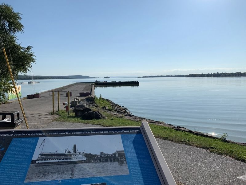
Location. 44° 48.435′ N, 73° 8.393′ W. Marker is in St. Albans Bay, Vermont, in Franklin County. It is in Saint Albans Bay. Marker can be reached from the intersection of Lake Street (Vermont Route 36) and Georgia Shore Road. Marker is at the end of the parking lot just before the dock starts. Touch for map. Marker is in this post office area: Saint Albans Bay VT 05481, United States of America. Touch for directions.
Other nearby markers. At least 8 other markers are within 3 miles of this marker, measured as the crow flies. Boyrereau Brinch "Jeffrey Brace" (approx. 2 miles away); Rail City / La ville ferroviaire (approx. 2.7 miles away); St. Albans Raid (approx. 2.8 miles away); Franklin County Veterans Memorial (approx. 2.8 miles away); St. Albans War Memorial (approx. 2.8 miles away); The Smith Legacy / L'héritage de la famille Smith (approx. 2.8 miles away); St. Albans World War Memorial (approx. 2.8 miles away); St. Albans Civil War Memorial (approx. 2.8 miles away).
Credits. This page was last revised on February 16, 2023. It was originally submitted on September 24, 2019, by Steve Stoessel of Niskayuna, New York. This page has been viewed 127 times since then and 9 times this year. Photos: 1, 2. submitted on September 24, 2019, by Steve Stoessel of Niskayuna, New York. • Andrew Ruppenstein was the editor who published this page.

