Lock 38
Boat Elevator
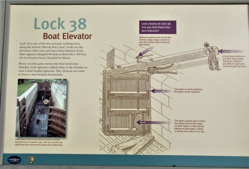
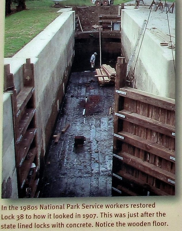
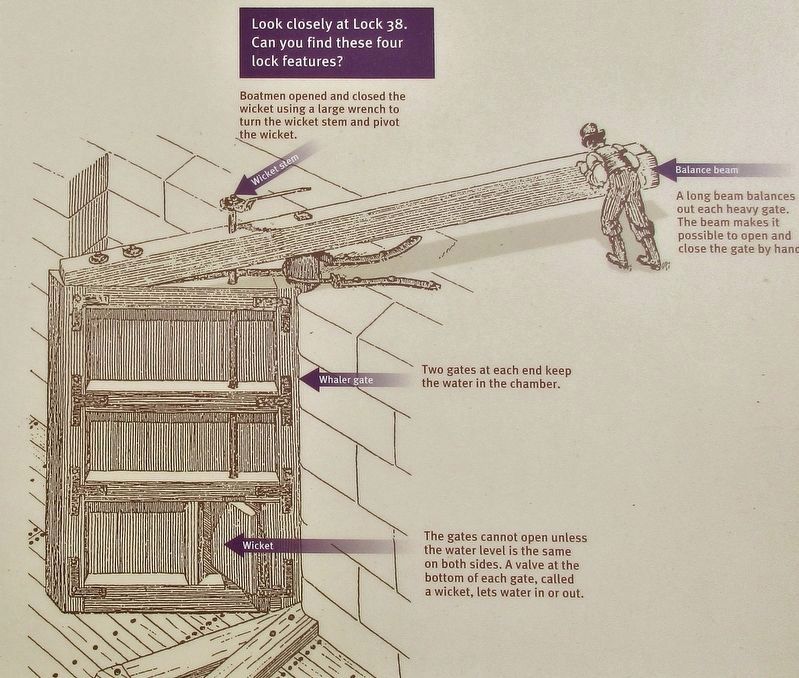
Heavy wooden gates enclose the boat-sized stone
chamber. Lock operators added water to the chamber to
raise a boat headed upstream. They drained out water
to lower a boat headed downstream.
Topics and series. This historical marker is listed in this topic list: Waterways & Vessels. In addition, it is included in the Ohio and Erie Canal series list.
Location. 41° 22.362′ N, 81° 36.771′ W. Marker is in Valley View, Ohio, in Cuyahoga County. It can be reached from the intersection of Ohio & Erie Canal Towpath Trail and Hillside Road. marker is located at the Canal Exploration Center
on the Ohio & Erie Canal Towpath Trail. Touch for map. Marker is at or near this postal address: 7104 Canal Road, Cleveland OH 44125, United States of America. Touch for directions.
Regionally, this marker is in Greater Cleveland,
this page online
Other nearby markers. At least 8 other markers are within 2 miles of this marker, measured as the crow flies: Hell's Half Acre (a few steps from this marker); Mule Power (about 300 feet away, measured in a direct line); Valley View Veterans Honor Roll (approx. 0.6 miles away); Valley View Village Town Hall (approx. 0.6 miles away); South Park Village and the Whittlesley Tradition (approx. one mile away); Late Prehistoric Period (approx. one mile away); Lock 37 (approx. 1.4 miles away); Floods and Repairs (approx. 1.4 miles away). Touch for a list and map of all markers in Valley View.
Credits. This page was last revised on September 26, 2019. It was originally submitted on September 26, 2019, by Rev. Ronald Irick of West Liberty, Ohio. This page has been viewed 776 times since then and 84 times this year. Photos: 1, 2, 3, 4, 5. submitted on September 26, 2019, by Rev. Ronald Irick of West Liberty, Ohio. • Andrew Ruppenstein was the editor who published this page.
