Near Grace in Caribou County, Idaho — The American West (Mountains)
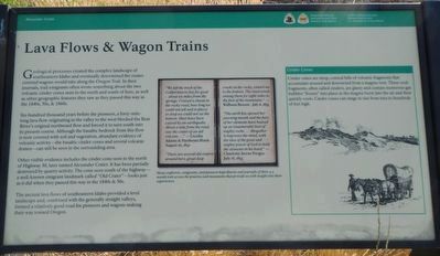
Lava Flows and Wagon Trains
Six-hundred thousand years before the pioneers, a forty-mile-long lava flow originating in the valley to the west blocked the Bear River's original northward flow and forced it to turn south into its present course. Although the basaltic bedrock from this flow is now covered with soil and vegetation, abundant evidence of volcanic activity--the basaltic cinder cones and several volcanic domes--can still be seen in the surrounding area.
Other visible evidence includes the cinder cone seen to the north on Highway 30, later named Alexander Crater. It has been partially destroyed by quarry activity. The cone seen south of the highway--a well-known emigrant landmark called "Old Crater"--looks just as it did when they passed this way in the 1840s & 50s.
The ancient lava flows of southeastern Idaho provided a level landscape and, combined with the generally straight valleys, formed a relatively good road for pioneers and wagons making their way toward Oregon.
Many explorers, emigrants, and pioneers kept diaries and journals of their 4-5 month trek across the prairies and mountains that provide us with insight into their experiences.
"We left the track of the Californians to day for good - about six miles from the springs. Crossed a chasm in the rocky road, how long we could not tell and in places so deep we could not see the bottom. Must have been caused by an earthquake. About a mile from the road, saw the crater of an old volcano..." -- Cecelia Adams and Parthenia Blank - August 16, 1852
"There are several old craters around here, great deep cracks in the rocks, cannot see to the bottom. The road winds among them for eight miles to the foot of the mountains." -- Welboen Beeson - July 6, 1853
"The earth has openers her yawning mouth and the fury of her elements have heaved up an innumerable host of mighty rocks ... Altogether it impresses the mind, with the idea of the great and mighty power of God to hold the elements in his hand." -- Charlotte Sterns Pengra - July 18, 1853
Cinder Cones
Cinder cones are steep, conical hills of volcanic fragments that accumulate around and downwind from a magma vent. These rock fragments, often called cinder cones, are glassy and contain numerous gas bubbles "frozen" into place as the magma burst into the air and then quickly cools. Cinder cones can range in size from tens to hundreds of feet high.
Erected by National Park Service, Caribou Historical Society, Oregon and California National Historic Trails, National Trails System.
Topics and series. This historical marker is listed in these topic lists: Natural Features • Roads & Vehicles. In addition, it is included in the California Trail, and the Oregon Trail series lists.
Location. 42° 38.638′ N, 111° 43.824′ W. Marker is near Grace, Idaho, in Caribou County. Marker is on State Highway 34 near U.S. 30, on the right when traveling south. Touch for map. Marker is in this post office area: Grace ID 83241, United States of America. Touch for directions.
Other nearby markers. At least 8 other markers are within 2 miles of this marker, measured as the crow flies. California dreaming in 1841 (here, next to this marker); Bear River Lava (approx. 1˝ miles away); John Bidwell (approx. 1˝ miles away); Horatio's Journey (approx. 1˝ miles away); Guiding Landmark... (approx. 1˝ miles away); William Henry Harrison (approx. 1˝ miles away); The Value Of A Shortcut (approx. 1˝ miles away); Hudspeth Cutoff (approx. 1˝ miles away).
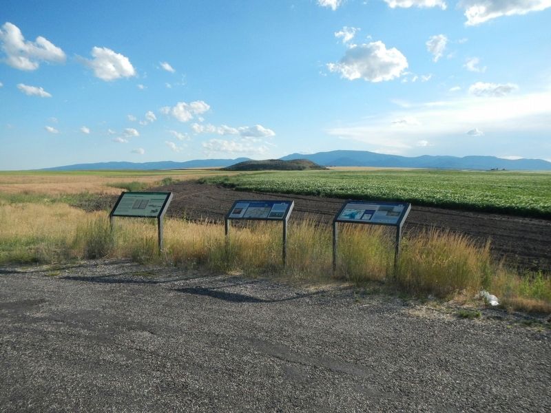
More about this marker. This marker is just south of US Highway 30 on Idaho State Highway 34.
Credits. This page was last revised on September 28, 2019. It was originally submitted on September 28, 2019, by Barry Swackhamer of Brentwood, California. This page has been viewed 388 times since then and 51 times this year. Photos: 1, 2. submitted on September 28, 2019, by Barry Swackhamer of Brentwood, California.

